Road condition assessment method and system based on road high-definition checkpoint data
A high-definition bayonet, road section technology, applied in the direction of road vehicle traffic control system, traffic control system, instruments, etc., can solve the problem of inability to intuitively and visually know the traffic conditions of the road section, unable to scientifically evaluate the traffic conditions of the road section, etc. The effect of traffic condition assessment
- Summary
- Abstract
- Description
- Claims
- Application Information
AI Technical Summary
Problems solved by technology
Method used
Image

Examples
Embodiment 1
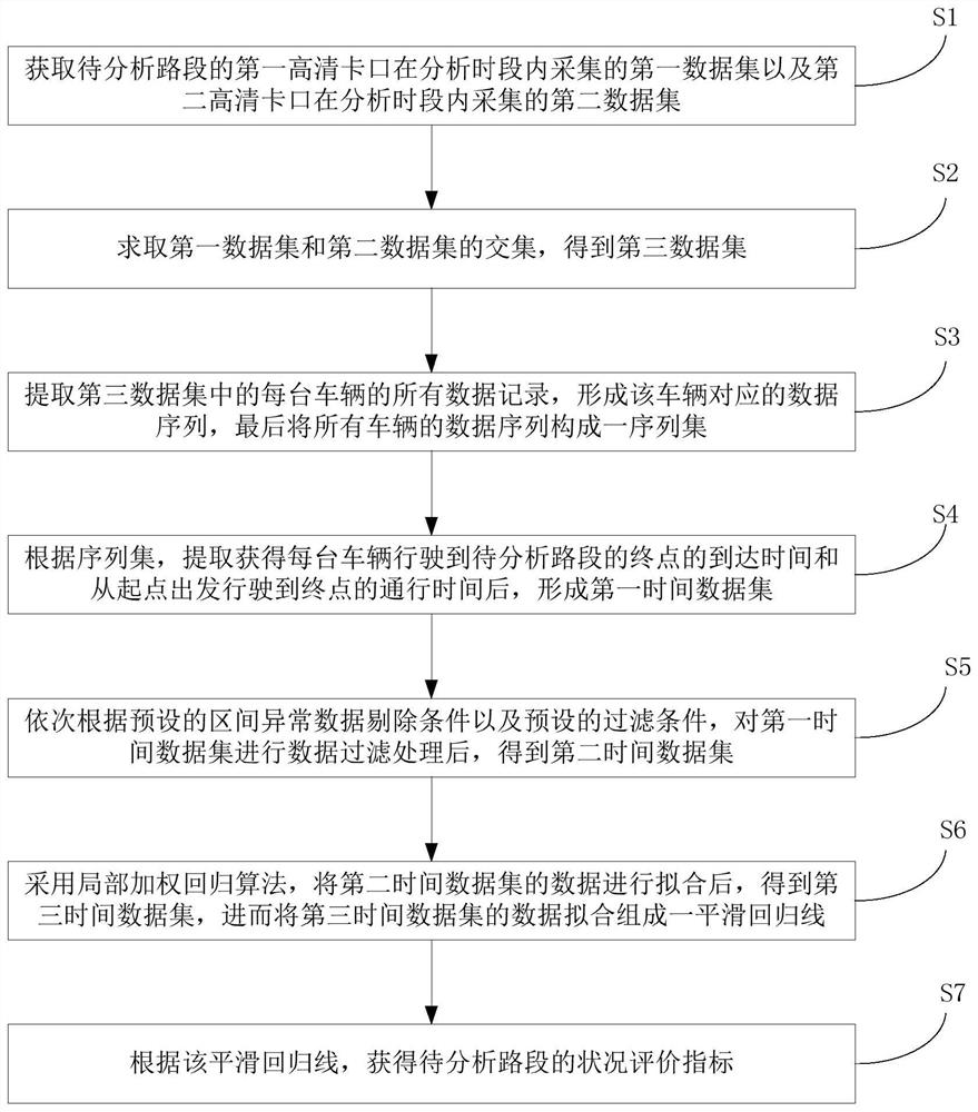
[0043] refer to figure 1 , the present invention provides a method for assessing road conditions based on road high-definition checkpoint data, comprising the following steps:
[0044] S1. Obtain the first data set collected by the first high-definition bayonet of the road section to be analyzed within the analysis period and the second data set collected by the second high-definition bayonet during the analysis period; the first high-definition bayonet is set in the analysis period The starting point of the road section, the second high-definition bayonet is set at the end point of the road section to be analyzed;
[0045] S2. Calculate the intersection of the first data set and the second data set to obtain a third data set;
[0046] S3. Extract all data records of each vehicle in the third data set to form a data sequence corresponding to the vehicle, and finally form a sequence set of data sequences of all vehicles;
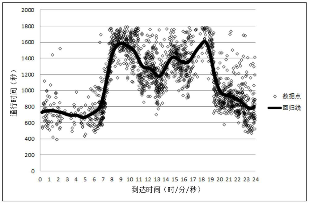
[0047] S4. According to the sequence set, after obtai...
Embodiment 2
[0077] This embodiment is a detailed embodiment of embodiment one, and discusses the train of thought of the present invention as a whole, specifically as follows:
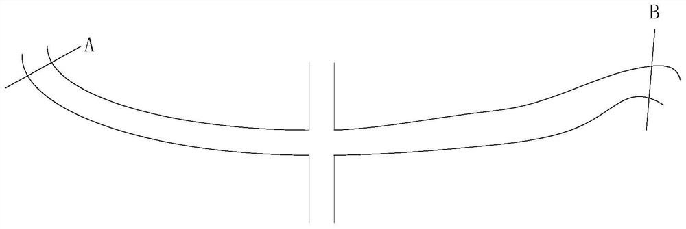
[0078] figure 2 As shown, it is an expressway section in a certain city, and the starting point and the ending point of the section are section A and section B respectively. Section A and section B are respectively equipped with high-definition mounts. In this specific embodiment, the two high-definition bayonets are respectively named bayonet a and bayonet b. Here, only one-way traffic from section A to section B is considered.
[0079] First, define the nouns described in Table 1 below:
[0080] Table 1
[0081]
[0082]
[0083] Rule 1: If a vehicle travels continuously from section A to section B (leaves the road section without any exit and then returns to the road section), it must be photographed by bayonet a, and then by bayonet b.
[0084] Based on rule 1, if a vehicle continuously travels from...
Embodiment 3
[0116] refer to Figure 7 , a road section condition assessment system based on road HD checkpoint data, including:
[0117] at least one processor 100;
[0118] at least one memory 200 for storing at least one program;
[0119] When the at least one program is executed by the at least one processor 100, the at least one processor 100 implements the road section condition assessment method based on road HD checkpoint data.
[0120] The vehicle destination prediction system based on user behavior in this embodiment can execute the vehicle destination prediction method based on user behavior provided by the method embodiment of the present invention, can execute any combination of implementation steps of the method embodiment, and has the corresponding method Functions and beneficial effects.
PUM
 Abstract
Description
Claims
Application Information
 - R&D
- Intellectual Property
- Life Sciences
- Materials
- Tech Scout
- Unparalleled Data Quality
- Higher Quality Content
- 60% Fewer Hallucinations
Browse by: Latest US Patents, China's latest patents, Technical Efficacy Thesaurus, Application Domain, Technology Topic, Popular Technical Reports.
© 2025 PatSnap. All rights reserved.Legal|Privacy policy|Modern Slavery Act Transparency Statement|Sitemap|About US| Contact US: help@patsnap.com