
Spatial Prediction Method of Forest Soil Nutrient Based on Artificial Neural Network Kriging Interpolation

An artificial neural network and kriging interpolation technology, which is applied in the field of spatial prediction of forest soil nutrients, can solve the problems of inconsistent soil nutrients, not considering the spatial autocorrelation of residuals, and not soil nutrient maps. Solve the phenomenon of soil nutrient mutation and overcome the effect of poor model stability

Active Publication Date: 2021-10-26
NORTHEAST INST OF GEOGRAPHY & AGRIECOLOGY C A S
View PDF1 Cites 0 Cited by
  • Summary
  • Abstract
  • Description
  • Claims
  • Application Information

AI Technical Summary

Problems solved by technology

However, similar to geographically weighted regression, each prediction unit is represented by the predicted value of soil nutrients at a node, and only the influence of environmental factors at this node is considered, and the spatial autocorrelation of residuals is not considered, so the generated soil nutrient map is not a smooth one. continuous surface, and in the case of fewer nodes, it will lead to soil nutrient mutation phenomenon that is inconsistent with reality

Method used


Image

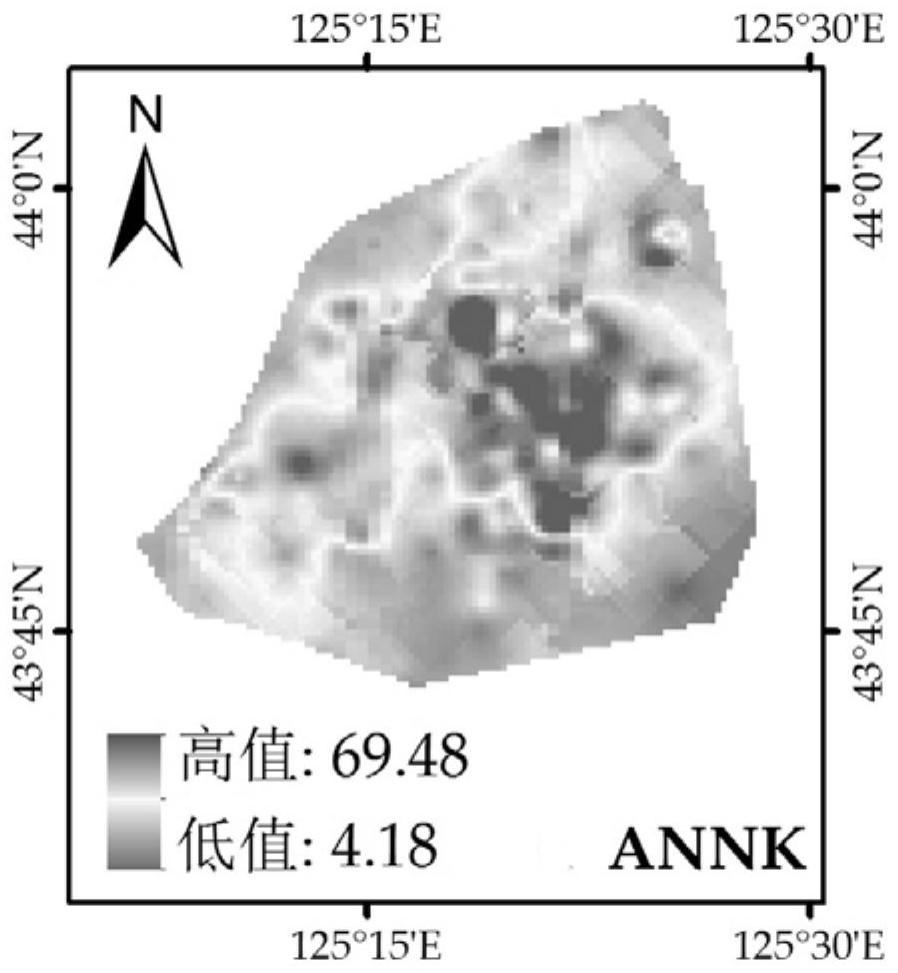
  • Spatial Prediction Method of Forest Soil Nutrient Based on Artificial Neural Network Kriging Interpolation
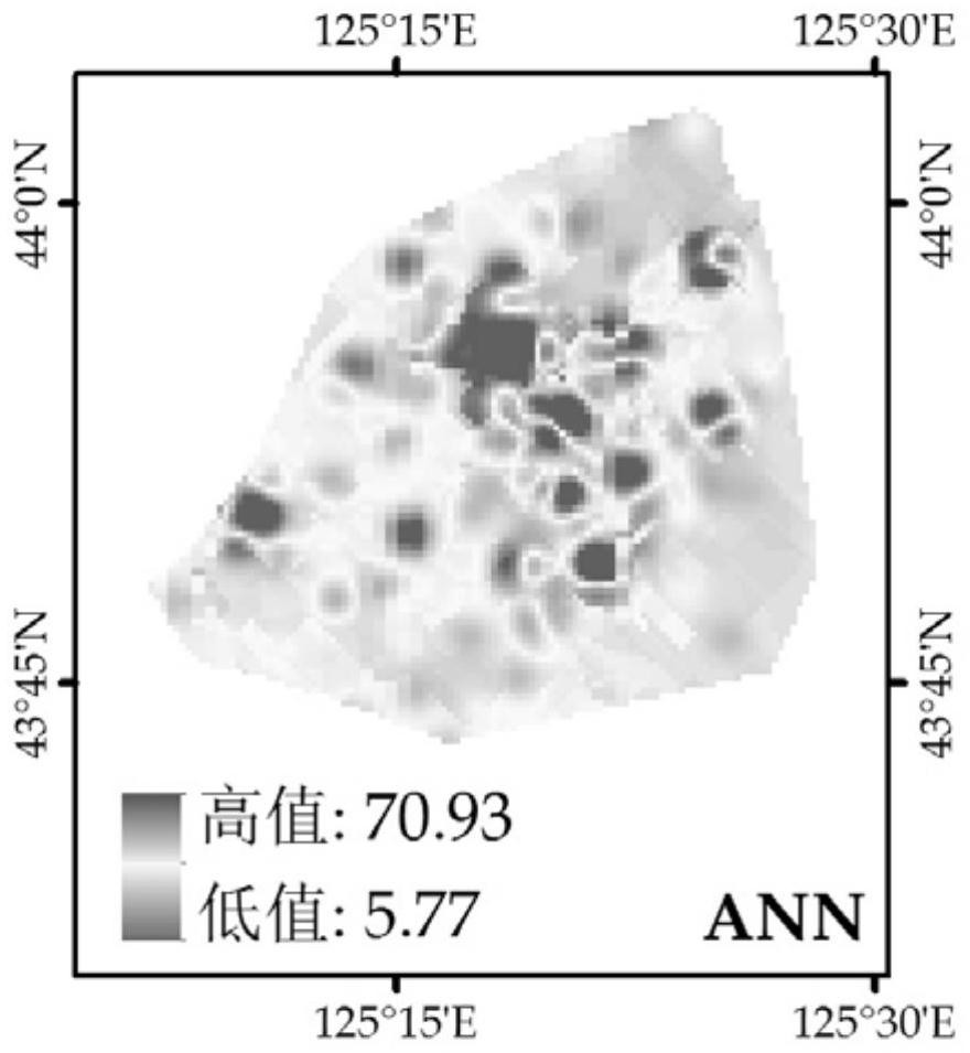
  • Spatial Prediction Method of Forest Soil Nutrient Based on Artificial Neural Network Kriging Interpolation
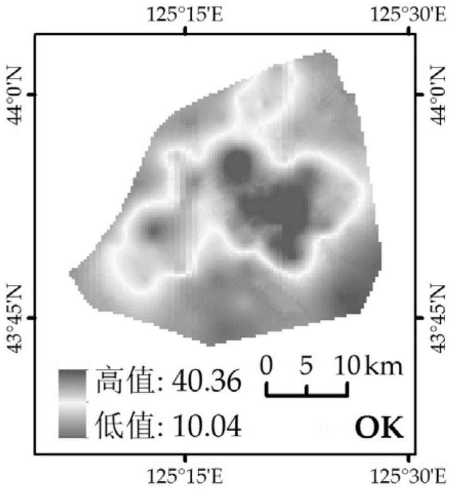
  • Spatial Prediction Method of Forest Soil Nutrient Based on Artificial Neural Network Kriging Interpolation

Examples


Embodiment

[0040] Based on the measured values ​​of organic carbon content and bulk density of forest soil surface (0-20 cm), meteorological station observations (precipitation, temperature and humidity), Landsat8OLI remote sensing images and 30-meter DEM topographic data, combined with multilayer perceptron neural network model and ordinary The mixing of Kriging interpolation is used to predict the content of organic carbon in the top soil of the forest. The specific methods are as follows:

[0041] Step 1: Use the Geostatistical Analyst module of ArcGIS software to perform inverse distance weight interpolation on the measured data of forest soil bulk density (BD) to obtain a continuous surface.

[0042] Step 2: Use the Geostatistical Analyst module of ArcGIS software to perform inverse distance weighted interpolation on the precipitation (P), temperature (T) and humidity (H) data of meteorological stations to obtain 3 continuous surfaces.

[0043] Step 3: Use the Surface module, the Hy...


PUM


Abstract

The invention discloses a forest soil nutrient spatial prediction method based on artificial neural network kriging interpolation, which comprises the following steps: obtaining environmental factor grid data; calculating and obtaining a forest soil nutrient spatial distribution map based on a multilayer perceptron neural network Carry out the calculation of the residual between the measured nutrient value and the predicted value; analyze and test the residual of the neural network prediction; carry out the semivariance calculation of the residual and the model simulation of the semivariogram function to obtain each model type and parameters; Ordinary Kriging interpolation is performed on the residuals to obtain the semivariance model parameters to obtain the spatial distribution of neural network prediction residuals; the forest soil nutrient grid based on the multilayer perceptron neural network is added to the grid of prediction residuals The spatial distribution map of forest soil nutrients was obtained based on artificial neural network kriging interpolation. The prediction accuracy obtained by the invention is significantly improved compared with the accuracy of only using the multi-layer perceptron neural network model or the common Kriging interpolation method.

Description

technical field [0001] The invention relates to the technical field of soil nutrient spatial prediction, in particular to a spatial prediction method of forest soil nutrients based on artificial neural network kriging interpolation. Background technique [0002] Forest is the main body of terrestrial ecosystem, and the spatial distribution of soil nutrients plays an important role in the formation and succession of plant community spatial pattern, and is directly related to ecosystem productivity. Therefore, the research on spatial prediction of forest soil nutrients is an important support for the realization of sustainable forest utilization and global change research. In recent years, experts and scholars at home and abroad have carried out research on spatial prediction methods for soil nutrients in various ecosystems such as cultivated land, forest land, and wetlands. However, due to the high spatial correlation and heterogeneity of forest soil, the spatial distribution...

Claims


Application Information

Patent Timeline
Patent Type & Authority Patents(China)
IPC IPC(8): G01N33/24
CPCG01N33/24
Inventor 陈琳任春颖张柏王宗明
Owner NORTHEAST INST OF GEOGRAPHY & AGRIECOLOGY C A S
Learn More