Method and device for determining road section on basis of position and storage medium

A road section and target location technology, applied in the field of location-based determination of road sections, can solve problems such as navigation route deviation, positioning error, detour, etc., and achieve the effect of avoiding deviation and improving accuracy

Active Publication Date: 2019-03-19
TENCENT TECH (SHENZHEN) CO LTD
View PDF10 Cites 5 Cited by
  • Summary
  • Abstract
  • Description
  • Claims
  • Application Information

AI Technical Summary

Problems solved by technology

[0004] However, there may be positioning errors in the actual navigation process, that is, there may be a position error between the target position indicated by the given target position information and the user's actual position, so the r

Method used


Image

  • Method and device for determining road section on basis of position and storage medium
  • Method and device for determining road section on basis of position and storage medium
  • Method and device for determining road section on basis of position and storage medium

Examples


Embodiment Construction

[0031] In order to make the object, technical solution and advantages of the present invention clearer, the implementation manner of the present invention will be further described in detail below in conjunction with the accompanying drawings.

[0032] Before explaining and describing the embodiments of the present invention in detail, the names involved in the embodiments of the present invention will be explained first.

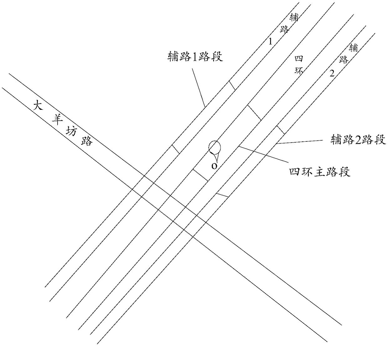
[0033] Adsorption: When planning a navigation route, it is usually necessary to convert the given location coordinates to specific road sections in the navigation map first, that is, to determine the road section that matches the given location coordinates, and to determine the road section that matches the given location coordinates The process is called adsorption.

[0034] Single adsorption: If the adsorption process can only output one road segment for a given position coordinate, this adsorption strategy is called single adsorption. For example, in re...


PUM


Abstract

The invention discloses a method and a device for determining road section on the basis of position and a storage medium and belongs to the technical field of navigation. The method includes: based ontarget position information and a preset navigation map, determining nearest distance between a road section closest to a target position and the target position in multiple road sections included inthe preset navigation map, wherein the target position is a position indicated by the target position information; determining a target range matched with the target position information on the basisof the nearest distance; determining a target road section corresponding to the target position information in the road sections in the target range. By adopting a multi-adsorption mode, deviation caused when navigation routes are planned on the basis of the nearest road section only is avoided, and accuracy of navigation route planning is improved.

Description

technical field [0001] The present invention relates to the technical field of navigation, in particular to a method, device and storage medium for determining a road section based on a location. Background technique [0002] In the field of navigation technology, it is usually necessary to plan a navigation route based on given target location information, where the target location may be a starting point or an ending point. In practical applications, since a navigation route is often composed of multiple road segments, when planning a route, it is usually necessary to first determine a target road segment that matches the target location information, and then plan a route based on the target road segment. For example, it is necessary to first determine the starting road segment matching the starting point location information and the ending point road segment matching the ending point location information, and then plan the navigation route based on the starting point road...

Claims


Application Information

Patent Timeline
IPC IPC(8): G01C21/34
CPCG01C21/34
Inventor 张国晟
Owner TENCENT TECH (SHENZHEN) CO LTD
Why Eureka
Try Eureka