An orchard modeling analysis system and method based on unmanned aerial vehicle positioning shooting

An analysis system and analysis method technology, applied in the field of orchard modeling and analysis system based on UAV positioning and shooting, can solve the problems of high labor intensity, low census efficiency, and cost of money, and achieve the effect of improving the efficiency of anomaly detection

Pending Publication Date: 2019-04-09
ZHONGKAI UNIV OF AGRI & ENG
View PDF3 Cites 3 Cited by
  • Summary
  • Abstract
  • Description
  • Claims
  • Application Information

AI Technical Summary

Problems solved by technology

Manual census is labor-intensive and costly, and the census efficiency is low, especially when the orchard area is large

Method used


Image

  • An orchard modeling analysis system and method based on unmanned aerial vehicle positioning shooting
  • An orchard modeling analysis system and method based on unmanned aerial vehicle positioning shooting
  • An orchard modeling analysis system and method based on unmanned aerial vehicle positioning shooting

Examples


Embodiment

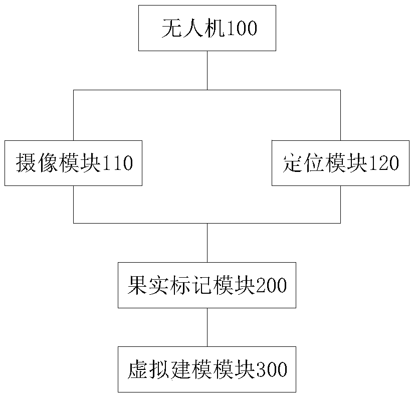
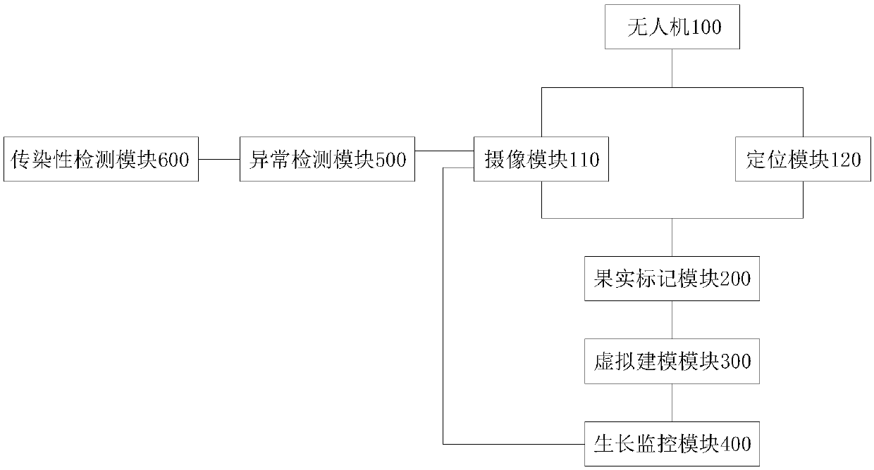
[0054] Such as figure 1 As shown, an orchard modeling and analysis system based on UAV positioning and shooting includes UAV 100, fruit marking module 200, virtual modeling module 300, and UAV 100 is provided with camera module 110 and positioning module 120;

[0055] The camera module 110 is used to take images of fruits in the orchard when the unmanned aerial vehicle 100 is flying;

[0056] The positioning module 120 is used to obtain the position of the drone when the camera module 110 captures the image;

[0057] The fruit marking module 200 is used to obtain the drone position from the positioning module 120, and determine the fruit image position on the image taken by the camera module 110, and mark the fruit on the image according to the drone position and the fruit image position;

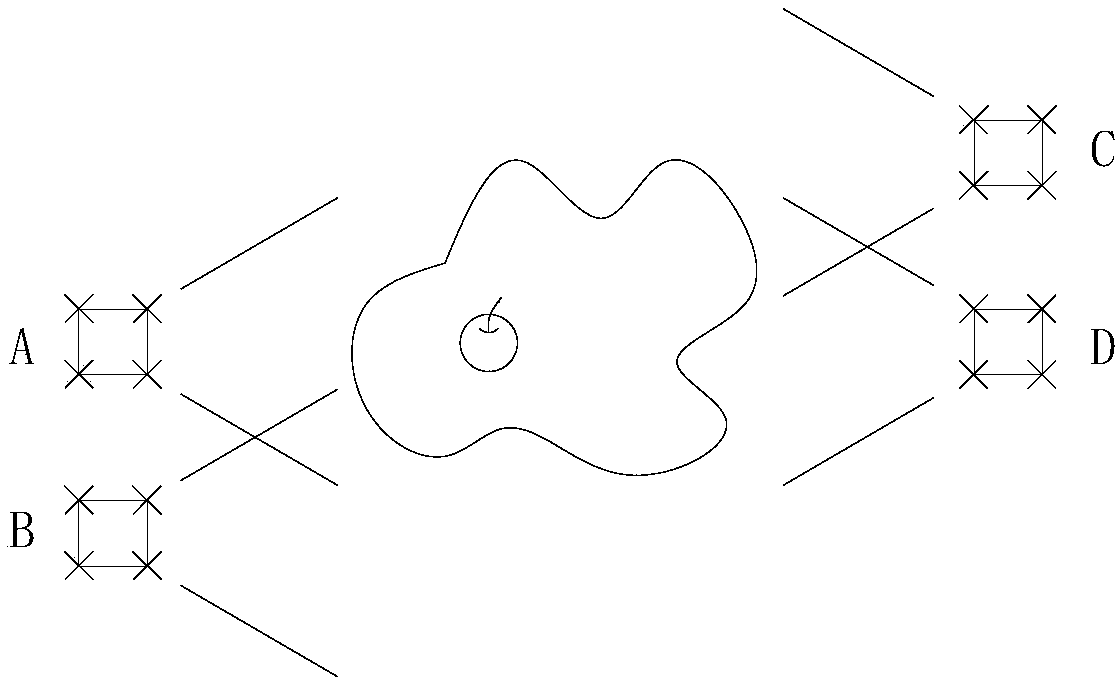
[0058] The virtual modeling module 300 is used to calculate the UAV position range and the fruit image position range where the target fruit can be photographed, according to the calculate...


PUM


Abstract

The invention relates to an orchard modeling analysis system and method based on unmanned aerial vehicle positioning shooting. The system comprises an unmanned aerial vehicle, a fruit marking module and a virtual modeling module; the fruit marking module is used for obtaining the position of the unmanned aerial vehicle from a positioning module, determining the position of a fruit image on an image shot by a camera module, and marking fruits on the image according to the position of the unmanned aerial vehicle and the position of the fruit image, wherein The virtual modeling module is used forcalculating an unmanned aerial vehicle position range and a fruit image position range in which a target fruit can be shot; and according to the calculated unmanned aerial vehicle position range, thefruit image position range and the unmanned aerial vehicle position and fruit image position marked by the target fruit, calling a plurality of images of the target fruit shot by the camera module, and establishing a three-dimensional model of the target fruit and/or the plant where the target fruit is located according to the plurality of images of the target fruit. According to the method, thefruits in the orchard can be conveniently marked, and the health conditions of the fruits and plants where the fruits are located can be modeled and analyzed.

Description

technical field [0001] The invention relates to the technical field of orchard monitoring, in particular to an orchard modeling and analysis system and method based on drone positioning and shooting. Background technique [0002] The health of fruit growth will affect the fruit output of the orchard, which is related to the economic benefits of the orchard. Effective monitoring of the orchard can help deal with abnormally grown fruits, improve the output quality of the fruit, and minimize the economic loss of the orchard. Improve economic efficiency. At present, the method of manual census is mainly used to monitor the growth and health of orchards. Manual census is labor-intensive and costly, and the census efficiency is low, especially when the orchard area is large. Contents of the invention [0003] In order to overcome at least one defect (deficiency) of the above-mentioned prior art, the present invention provides an orchard modeling and analysis system and method ...

Claims


Application Information

Patent Timeline
Patent Type & Authority Applications(China)
IPC IPC(8): G06K9/00G06T17/00
CPCG06T17/00G06V20/10
Inventor 唐宇骆少明侯超钧庄家俊郭琪伟褚璇苗爱敏高升杰程至尚朱耀宗
Owner ZHONGKAI UNIV OF AGRI & ENG
Why Eureka
Try Eureka