Multilayer cloud inversion method for multi-channel scanning imaging radiometer of FengYun 4A meteorological satellite
A meteorological satellite, scanning imaging technology, applied in the field of satellite remote sensing, can solve the problems that it is difficult to quantitatively provide product data and cannot be fully referenced
- Summary
- Abstract
- Description
- Claims
- Application Information
AI Technical Summary
Problems solved by technology
Method used
Image
Examples
specific Embodiment approach
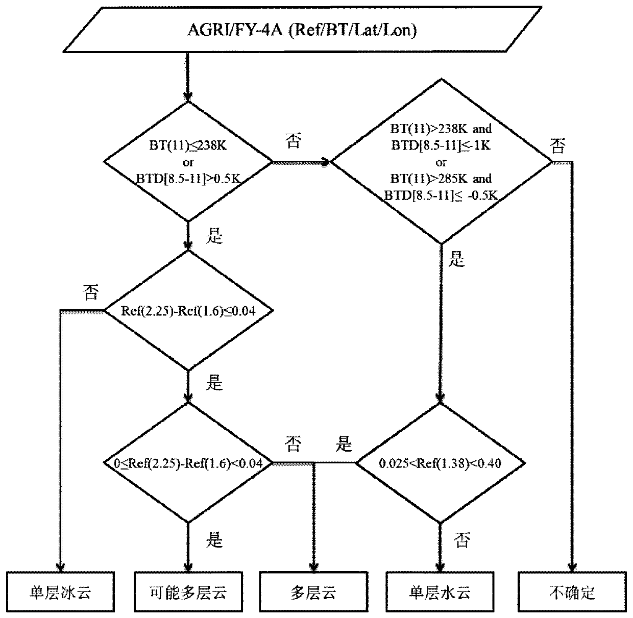
[0023] (1) Based on the multi-spectral threshold cloud detection algorithm developed by the National Satellite Meteorological Center based on the meteorological satellite wind and cloud 3D (FY-3D) imager MERSI-II, develop and optimize the cloud identification algorithm suitable for AGRI / FY-4A. Using the AGRI / FY-4A data, according to the cloud detection products obtained by the cloud detection algorithm based on multi-spectral threshold, determine the cloudy or clear sky conditions of each pixel, which are divided into four categories: cloudy, likely cloudy, clear sky, and possibly clear sky. AGRI / FY-4A data used in the present invention (such as figure 1 , where Ref(1.6) and Ref(2.25) represent the reflectivity of 1.6 and 2.25 μm channels respectively, BT(8.5) and BT(11) represent the brightness temperature of 8.5 and 11 μm channels respectively, and BTD[8.5-11] represents the 8.5 and 11 μm channels 11 μm channel brightness temperature difference, Lon and Lat represent longitu...
PUM
 Abstract
Description
Claims
Application Information
 - R&D
- Intellectual Property
- Life Sciences
- Materials
- Tech Scout
- Unparalleled Data Quality
- Higher Quality Content
- 60% Fewer Hallucinations
Browse by: Latest US Patents, China's latest patents, Technical Efficacy Thesaurus, Application Domain, Technology Topic, Popular Technical Reports.
© 2025 PatSnap. All rights reserved.Legal|Privacy policy|Modern Slavery Act Transparency Statement|Sitemap|About US| Contact US: help@patsnap.com


