Reconstruction method of long-term continuous water area change in lakes based on remote sensing big data platform

A big data platform and lake technology, applied in the field of remote sensing, can solve problems such as incomplete reflection of lake waters, low spatial resolution, and limited research development.

Active Publication Date: 2022-02-01
NANJING INST OF GEOGRAPHY & LIMNOLOGY
View PDF5 Cites 0 Cited by
  • Summary
  • Abstract
  • Description
  • Claims
  • Application Information

AI Technical Summary

Problems solved by technology

These methods still have various problems to be overcome, the spatial resolution of the former is not high (90m), the latter is due to sensor failure (such as SLC failure of Landsat-7ETM+ sensor) and image availability (lack of available high-quality images in some months), etc. The reason is that some of the results cannot fully reflect the submerged area of ​​lake water due to the lack of measurement areas in optical remote sensing images.
[0006] To sum up, the existing remote sensing extraction methods for continuously changing lake waters are often unable to obtain continuous and complete information of lake waters with both high spatial and high temporal resolution due to the limitations of sensors and satellites, which limits the development of relevant research

Method used


Image

  • Reconstruction method of long-term continuous water area change in lakes based on remote sensing big data platform
  • Reconstruction method of long-term continuous water area change in lakes based on remote sensing big data platform
  • Reconstruction method of long-term continuous water area change in lakes based on remote sensing big data platform

Examples


Embodiment 1

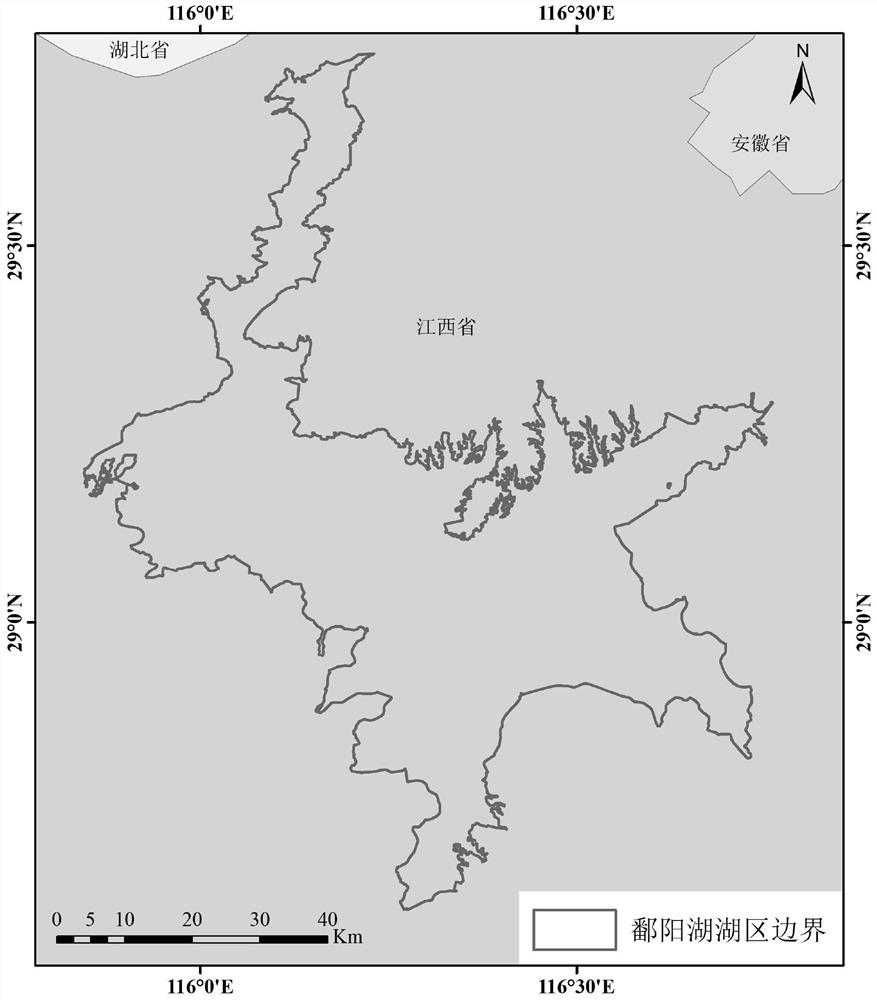
[0050] Embodiment 1 Taking Poyang Lake from January 2000 to October 2015 as an example, the method of the present invention is further described.

[0051] Such as figure 1 As shown, the research area is selected as the Poyang Lake area, with a total area of ​​about 3074 square kilometers. The image data uses Landsat-5, 7, 8TM, ETM+, OLI sensor optical remote sensing image data from February 1984 to October 2015. The auxiliary data includes Randolph Glacier Inventory 5.0 glacier data, Global Human Settlement DataLayer (GHSL) buildings data, DEM digital elevation model data, etc.

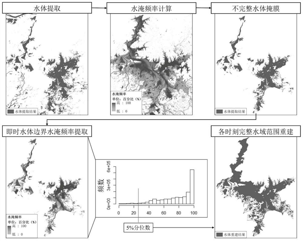
[0052] The flow process of the inventive method is as figure 2 shown, including the following steps:

[0053] Step 1. Obtain the remote sensing image data, and extract the water body raster images in the optical remote sensing images of each scene;

[0054] Combining expert system, visual analysis and evidence reasoning, water bodies are extracted from optical remote sensing images (Peke et al.,...


PUM


Abstract

The present invention provides a long-sequence continuous water change reconstruction method for lakes based on a remote sensing big data platform. On the basis of the multi-year monthly global water body distribution data set obtained by the existing technology fusion of expert systems, visual analysis and evidence reasoning water body extraction schemes, through For the percentile cut of the image histogram of flooding frequency of the research lake object, the incomplete part of the submerged area of ​​the lake water area obtained by the existing method is interpolated, and the reconstruction of the long-term continuous water area change of the large lake is effectively realized. This method can use free medium and high spatial resolution images (such as Landsat or environmental satellite environmental data) and auxiliary data, which expands the scope of application of the method and provides an important method for hydrological analysis of lakes and their watersheds and environmental change research. support.

Description

technical field [0001] The invention relates to the technical field of remote sensing, in particular to a method for reconstructing changes in long-term continuous water areas of lakes based on a remote sensing big data platform. Background technique [0002] Lakes play a role in maintaining, purifying and storing surface water and are an important part of the water cycle (Lehnerand 2004), its formation and evolution are not only affected by natural environmental factors and changes in the basin, but also deeply disturbed by human activities (Yang Guishan, Ma Ronghua, Zhang Lu, et al., 2010). Changes in lake water reflect regional water balance, biological Geochemical balance, energy and gas exchange with the atmosphere, and human water consumption (Sheng et al., 2016), and drastic changes in lake water volume will have an impact on the local ecological environment (Feng et al., 2012). The continuous water change data of lakes can be used to evaluate lake changes, provide ...

Claims


Application Information

Patent Timeline
Patent Type & Authority Patents(China)
IPC IPC(8): G06V20/10G06V20/13G06V10/26G06V10/762G06K9/62
CPCG06V20/182G06V10/267G06F18/23
Inventor 宋春桥吴倩浛刘凯马荣华
Owner NANJING INST OF GEOGRAPHY & LIMNOLOGY
Why Eureka
Try Eureka