Coastline transition remote sensing monitoring and analyzing method and device

A technology of remote sensing monitoring and coastline, applied to instruments, character and pattern recognition, scene recognition, etc., can solve the problems of high cost of manpower and material resources, long working cycle, and low efficiency

Pending Publication Date: 2020-04-10
BEIJING AEROSPACE TITAN TECH CO LTD
View PDF1 Cites 15 Cited by
  • Summary
  • Abstract
  • Description
  • Claims
  • Application Information

AI Technical Summary

Problems solved by technology

However, the field measurement method has problems such as long working

Method used


Image

  • Coastline transition remote sensing monitoring and analyzing method and device
  • Coastline transition remote sensing monitoring and analyzing method and device
  • Coastline transition remote sensing monitoring and analyzing method and device

Examples


Embodiment approach

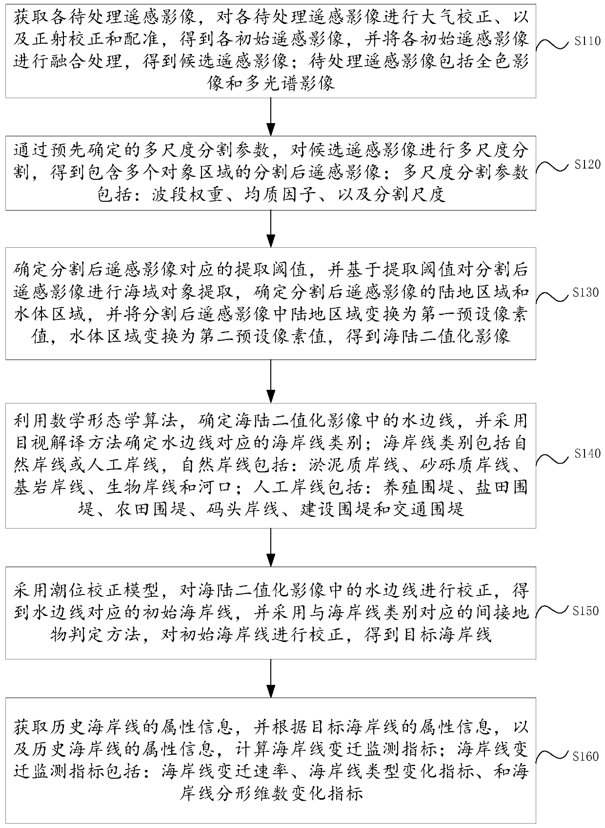
[0212] As an implementation manner of an embodiment of the present invention, the image acquisition module includes:

[0213] The atmospheric correction sub-module is used to perform atmospheric correction on each of the remote sensing images to be processed through the atmospheric radiation transfer model method;

[0214] The orthorectification sub-module is used to perform orthorectification on the atmospherically corrected panchromatic image through a rational function model, to correct the panchromatic image after correction, and to correct the previous panchromatic image of the panchromatic image Registering the multi-spectral image with the image as a reference; registering the panchromatic image with the corrected image of the last panchromatic image of the panchromatic image as a reference;

[0215] The fusion sub-module is configured to use the Pansharp fusion device to fuse the registered panchromatic image and the multi-spectral image to obtain candidate remote sens...


PUM


Abstract

The embodiment of the invention discloses a coastline transition remote sensing monitoring and analyzing method and device. By applying the scheme provided by the embodiment of the invention, the coastline can be automatically extracted through an object-oriented method based on a remote sensing technology, so that the dynamic change of a coastline can be efficiently monitored. Moreover, coast material composition and coast development status are comprehensively considered, and based on image features of different coast types, and features of colors, textures, spatial distribution and the likeare analyzed, so that accurate extraction of coast line types is realized. On the basis of sea-land separation, waterline extraction and coastline classification, the coastline is corrected accordingto a tide level correction model and in combination with indirect ground feature characteristics of different coasts, the coastline in strict significance is obtained, and the accuracy of coastline determination is improved. And the coastline change condition can be accurately analyzed through a coastline change rate, a coastline type change index and a coastline fractal dimension change index.

Description

technical field [0001] The invention relates to the technical field of coastline monitoring, in particular to a method and device for remote sensing monitoring and analysis of coastline changes. Background technique [0002] The coastline is the dividing line between land and sea. In my country, it also refers to the boundary between land and sea at the average high tide level of spring tides for many years. The geographical and ecological location near the coastline is special, which is an important support for the development of marine economy and society. The change of the coastline reflects the change of the environment of the coastal zone, which is closely related to human life and production activities. With the construction of various coastal projects and the rapid economic development of coastal areas, the location, length and trend of the coastline have undergone drastic changes, its natural attributes have rapidly decreased, and its original production capacity an...

Claims


Application Information

Patent Timeline
IPC IPC(8): G06K9/00G06K9/34G06K9/46G06K9/62G06K9/03
CPCG06V20/13G06V10/98G06V10/267G06V10/44G06F18/251
Inventor 谭靖李莹康芮王玮孙辉涛
Owner BEIJING AEROSPACE TITAN TECH CO LTD
Why Eureka
Try Eureka