Urban built-up area intelligent extraction method supporting multi-source data

A technology of multi-source data and extraction methods, applied in structured data retrieval, electronic digital data processing, geographic information databases, etc., can solve problems such as unsimple processing procedures and difficult popularization and application, and achieve low-cost effects

Active Publication Date: 2020-05-08
INST OF URBAN ENVIRONMENT CHINESE ACAD OF SCI
View PDF7 Cites 5 Cited by
  • Summary
  • Abstract
  • Description
  • Claims
  • Application Information

AI Technical Summary

Problems solved by technology

However, due to the different acquisition costs of different remote sensing data, the processing

Method used


Image

  • Urban built-up area intelligent extraction method supporting multi-source data
  • Urban built-up area intelligent extraction method supporting multi-source data
  • Urban built-up area intelligent extraction method supporting multi-source data

Examples


Embodiment Construction

[0048] To further illustrate the various embodiments, the present invention is provided with accompanying drawings. These drawings are a part of the disclosure of the present invention, which are mainly used to illustrate the embodiments, and can be combined with related descriptions in the specification to explain the operating principles of the embodiments. With reference to these contents, those skilled in the art should understand other possible implementations and advantages of the present invention. Components in the figures are not drawn to scale, and similar component symbols are generally used to denote similar components.

[0049] The present invention will be further described in conjunction with the accompanying drawings and specific embodiments.

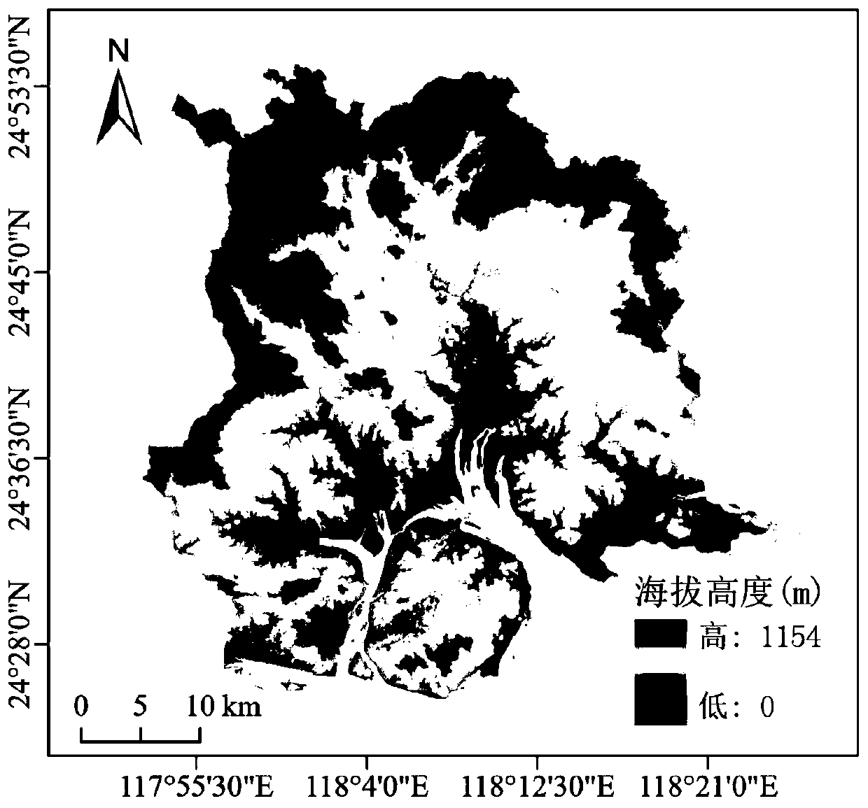
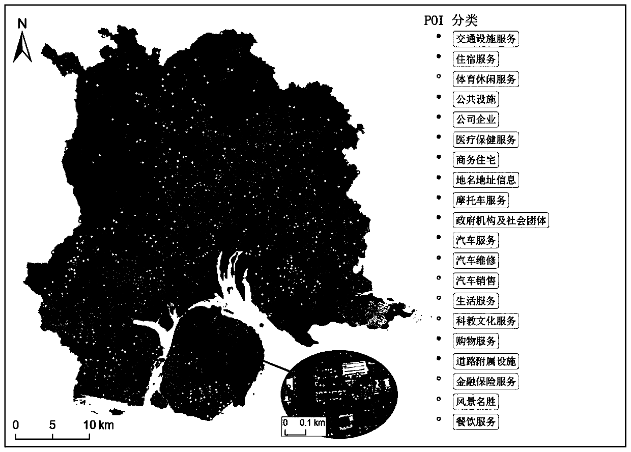
[0050] The invention discloses a method for intelligently extracting urban built-up areas supporting multi-source data, searching for low-cost data from different sources associated with information on urban built-up ar...


PUM


Abstract

The invention discloses an urban built-up area intelligent extraction method supporting multi-source data. Low-cost data of different sources associated with city built-up area information is searched, normalization of point, line and surface data sources is realized through a kernel density estimation method, and unified classifier construction and evaluation are realized through a decision treealgorithm so that an effective classifier is obtained; the data can be used independently or in a combined mode, city built-up area information is extracted through a classifier, and therefore the space distribution of the city built-up area is estimated. According to the extraction method, the change information of the urban built-up area can be provided for urban planners and decision departments at an extremely low cost, so that reference information is provided for the urban planners and the decision departments to detect urban expansion and formulate urban planning.

Description

technical field [0001] The invention relates to the fields of urban planning and urban management, in particular to an intelligent extraction method for urban built-up areas supporting multi-source data. Background technique [0002] Accurately obtaining information on urban built-up areas is a meaningful but challenging task. Scholars have carried out extensive research on this. Traditionally, information on urban built-up areas is mainly obtained from remote sensing images by means of remote sensing technology. Including Road Network (RN) data, Nighttime Light (NTL) data, radar image data and other data based on remote sensing images. Some achievements have been made in obtaining urban built-up area information from remote sensing images. However, due to the different acquisition costs of different remote sensing data and the processing flow is not simple, traditional research methods are difficult to achieve universal application. It is meaningful to find low-cost dat...

Claims


Application Information

Patent Timeline
IPC IPC(8): G06F16/9537G06F16/29G06K9/62
CPCG06F16/9537G06F16/29G06F18/2193G06F18/24323G06F18/214Y02A30/60
Inventor 唐立娜孙朗邱全毅李倩瑜
Owner INST OF URBAN ENVIRONMENT CHINESE ACAD OF SCI
Why Eureka
Try Eureka