Earth volume calculation method and system
A computing method and computing system technology, applied in computing, measuring device, image data processing and other directions, can solve the problem of the large limitations of UAV oblique photography technology, and achieve the effect of strong practical value
- Summary
- Abstract
- Description
- Claims
- Application Information
AI Technical Summary
Problems solved by technology
Method used
Image
Examples
Embodiment Construction
[0031] In order to make the above objects, features and advantages of the present invention more comprehensible, the present invention will be further described in detail below in conjunction with the accompanying drawings and specific embodiments.
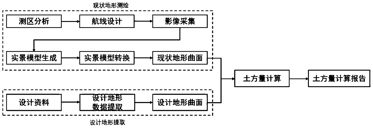
[0032] Such as figure 1 As shown, the present invention provides a method for calculating earthwork volume, comprising:
[0033] Step S1, using the UAV oblique photography technology to obtain the current terrain data of the target object;
[0034] Here, UAV oblique photography technology can be used to obtain oblique image data of the current terrain sequence, and at the same time, the coordinate information of site control points can be obtained by using measuring instruments such as total stations;
[0035] Step S2, processing the current terrain data to establish a real scene model of the current terrain;
[0036] Step S3, extracting (x, y, z) three-dimensional coordinates of each point graphic element in the terrain from th...
PUM
 Abstract
Description
Claims
Application Information
 - R&D
- Intellectual Property
- Life Sciences
- Materials
- Tech Scout
- Unparalleled Data Quality
- Higher Quality Content
- 60% Fewer Hallucinations
Browse by: Latest US Patents, China's latest patents, Technical Efficacy Thesaurus, Application Domain, Technology Topic, Popular Technical Reports.
© 2025 PatSnap. All rights reserved.Legal|Privacy policy|Modern Slavery Act Transparency Statement|Sitemap|About US| Contact US: help@patsnap.com

