

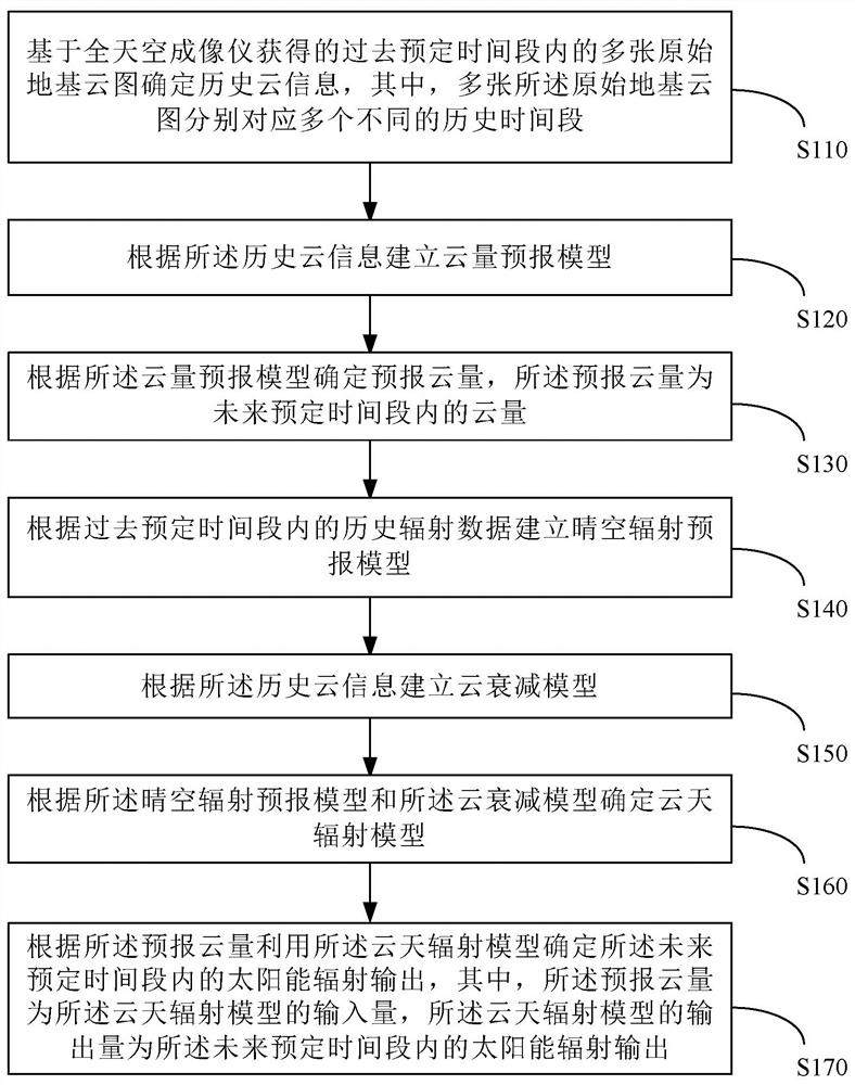
A method for ultra-short-term forecasting of solar energy resources based on ground-based cloud images
A technology for solar energy resources and ground-based cloud map, which is applied in the fields of computer-readable storage media, ultra-short-term forecasting of solar energy resources, and electronic equipment, and can solve problems such as low temporal resolution and spatial resolution, and limited forecast accuracy.
- Summary
- Abstract
- Description
- Claims
- Application Information
AI Technical Summary
Problems solved by technology
Method used
Image

Examples
Embodiment approach
[0072] For any one of the real-time all-sky cloud images, the step of determining the historical sun shading level according to the cloud coverage area of the current real-time all-sky cloud image includes:
[0073] Determine the position of the sun in the current real-time all-sky cloud map;
[0074] The surrounding area of the sun in the current real-time all-sky cloud image is analyzed to determine the historical sun occlusion level.
[0075] In the present disclosure, there is no special limitation on how to calculate the position of the sun in the real-time all-sky cloud map. For example, the position of the sun in the real-time all-sky cloud map can be calculated through the lens installation position of the all-sky imager, azimuth information, time information of the region where the all-sky imager is installed, and the distortion projection function of the fisheye lens picture .
[0076] In order to comprehensively consider the influence of various factors, a dee...
PUM
 Abstract
Description
Claims
Application Information