Airline planning method

A route and building technology, applied in three-dimensional position/channel control, vehicle position/route/altitude control, non-electric variable control, etc., can solve the problem of unfavorable collection of high-rise building data in the original unit route, and achieve the goal of improving the data collection effect. Effect

Pending Publication Date: 2021-07-13
CHENGDU RAINPOO TECH CO LTD
View PDF11 Cites 3 Cited by
  • Summary
  • Abstract
  • Description
  • Claims
  • Application Information

AI Technical Summary

Problems solved by technology

[0004] In order to solve the above problems, the present invention provides a route planning method. By adopting this scheme, the situation that the original unit route is not conducive to collecting high-rise building data is solved, and the data collection effect of high-rise buildings in cities is improved. Even if there are high-rise buildings in the survey area Buildings can also collect high-quality data

Method used


Image

  • Airline planning method
  • Airline planning method
  • Airline planning method

Examples


Embodiment

[0025] Example: such as Figure 1 to Figure 7 As shown, the specific steps of a route planning method in this embodiment are:

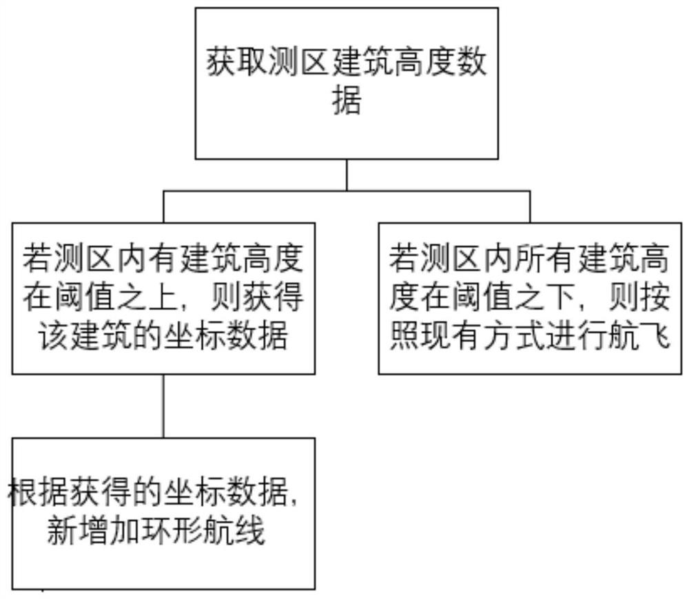
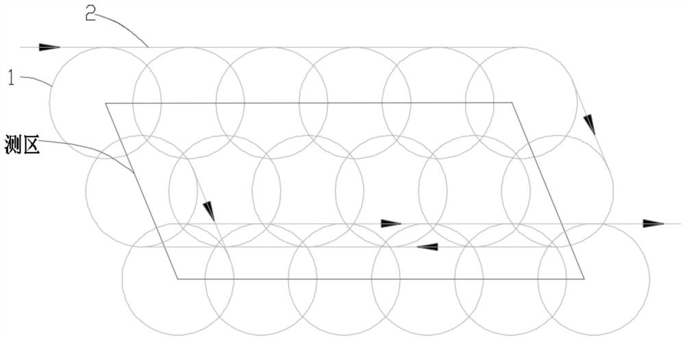
[0026] 1. Divide the survey area (including the extended area of ​​the survey area) into several units of the same size, and the aircraft flies in each unit according to the route of the predetermined shape, and then connects the routes of each unit to form a complete flight route 6. These routes in each unit are called unit routes, and the routes connecting each unit route are called connecting routes. The unit routes are encircling, and their shapes can be regular polygons such as squares, regular hexagons, and regular octagons. is round. The route generated in this way is called the original route, the unit route in this route is called the original unit route 1, and the connecting route in this route is called the original connecting route 2.

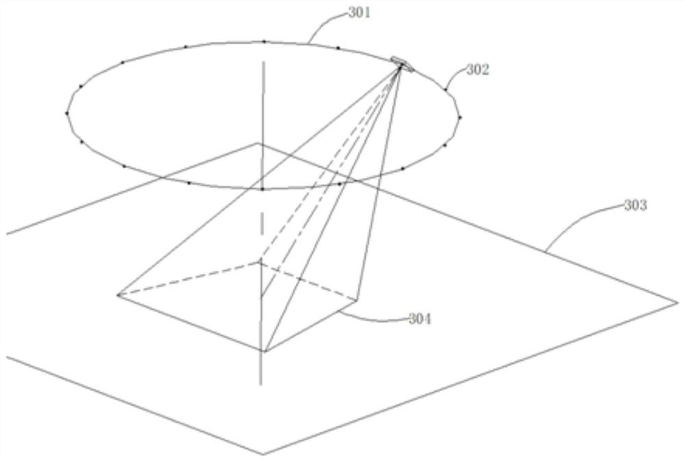
[0027] 2. The following is the calculation method for the flight height, radius and number of photos ...


PUM


Abstract

The invention provides a route planning method, and relates to the technical field of unit route data acquisition, and the method comprises the following steps: S1, obtaining elevation data of a measurement area; s2, judging whether the height of each building in the measuring area exceeds a threshold value or not; and S3, if the set threshold value is exceeded, obtaining coordinates of the building, and adding a new unit route according to the coordinates. By the adoption of the scheme, the problem that an original unit route is not beneficial to collection of high-rise building data is solved; so that the data collection effect of urban high-rise buildings is improved, and high-quality data can be collected even if high-rise buildings exist in a measurement area.

Description

technical field [0001] The invention relates to the technical field of unit route data collection, in particular to a route planning method. Background technique [0002] In the prior art, the use of unit routes for data collection is a new data collection method in the field of oblique photography. Compared with the previous five-camera data collection method, this method requires fewer cameras and less data; but this This method is currently only effective in suburban or rural areas, but because of the poor effect of this method on data collection of high-rise buildings, the effect in urban high-rise areas is poor. [0003] Therefore, how to use the data collection method of unit routes to improve the data collection effect in urban high-rise buildings is an urgent problem to be solved at present. Contents of the invention [0004] In order to solve the above problems, the present invention provides a route planning method. By adopting this scheme, the situation that th...

Claims


Application Information

Patent Timeline
Patent Type & Authority Applications(China)
IPC IPC(8): G05D1/08G05D1/10
CPCG05D1/0808G05D1/101
Inventor 李成何超吴阳陈钱刘斌
Owner CHENGDU RAINPOO TECH CO LTD
Why Eureka
Try Eureka