A Ridgeline Extraction Method Combining Morphological Features and Runoff Simulation
A technology of morphological features and extraction methods, applied in character and pattern recognition, computing, computer parts, etc., can solve the problem of poor comparability of ridge lines
- Summary
- Abstract
- Description
- Claims
- Application Information
AI Technical Summary
Problems solved by technology
Method used
Image
Examples
Embodiment 1
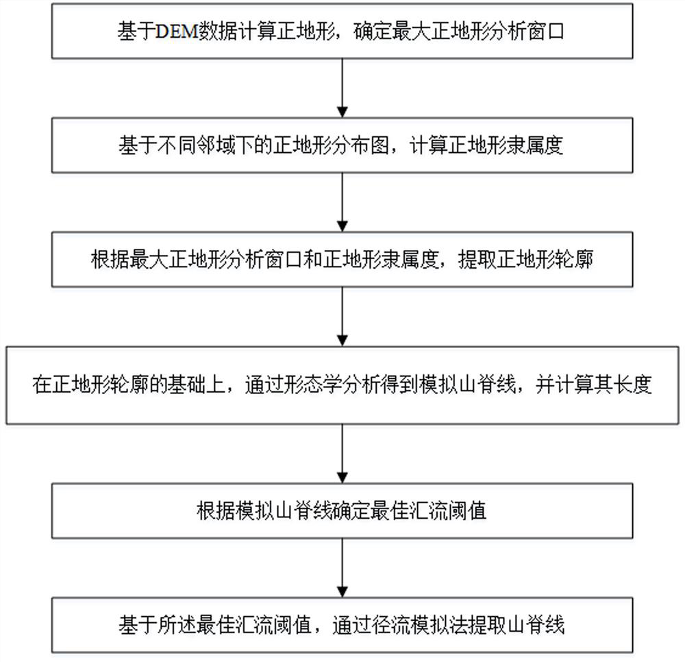
[0052] A ridgeline extraction method that combines morphological features and runoff simulation, such as figure 1 shown, including:
[0053] Step S1, calculating positive terrain based on DEM data, and determining the maximum positive terrain analysis window;
[0054] Step S2, calculating the membership degree of positive terrain based on the distribution map of positive terrain in different neighborhoods;
[0055] Step S3, according to the maximum positive terrain analysis window and the positive terrain membership degree, extract the positive terrain profile;
[0056] Step S4, on the basis of the positive terrain profile, obtain the simulated ridgeline through morphological analysis, and calculate its length;
[0057] Step S5, determining the optimal confluence threshold according to the simulated ridgeline;
[0058] Step S6, based on the optimal confluence threshold, extract the ridgeline by the runoff simulation method.
[0059] Preferably, the method for determining ...
Embodiment 2
[0073] A ridgeline extraction method combining morphological features and runoff simulation, the main process includes:
[0074] (1) Positive terrain calculation.
[0075] Positive terrain is a relatively high part within a certain range, which can be determined by the macroscopic shape factor P add area
[0076] point. when P When > 0, it is positive terrain, and its calculation formula is as follows:
[0077]
[0078] in H i,j is the elevation value of the grid at the center of the window, is the sum of the elevation values of the valid rasters in the window, n is the number of valid grids in the window.
[0079] (2) The maximum positive terrain analysis window is determined.
[0080] In the process of positive terrain analysis, the size of the local neighborhood plays a crucial role in whether it is a positive terrain. This embodiment starts with the multiple neighborhood analysis of DEM, determines the law that the area of positive terrain changes with th...
Embodiment 3
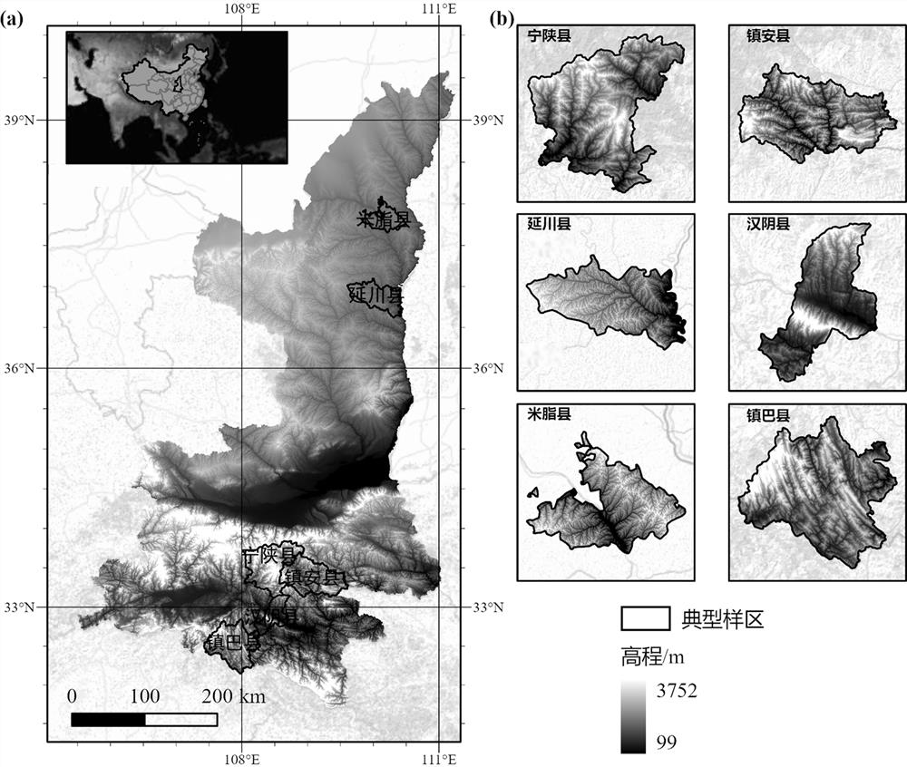
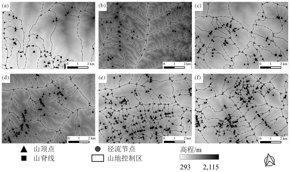
[0100] In order to verify the accuracy of the method of the present application, the present embodiment is based on the extraction method described in figure 2 Experiments were performed on the 6 typical plots shown.
[0101] figure 2The study area shown is Shaanxi Province (105°29′E~111°15′E, 31°42′N~39°35′N) located in the hinterland of northwest China, with a land area of 205,700 km2. The general feature of the terrain of Shaanxi Province is that it is high in the north and south and low in the middle. At the same time, the characteristics of the terrain sloping from west to east are also obvious. Beishan and Qinling divide Shaanxi into three natural areas: the northern part is the northern Shaanxi Plateau, including aeolian sand landforms, Loess Plateau (including plateaus, beams, ridges, hills and ravines, etc.) landforms. Precipitation is scarce and unevenly distributed, which is an ecologically fragile area. The frequency of drought is high and the soil erosion i...
PUM
 Abstract
Description
Claims
Application Information
 - R&D
- Intellectual Property
- Life Sciences
- Materials
- Tech Scout
- Unparalleled Data Quality
- Higher Quality Content
- 60% Fewer Hallucinations
Browse by: Latest US Patents, China's latest patents, Technical Efficacy Thesaurus, Application Domain, Technology Topic, Popular Technical Reports.
© 2025 PatSnap. All rights reserved.Legal|Privacy policy|Modern Slavery Act Transparency Statement|Sitemap|About US| Contact US: help@patsnap.com


