Mapping method and system

a mapping method and mapping system technology, applied in the field of computer network-based mapping systems, can solve the problem of not being able to facilitate the user's interaction with the location aspect of the data

Inactive Publication Date: 2005-02-03
OATH INC
View PDF21 Cites 483 Cited by
  • Summary
  • Abstract
  • Description
  • Claims
  • Application Information

AI Technical Summary

Benefits of technology

[0006] A method comprises the steps of: receiving a query from a user, generating a map in response to the query, identifying items within an area covered by the map, displaying interactive icons on the map at locations corresponding to the locations of the items, displaying a textual list of the items displayed on the map, enabling a user to select at least one item from the textual list for continued display; and displaying the at least one selected item on the map simultaneously while displaying items found by a subsequent query, regardless of whether the at least one selected item satisfies a search criterion used in the subsequent query.

Problems solved by technology

In all these cases, the location information is an important aspect of each item, however, in many systems there is no easy way for the user to interact with the location aspect of the data.

Method used


Image

  • Mapping method and system
  • Mapping method and system
  • Mapping method and system

Examples


Embodiment Construction

[0027] U.S. Provisional Patent Application No. 60 / 471,822, filed May 20, 2003, and U.S. Patent Application Publication US 2004 / 0073538, and U.S. Pat. No. 6,240,360 are incorporated by reference as though set forth herein in their entireties.

[0028] This description of the exemplary embodiments is intended to be read in connection with the accompanying drawings, which are to be considered part of the entire written description.

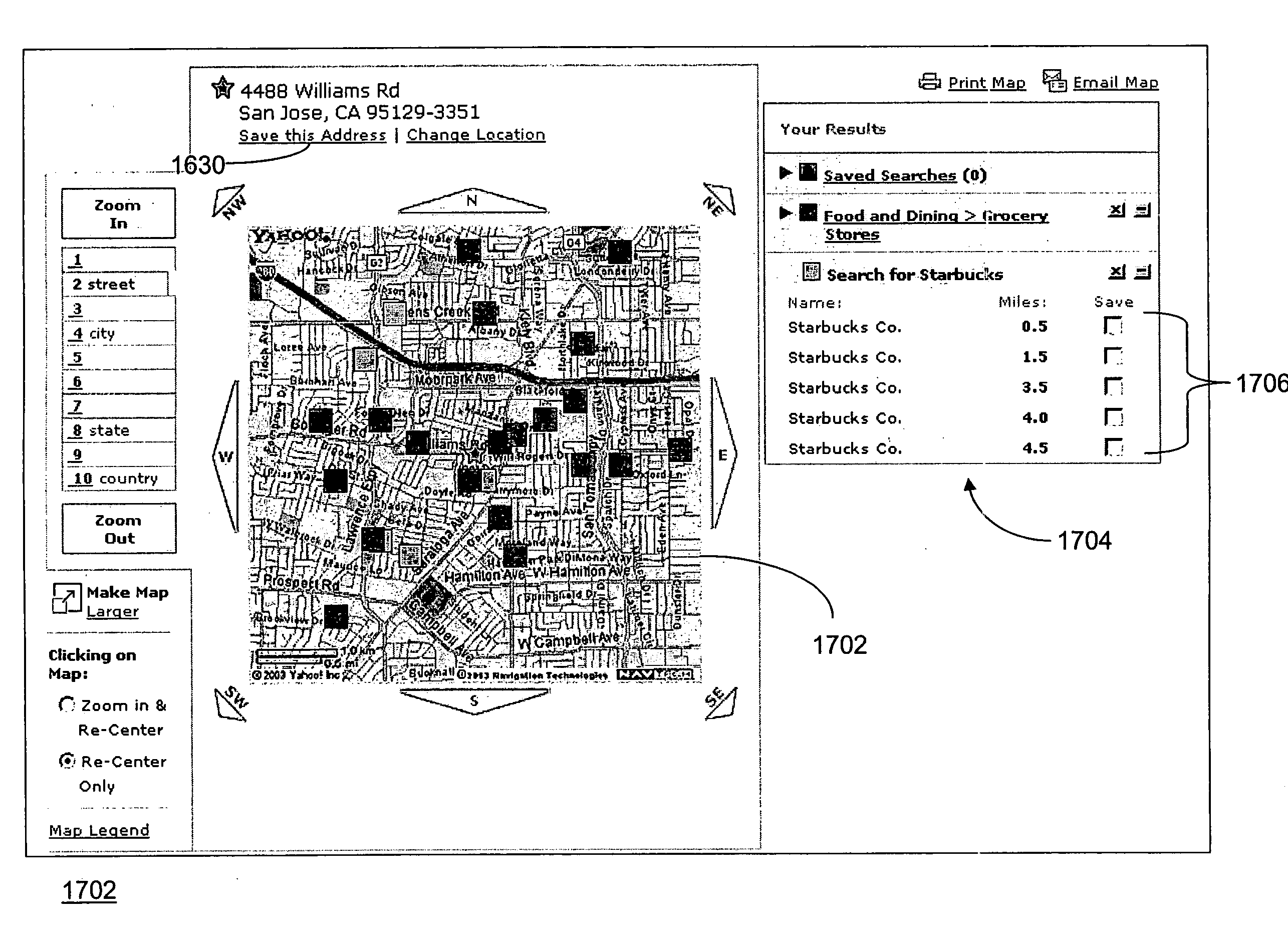
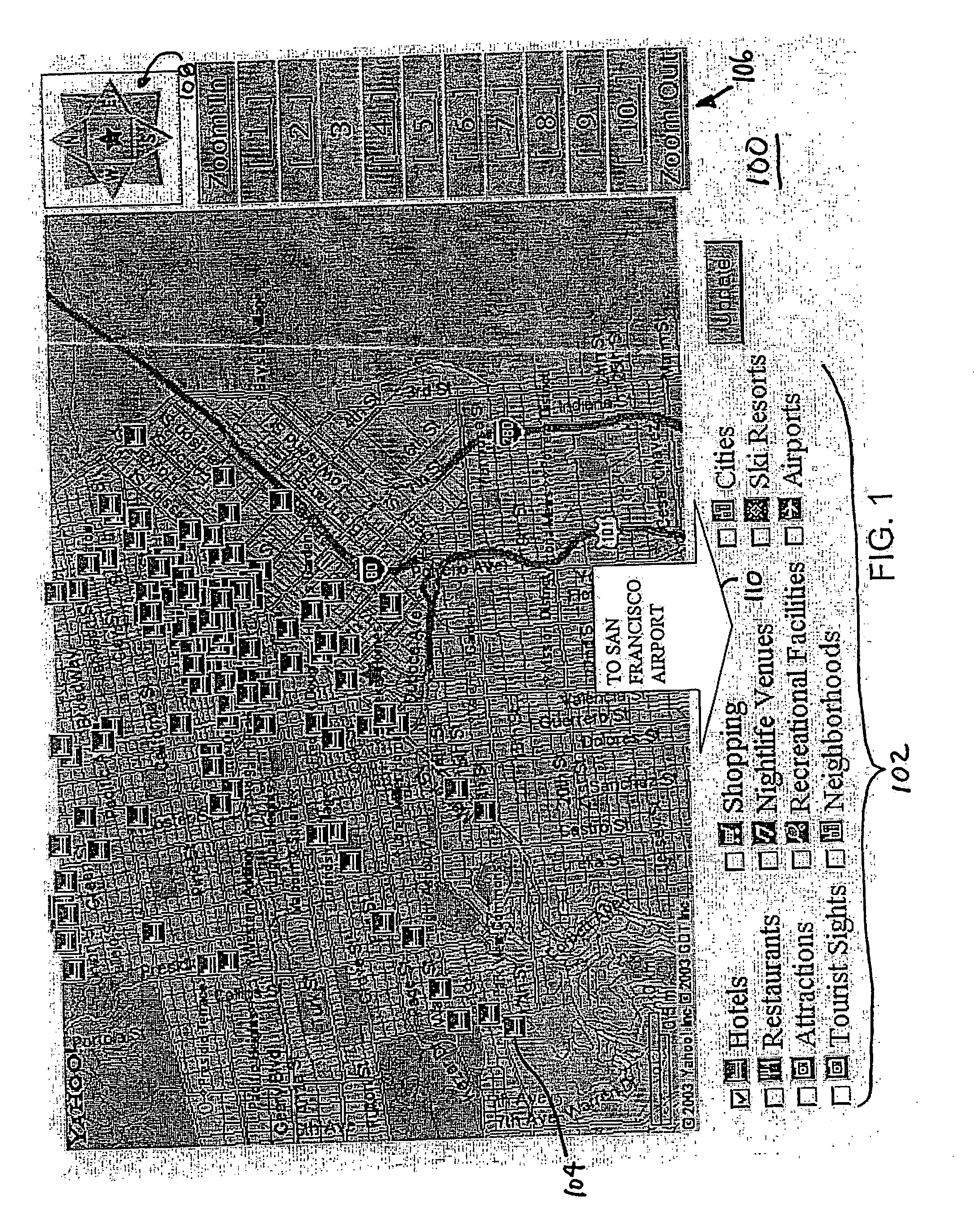
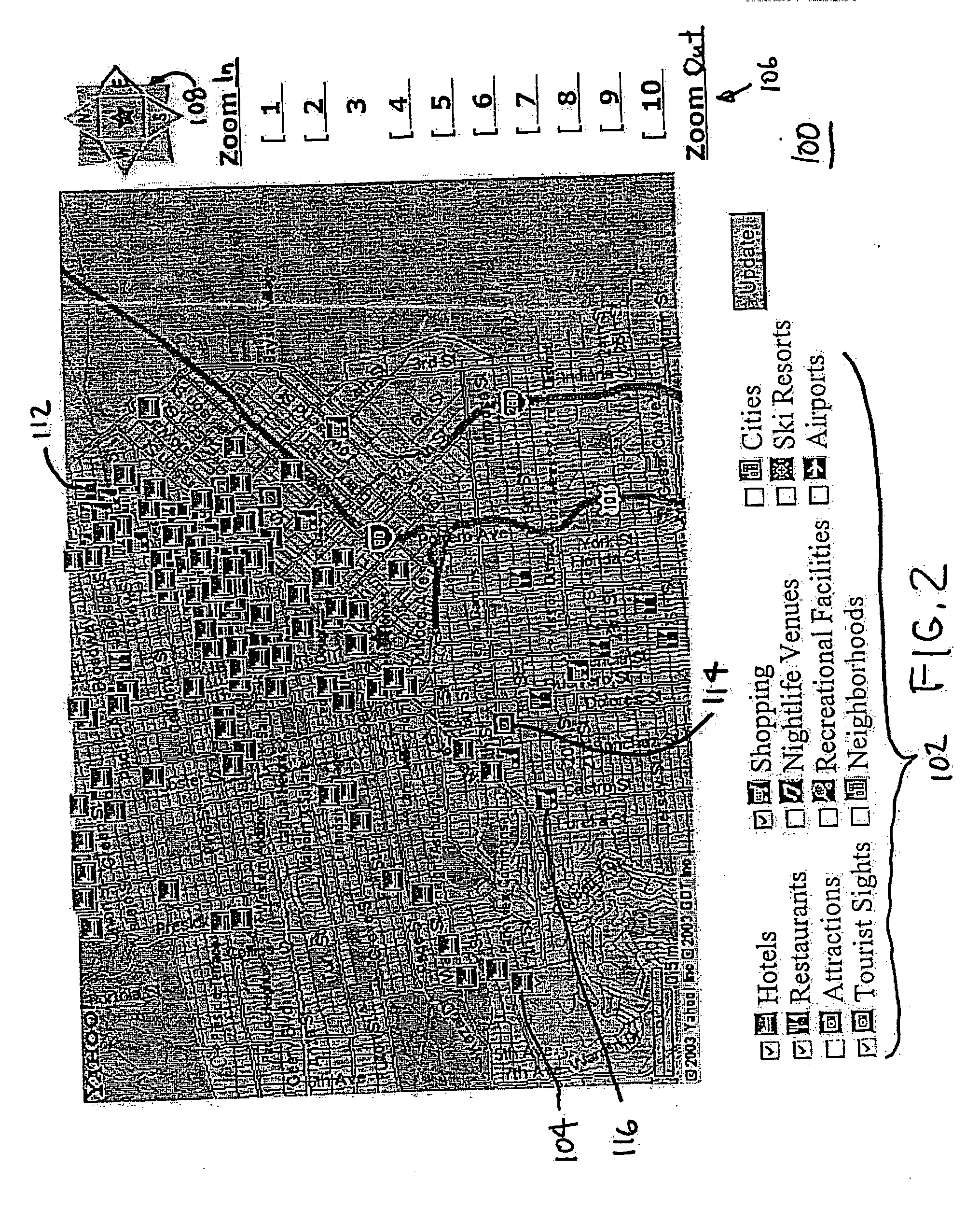
[0029] An exemplary method of presenting location based items, integrated with a geographical map, allows the user to obtain detailed information about the items and their spatial relationships, and to control their display.

[0030] The term “items” as used herein are not limited to public, historic or well known landmarks and attractions, but broadly cover a wide variety of objects or locations, such as buildings, monuments, artworks, tracts of land or other items that may be of interest to any person, for either tourist, commercial, residential, academic, his...


PUM


Abstract

A method includes: receiving a query from a user, generating a map in response to the query, identifying items within an area covered by the map, displaying interactive icons on the map at locations corresponding to the locations of the items, displaying a textual list of the items displayed on the map, enabling a user to select at least one item from the textual list for continued display; and displaying the at least one selected item on the map simultaneously while displaying items found by a subsequent query, regardless of whether the at least one selected item satisfies a search criterion used in the subsequent query.

Description

[0001] This application claims the benefit of U.S. Provisional Patent Application No. 60 / 471,822, filed May 20, 2003.FIELD OF THE INVENTION [0002] The present invention relates to computer-network-based mapping systems. BACKGROUND [0003] Many online databases are concerned with data items that are inherently location based. For example, an online database of hotels or a database of real estate listings or a database of weekend garage sales can all have locations in the form of street addresses associated with them. In all these cases, the location information is an important aspect of each item, however, in many systems there is no easy way for the user to interact with the location aspect of the data. [0004] For example, it is known to provide a web-based system that shows maps with numbered icons in response to a user's query. For example, if the user requests information on hotels in Miami, the system will show the user what hotels are available by displaying numbers at the locat...

Claims


Application Information

Patent Timeline
Patent Type & Authority Applications(United States)
IPC IPC(8): G06F17/30
CPCG06F17/30994G06F17/30241G06F16/29G06F16/904
Inventor SADRI, PASHAKREITLER, JEREMYGIL, BRIANTRAN, THAI
Owner OATH INC
Why Eureka
Try Eureka