
Geographic information system (GIS) for displaying 3D geospatial images with reference markers and related methods

Inactive Publication Date: 2007-11-08
HARRIS CORP
View PDF9 Cites 36 Cited by
  • Summary
  • Abstract
  • Description
  • Claims
  • Application Information

AI Technical Summary

Problems solved by technology

One challenge of displaying and interacting with digital 3D images on a computer is that this is traditionally accomplished using two-dimensional (2D) interaction mechanisms.
The first way is to create or place a 3D object in the scene, which can be a cumbersome multi-step process.
While there are multiple points of view often being displayed simultaneously, the process may still be relatively unintuitive to the user.
While such approaches may be helpful for interacting with 2D images, these approaches may not be of use for working with 3D images.
While certain haptic (i.e., technology that interfaces the user via the sense of touch) and inherently 3D input devices do exist which attempt to facilitate interaction with 3D data, such devices are typically expensive, require specialized hardware / software, have a substantial learning curve, and / or are not readily available.

Method used


Image

  • Geographic information system (GIS) for displaying 3D geospatial images with reference markers and related methods
  • Geographic information system (GIS) for displaying 3D geospatial images with reference markers and related methods
  • Geographic information system (GIS) for displaying 3D geospatial images with reference markers and related methods

Examples


Embodiment Construction

[0021] The present invention will now be described more fully hereinafter with reference to the accompanying drawings, in which preferred embodiments of the invention are shown. This invention may, however, be embodied in many different forms and should not be construed as limited to the embodiments set forth herein. Rather, these embodiments are provided so that this disclosure will be thorough and complete, and will fully convey the scope of the invention to those skilled in the art. Like numbers refer to like elements throughout, and prime and multiple prime notation are used to indicate similar elements in alternate embodiments.

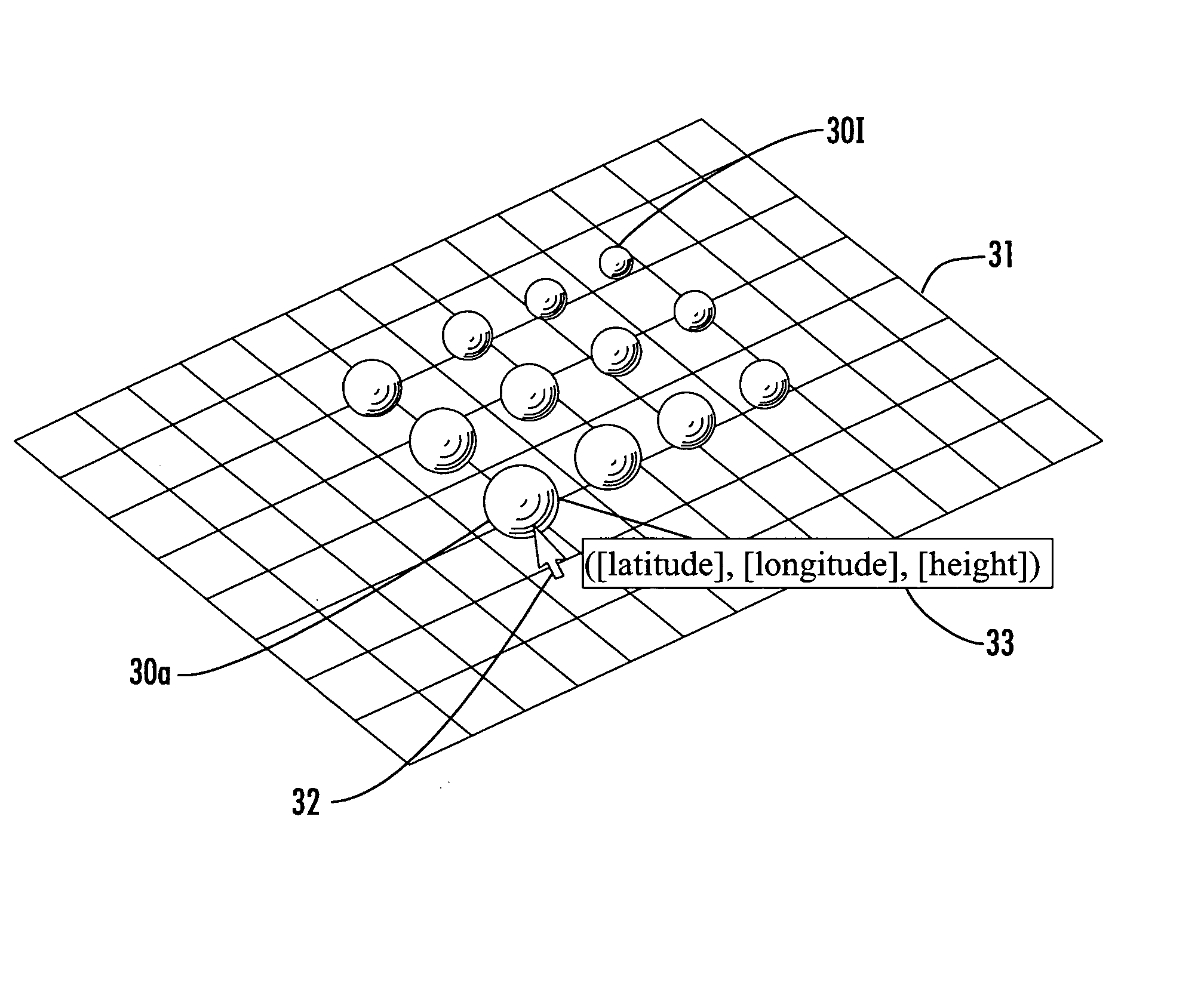
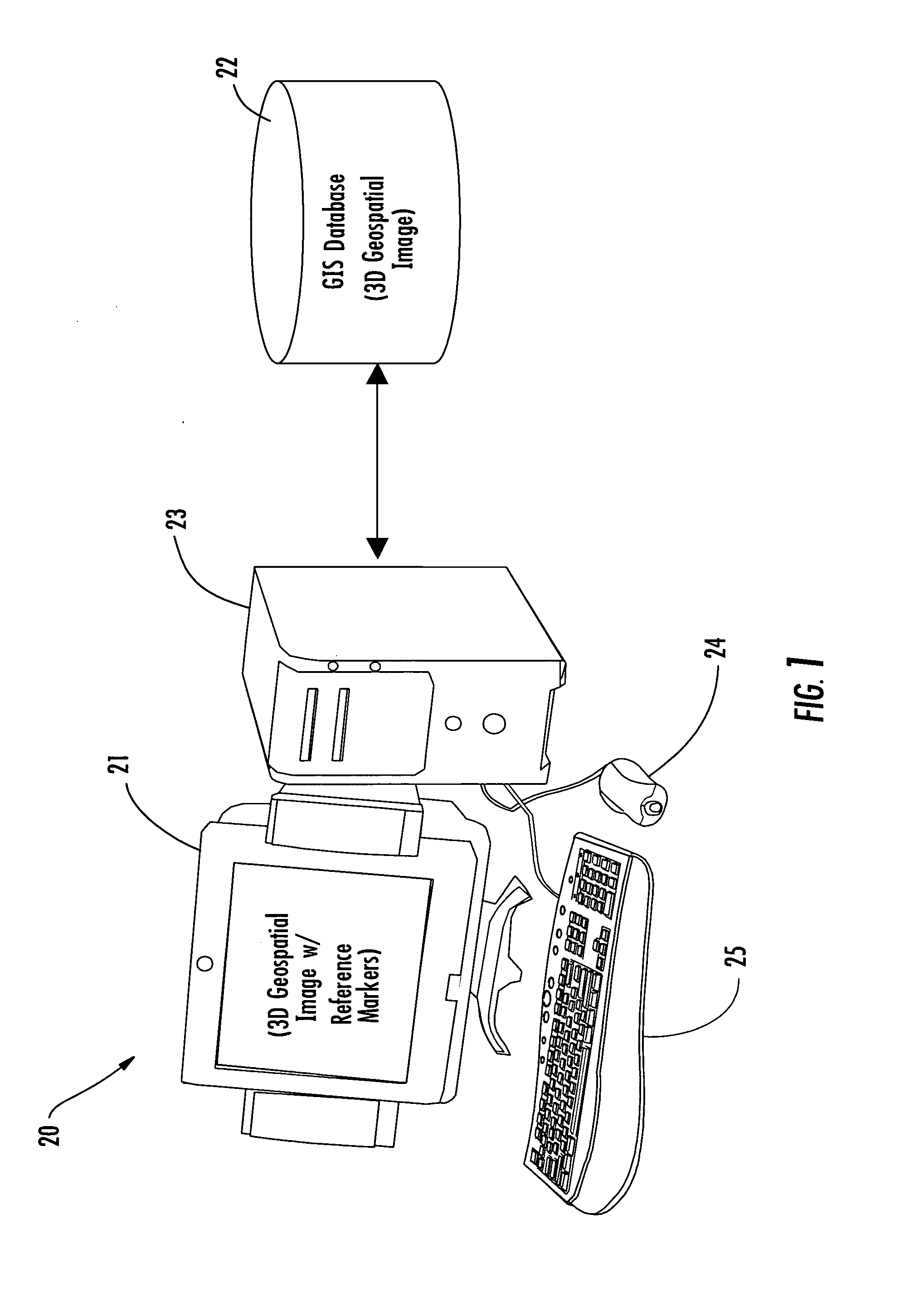
[0022] Referring initially to FIG. 1, a geographic information system (GIS) 20 illustratively includes a display 21, a GIS (or other 3D image) database 22, and a processor 23 (e.g., a computer CPU). Moreover, input devices such as a mouse 24 and a keyboard 25 are connected to the processor 23 for allowing a user to interact with and manipulate data (e.g....


PUM


Abstract

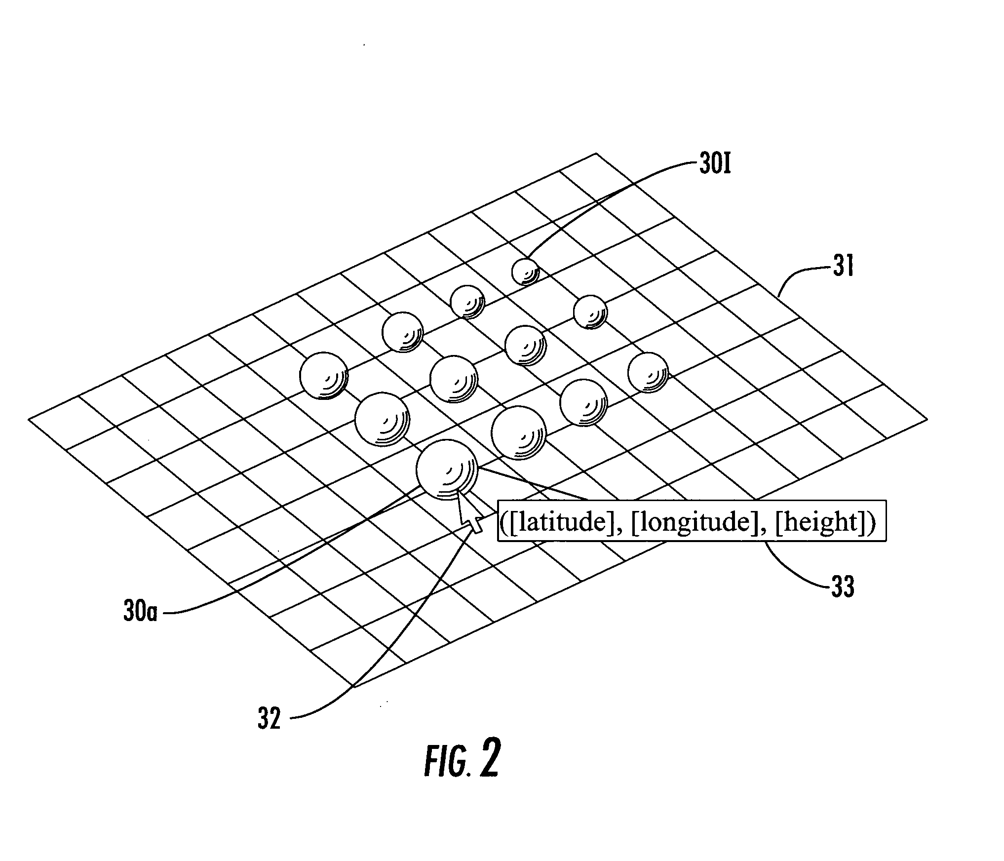
A geographic information system (GIS) may include a display, a GIS database, and a processor the processor may cooperate with the display and the GIS database to display a three-dimensional (3D) geospatial image including a plurality of spaced-apart reference markers therein. The reference markers may have different visual characteristics indicative of different relative positions within the 3D geospatial image. The processor may also associate with each reference marker selectively displayable position data. The reference markers may have different sizes and / or colors, for example.

Description

FIELD OF THE INVENTION [0001] The present invention relates to the field of image processing systems, and, more particularly, to geographic information systems (GIS) and related methods. BACKGROUND OF THE INVENTION [0002] In certain applications it is desirable to provide digital representations of three-dimensional (3D) objects or images. By way of example, such applications may include mapping programs (e.g., Google Earth) architectural design applications (e.g., Pro / E, CATIA), digital design and modeling tools (e.g. Maya, 3DStudio Max), and three-dimensional visualization analysis tools. [0003] One challenge of displaying and interacting with digital 3D images on a computer is that this is traditionally accomplished using two-dimensional (2D) interaction mechanisms. More particularly, in 3D application domains, a 3D object is typically created / edited using only 2D input / output devices such as a monitor or display, mouse, keyboard, and / or joystick. This is usually done in one of t...

Claims


Application Information

Patent Timeline
IPC IPC(8): G06T15/00G06T17/05
CPCG06T19/00G06T17/05G06T17/00
Inventor GUTIERREZ, GUILLERMOFAULKNER, TIMOTHY
Owner HARRIS CORP
Learn More