System and method for representation of business information

a technology of business information and system, applied in the field of system and method for generating a spatial representation of business information, can solve the problems of not being able to accurately represent or detect spatial trends or associations, requiring a specialist, and taking a significant amount of tim

Inactive Publication Date: 2008-10-02
FORGE RES
View PDF1 Cites 29 Cited by
  • Summary
  • Abstract
  • Description
  • Claims
  • Application Information

AI Technical Summary

Benefits of technology

[0020]The system of the present invention, therefore, preferably has the advantage that BI information from a business intelligence (BI) application can be presented in a spatial domain (the map representation), so that a user can view relationships, trends or associations in the spatial domain and obtain insights that they may not be able to from a BI application.
[0022]The system therefore has an advantage that, in preferred embodiments, the user may work both in the spatial domain (map representation and manipulation means) and in the BI application domain, and manipulations (which includes selection of data and changes to data) of the data in either domain are provided to the other domain. This enables, for example, analysis to take place in an iterative manner between both the spatial domain and the BI application domain. Spatial patterns may be observed and spatial constraints placed on the data in the spatial domain. Manipulated data can then be sent back to the BI application for further analysis. This creates a virtuous circle where each iteration between the domains takes the analyst closer to their final analysis goal.

Problems solved by technology

BI applications are not good at representing or detecting spatial trends or associations that may exist in the BD.
This takes a significant amount of time and requires a specialist.
A problem is that the present process for creating the map layers using GIS applications is cumbersome.
Further, GIS applications allow spatial analysis but do not offer the level of statistical or numerical data analysis that is provided by BI applications.

Method used


Image

  • System and method for representation of business information
  • System and method for representation of business information
  • System and method for representation of business information

Examples


example 1

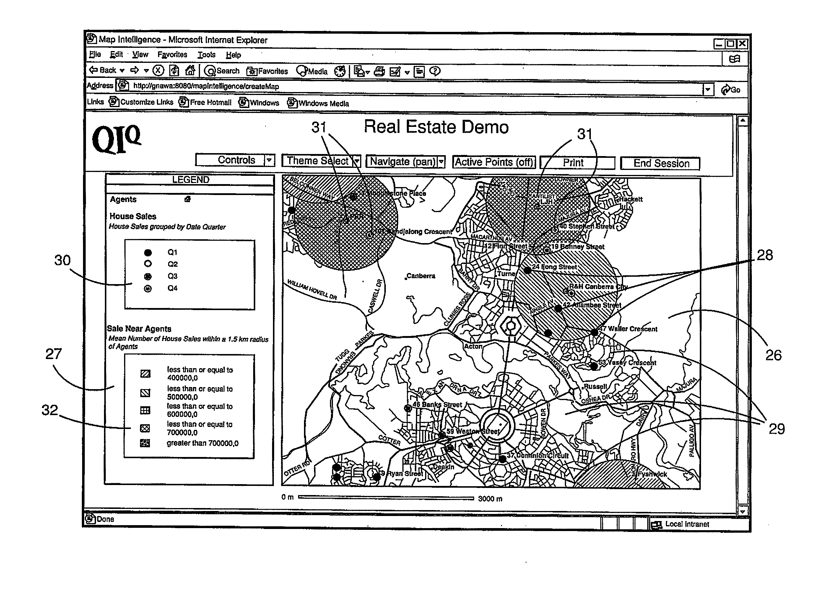
[0082]A dashboard (BI application) is used to display various ways of looking at accidents in the last month. For example by car type, by time of day, by age of driver, by weather conditions. The dashboard cannot show “accident black spots”. To do that we send these accidents to the mapping server for spatial analysis. High concentrations of accidents are easy to see on the map view. Groups of such “proximate” accidents are then selected from the map—an accident black spot. These are retrieved by the BI application which then can focus on those accidents and provide an in depth analysis of just the accidents that took place at one or more “black spots”. These accidents could not have been selected in the BI dashboard because the dashboard lacks spatial semantics, and a report showing the distribution of accidents by driver age could not be produced from the map.

example 2

[0083]The accidents are sent to the mapping server as in Example 1. Instead of selecting sets of accidents however, this time the user selects the road junctions that are the black spots as indicated by the high concentration of accidents in the last month i.e. selecting base map data. These are retrieved by the BI application and are used to generate a new query and report that shows how the concentration of accidents has varied over a time span that goes beyond the last month (the extent of the original query) at these junctions and how maintenance work carried on at these junctions affect the levels of accident.

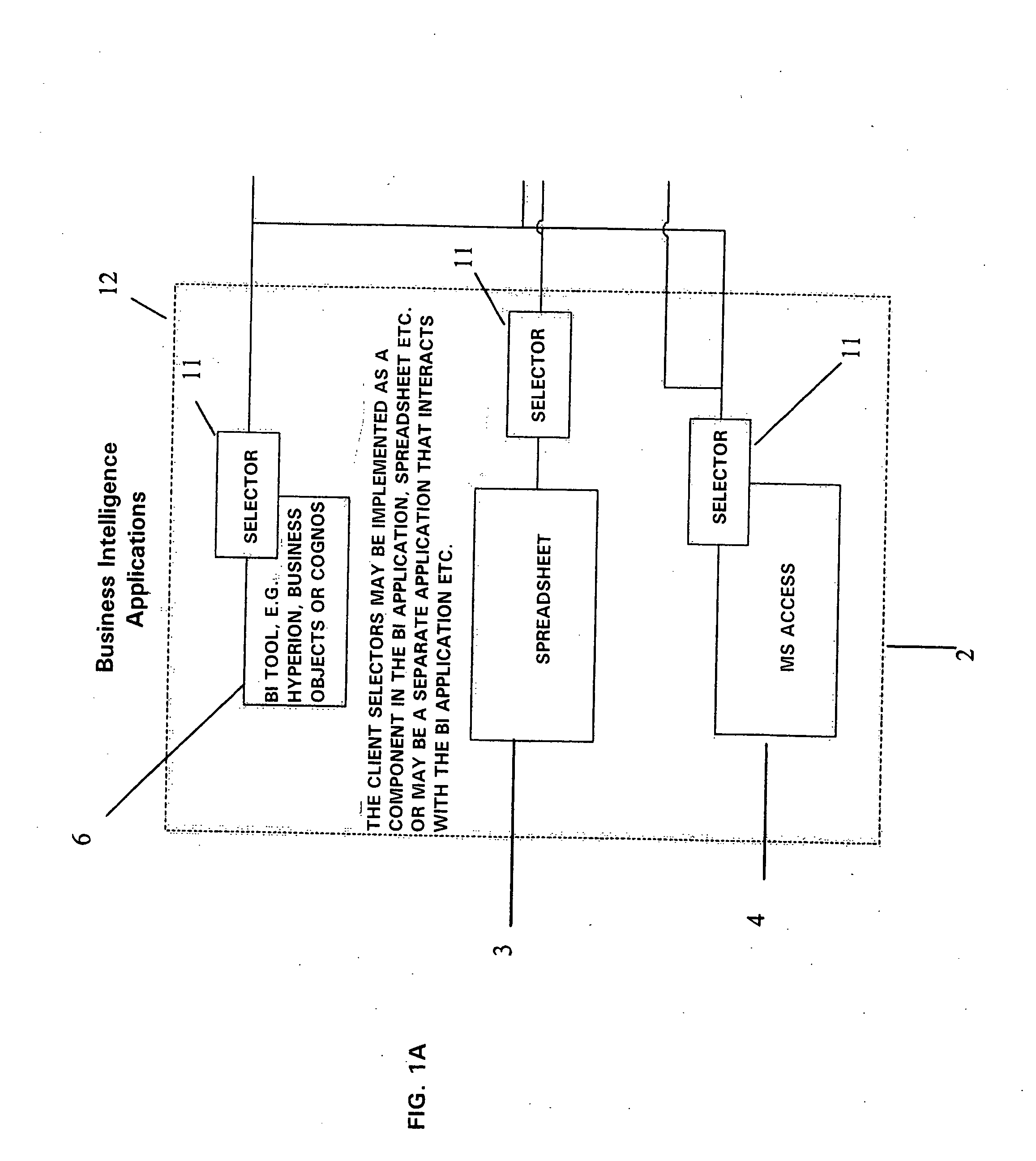
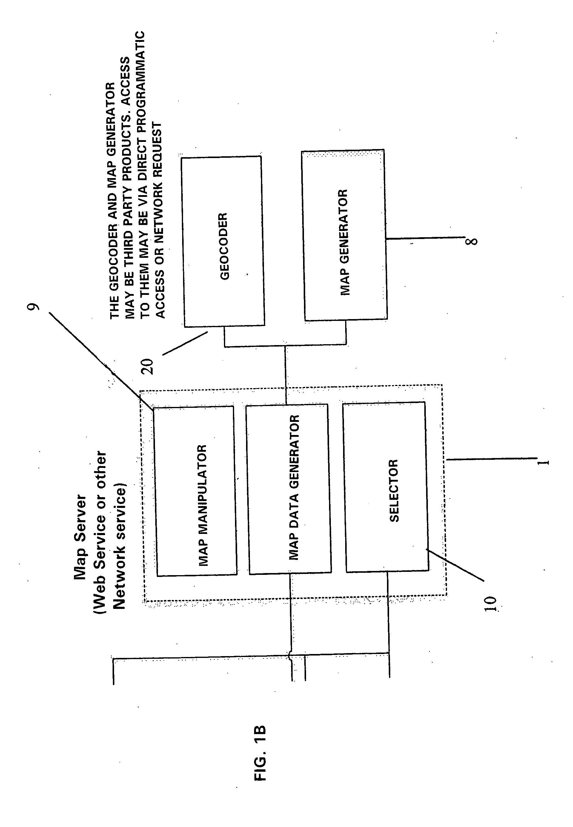
[0084]In both of these examples we are using information that is available in one or other domain, but not both to get insights that would be difficult to get from using either domain on its own. The ability to select flexibly in either medium and use the selection criteria to modify the “partner” application (map or BI application) provides great power that is not availab...


PUM


Abstract

A system and method generates a map representation of information from a BI (business intelligence) application. The BI information is used to generate map data, which in turn is used to generate a map representation. The system and method are arranged to generate the same thematics in a representation as provided by BI application. For example, if the BI information is information on crime in a particular area, the map representation will present the same theme in a spatial frame of reference, using similar metadata (thematic data) to express the theme on the map representation.

Description

[0001]This application is a continuation of copending application Ser. No. 10 / 887,454 filed on Jul. 8, 2004 claims the benefit thereof and incorporates the same by reference.FIELD OF THE INVENTION[0002]The present invention relates to a system and method for generating a spatial representation of business information, and particularly, but not exclusively, to a system and method which enables analysis of business information to be performed between a spatial domain and a business intelligence application.BACKGROUND OF THE INVENTION[0003]Business applications implemented by computing systems are vital to many organisations. Very broadly, business applications include any systems that store, present or otherwise process business data (BD). BD may include any data that is held by an organisation in a diverse set of data sources. Data sources are typically held on a wide variety of storage media including (but not limited to) magnetic or optical media. BD is most commonly held in a well...

Claims


Application Information

Patent Timeline
Patent Type & Authority Applications(United States)
IPC IPC(8): G06T11/20G06Q10/00G08G1/123G09B29/00
CPCG06Q10/10G09B29/007
Inventor MEEHAN, ANDREW MICHAELCAPPAS, SOCRATES
Owner FORGE RES
Why Eureka
Try Eureka