

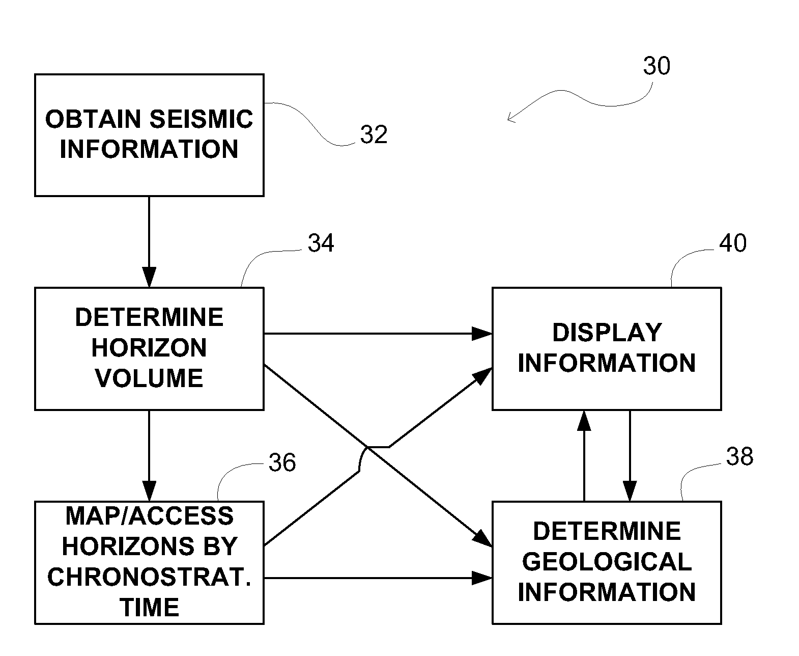
Method For Indexing A Subsurface Volume For The Purpose Of Inferring Geologic Information
a geological information and subsurface volume technology, applied in the field of systems and methods for determining geological information related to subsurface volumes of interest, can solve the problems of low resolution, sparse sampled data, and impaired usefulness of implementing the determined information in the derivation of further geological information
- Summary
- Abstract
- Description
- Claims
- Application Information
AI Technical Summary
Benefits of technology
Problems solved by technology
Method used
Image

Examples
Embodiment Construction
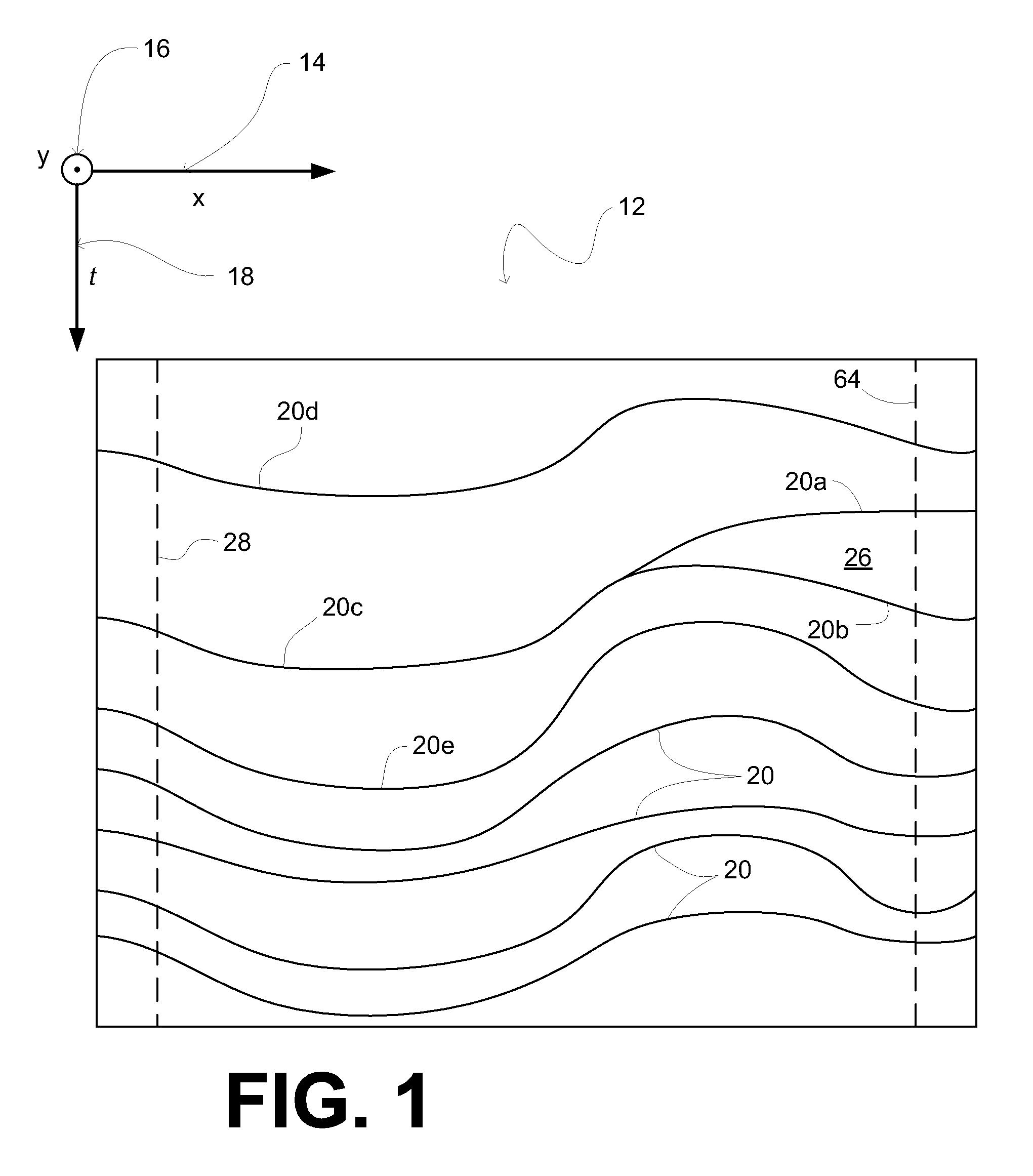
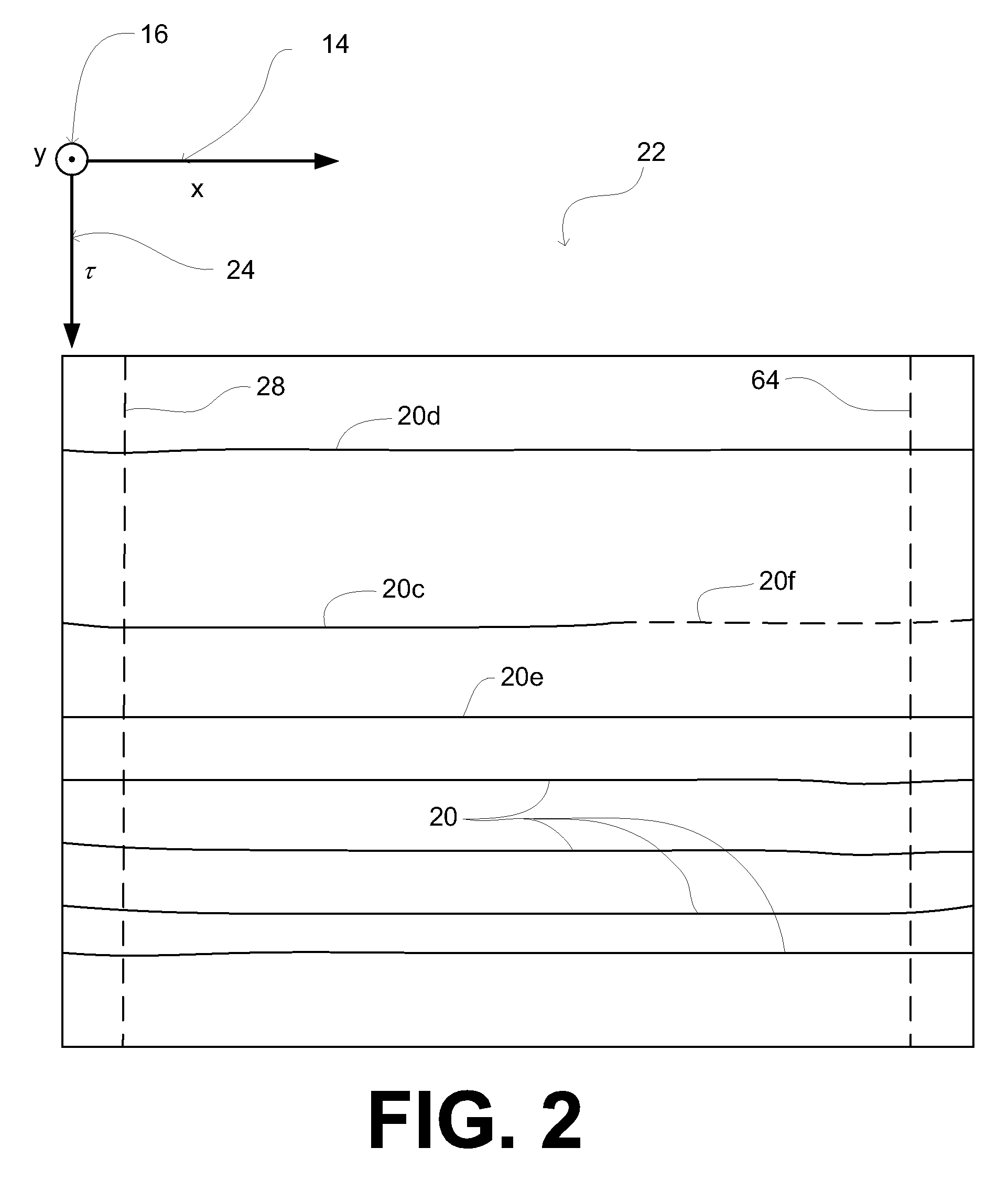
[0017]Reflection seismology (or seismic reflection) is a method of exploration geophysics that uses the principles of seismology to estimate the properties of a subsurface volume of interest within the Earth's subsurface from seismic waves directed to and reflected from the subsurface volume of interest. The method generally requires a source of seismic waves, such as explosives (e.g., dynamite / Tovex), a specialized air gun, a Vibroseis, and / or other sources. The source is used to introduce seismic waves into the subsurface volume of interest (usually at the surface), and data is acquired by an array of seismometers (usually disposed at the surface) that detect reflections of the seismic waves generated by the source as they arrive at the surface of the subsurface volume. The data acquired by the seismometers is then processed (e.g., migrated, etc.) to form a seismic data cube, which represents geological formations present within the subsurface volume at an array of data points wit...
PUM
 Abstract
Description
Claims
Application Information