System and method of indicating transition between street level images

a technology of system and method, applied in the field of system and method of indicating the transition between street level images, can solve the problem that the client computer lacks a sufficiently fast connection to the server to receiv

Inactive Publication Date: 2010-08-26
GOOGLE LLC
View PDF24 Cites 123 Cited by
  • Summary
  • Abstract
  • Description
  • Claims
  • Application Information

AI Technical Summary

Problems solved by technology

While advantageous in many circumstances, many client computers lack a sufficiently fast connection to the server to receive and display the intervening images.

Method used


Image

  • System and method of indicating transition between street level images
  • System and method of indicating transition between street level images
  • System and method of indicating transition between street level images

Examples


Embodiment Construction

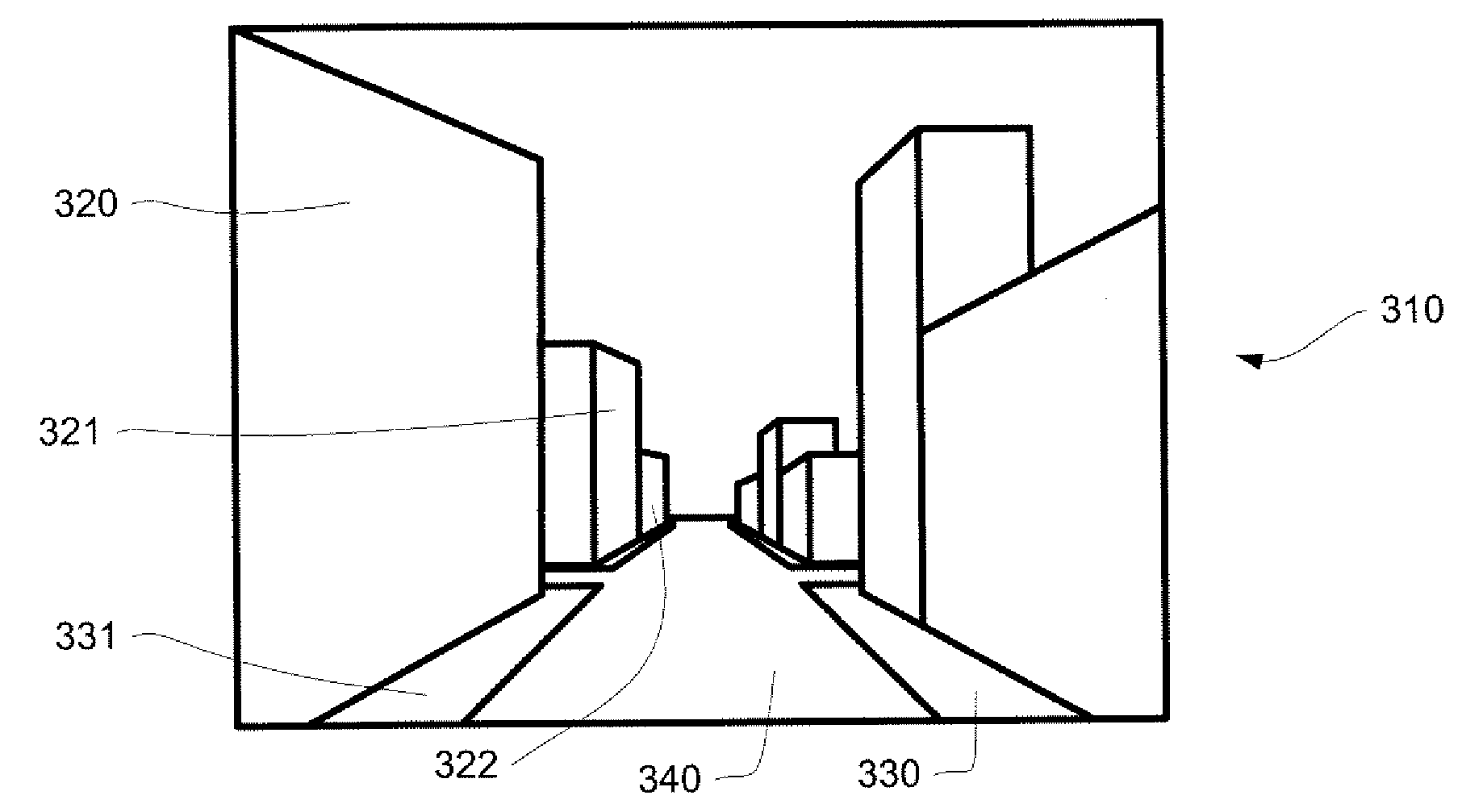
[0030]In one aspect, the system and method determines the position of the surfaces of geographic objects displayed in a street level image, such as buildings, and uses this information to create an animation that conveys the impression of moving through the scene represented in the image. The animation may be generated entirely by a client computer, which uses the position information received from a server to create polygons that are textured with image information from the current street level image. The client computer may also calculate a series of intermediate geographic locations from the current street level image to the next street level image; these intermediate locations are used to render and display a series of two-dimensional views based on the polygons from these locations. This aspect of the system and method provides a great deal of flexibility for creating the impression of animated movement through the geographic objects shown in a street level image.

[0031]As shown...


PUM


Abstract

A system and method of displaying transitions between street level images is provided. In one aspect, the system and method creates a plurality of polygons that are both textured with images from a 2D street level image and associated with 3D positions, where the 3D positions correspond with the 3D positions of the objects contained in the image. These polygons, in turn, are rendered from different perspectives to convey the appearance of moving among the objects contained in the original image.

Description

BACKGROUND OF THE INVENTION[0001]Services such as Google Maps are capable of displaying street level images of geographic locations. These images, identified in Google Maps as “Street Views”, typically comprise photographs of buildings and other features and allow a user to view a geographic location from a person's perspective as compared to a top-down map perspective.[0002]The street level images tend to be taken at discrete locations. The Google Maps service provides a variety of mechanisms that allow a user to change from street level image at one location to another, such as clicking an arrow icon.[0003]The Google Maps service also shows an animated transition between two street level images. For example, if the user indicates that he or she wants to move forward to the next image, the client computer is provided with instructions to zoom into the current street level. The zooming is intended to convey the impression of travelling into the image. Similarly, if the user moves to...

Claims


Application Information

Patent Timeline
Patent Type & Authority Applications(United States)
IPC IPC(8): G06K9/00
CPCG06T17/05G06T15/20G06T19/00G06F16/29G06F16/5866G06T15/04G06T19/003G06T2200/04
Inventor ZHU, JIAJUN
Owner GOOGLE LLC
Why Eureka
Try Eureka