Method and apparatus for initialization of a wellbore survey tool

a wellbore survey and tool technology, applied in the field of wellbore survey tools, can solve the problems of static surveying generally becoming less accurate than at low latitude, and affecting the accuracy of surveying

Inactive Publication Date: 2010-11-25
GYRODATA
View PDF14 Cites 14 Cited by
  • Summary
  • Abstract
  • Description
  • Claims
  • Application Information

AI Technical Summary

Problems solved by technology

Under certain circumstances, static surveying generally becomes less accurate than in other circumstances.
For example, when operating at high latitudes on the Earth's surface the static survey process becomes less accurate than at low latitudes.
Similar degradations in survey accuracy can also occur when using magnetic survey tools instead of, or in addition to, gyro-based survey tools.
As such, sur

Method used


Image

  • Method and apparatus for initialization of a wellbore survey tool
  • Method and apparatus for initialization of a wellbore survey tool
  • Method and apparatus for initialization of a wellbore survey tool

Examples


Embodiment Construction

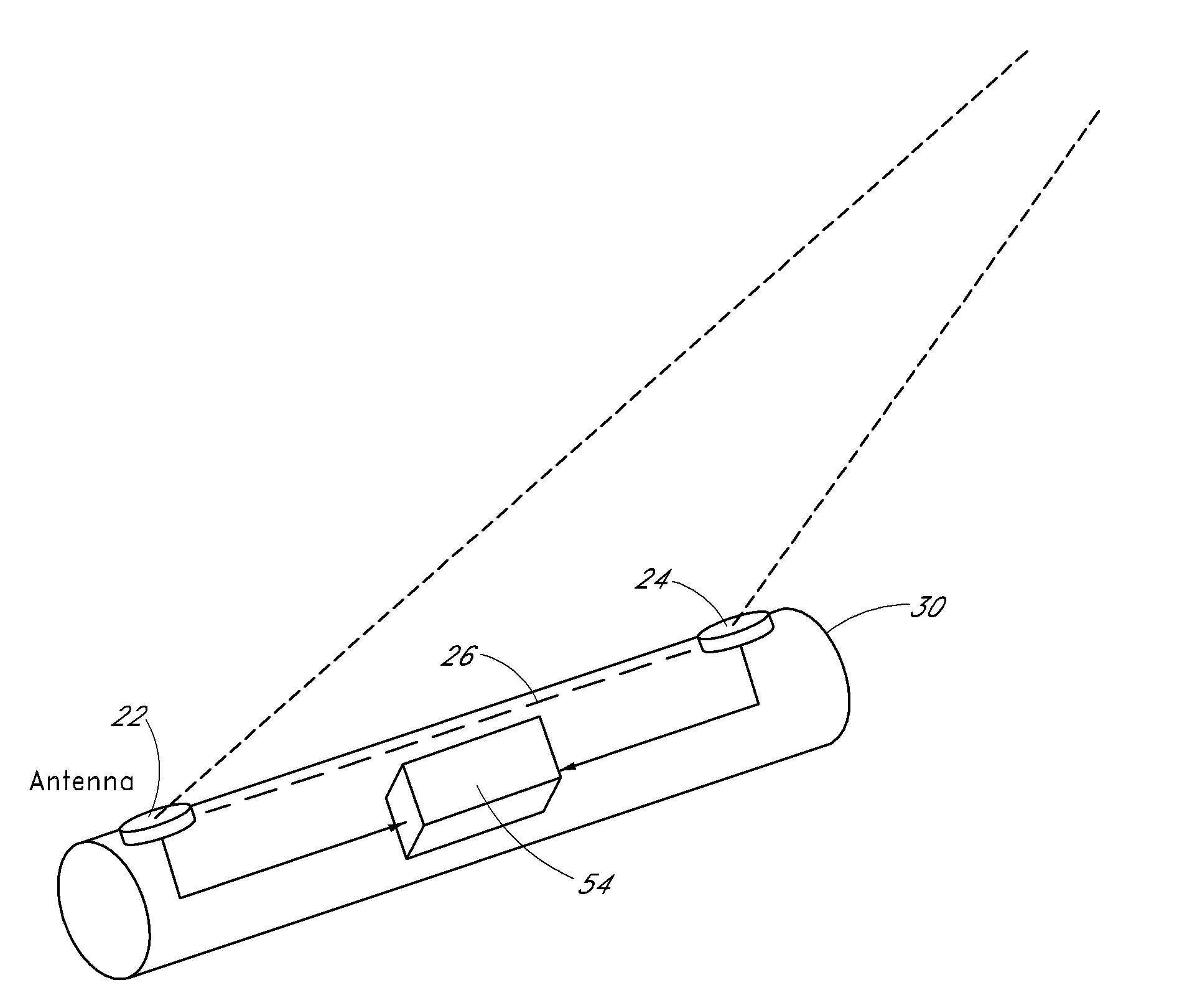
[0025]Embodiments described herein provide systems and methods which generally allow precision well surveys to be conducted at high latitude locations, from a moving surface (e.g., an off-shore moving platform), or both.

A. Overview

[0026]While underground, gyro survey tools generally rely upon gyro-compassing to conduct a static survey and / or to initiate a period of continuous surveying to determine the orientation of the survey tool with respect to a reference vector (e.g., the vector defined by the horizontal component of the Earth's rate). However, at the surface, there are other procedures which may be adopted. For example, land surveying techniques can be used to define a reference direction (which may also be referred to as a “benchmark direction”) to which the tool can be aligned. This process may be referred to as fore-sighting.

[0027]Alternatively, measurements from a directional reference system, such as a satellite navigation system, may be used to determine the orientation...


PUM


Abstract

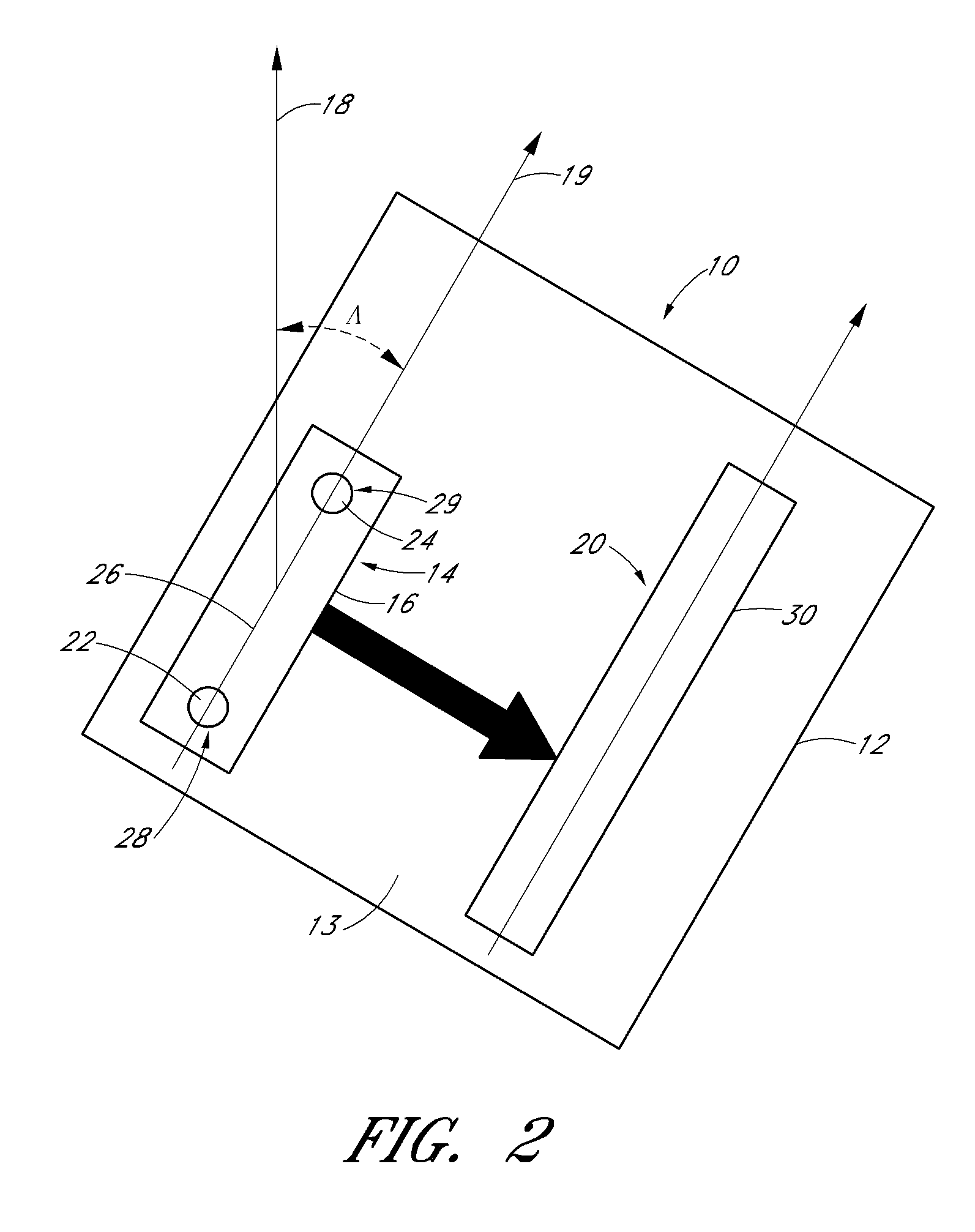
An apparatus for initializing a wellbore survey tool comprises a base portion and a first mounting portion mechanically coupled to the base portion. The first mounting portion can be adapted to be mechanically coupled to at least one directional reference system configured to provide data indicative of an orientation of the at least one directional reference system with respect to a reference direction. The apparatus of certain embodiments further comprises a second mounting portion mechanically coupled to the base portion, the second mounting portion configured to be mechanically coupled to a wellbore survey tool such that the wellbore survey tool has a predetermined orientation with respect to the at least one directional reference system.

Description

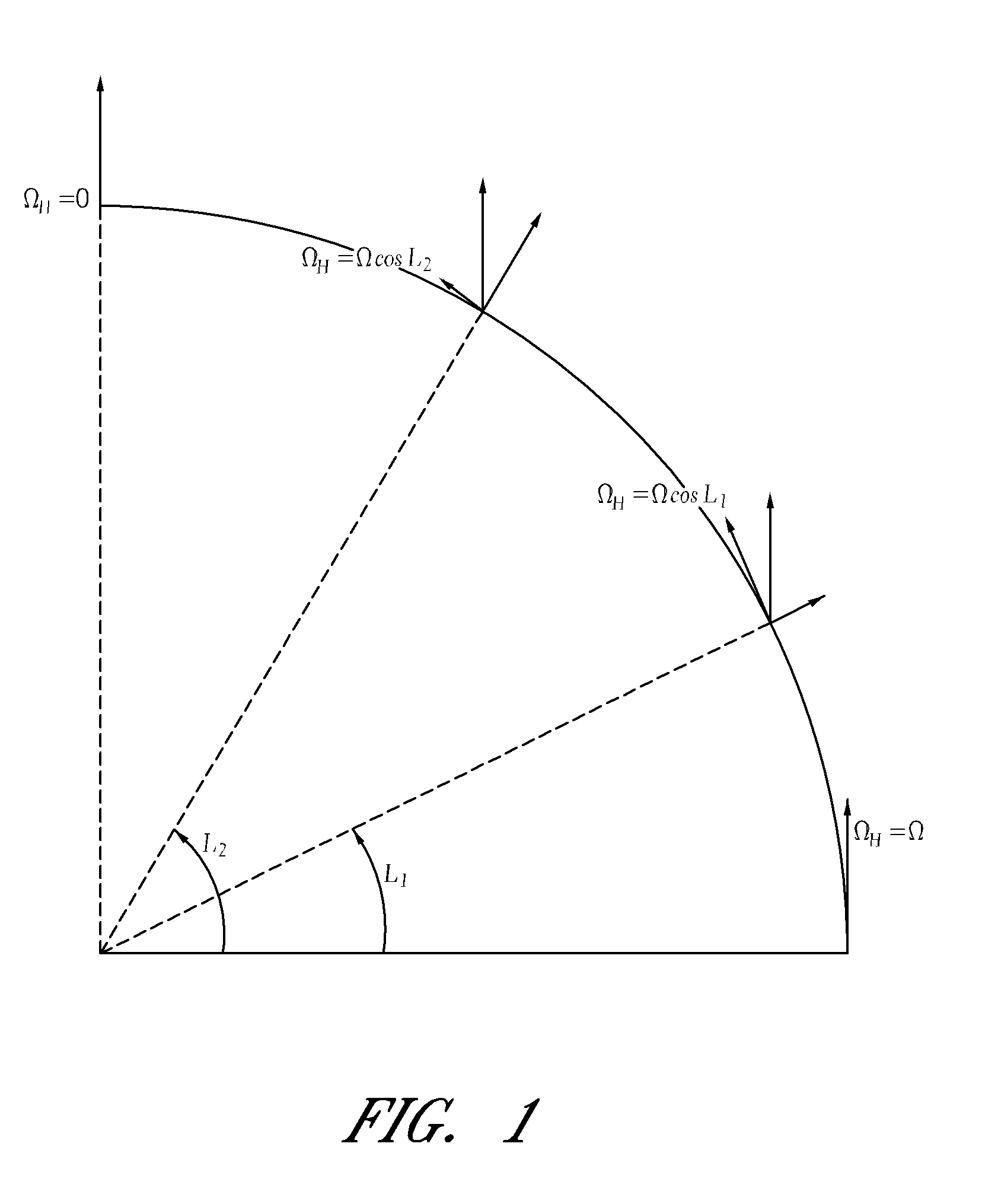
CROSS-REFERENCE TO RELATED APPLICATIONS[0001]This application claims the benefit of priority from U.S. Provisional Application Nos. 61 / 180,779 filed May 22, 2009, and 61 / 186,748 filed Jun. 12, 2009, both of which are incorporated in their entirety by reference herein.BACKGROUND[0002]1. Field[0003]The present application relates generally to methods and apparatus for initialization of a wellbore survey tool.[0004]2. Description of the Related Art[0005]There are typically two types of surveying by which wellbore survey tools conduct surveys (e.g., gyroscopic- or gyro-based surveys) of wellbores. The first type is static surveying, in which measurements of the Earth's rotation are taken at discrete depth intervals along the well trajectory. These measurements can be used to determine the orientation of the survey tool with respect to a reference vector, such as the vector defined by the horizontal component of the Earth's rate in the direction of the axis of the Earth's rotation; a pro...

Claims


Application Information

Patent Timeline
IPC IPC(8): G01V3/00G01S19/53
CPCE21B19/00E21B47/024G01V3/18F16M13/022G01C21/16G01C21/166
Inventor WESTON, JOHN LIONELEKSETH, ROGER
Owner GYRODATA
Why Eureka
Try Eureka