Accessing positional information for a mobile station using a data code label

a technology of positional information and data code, applied in the field of positioning system for mobile stations, can solve the problems of limited operation and normal unusability of the devi

Inactive Publication Date: 2011-02-17
QUALCOMM INC
View PDF43 Cites 97 Cited by
  • Summary
  • Abstract
  • Description
  • Claims
  • Application Information

AI Technical Summary

Problems solved by technology

One limitation of current SPS receivers is that their operation is limited to situations in which multiple satellites are clearly in view, without obstructions, and where a good quality antenna is properly positioned to receive such signals.
As such, they normally are unusable in areas with blockage conditions, such as where there is significant foliage or building blockage (e.g., urban canyons) and within buildings.

Method used


Image

  • Accessing positional information for a mobile station using a data code label
  • Accessing positional information for a mobile station using a data code label
  • Accessing positional information for a mobile station using a data code label

Examples


Embodiment Construction

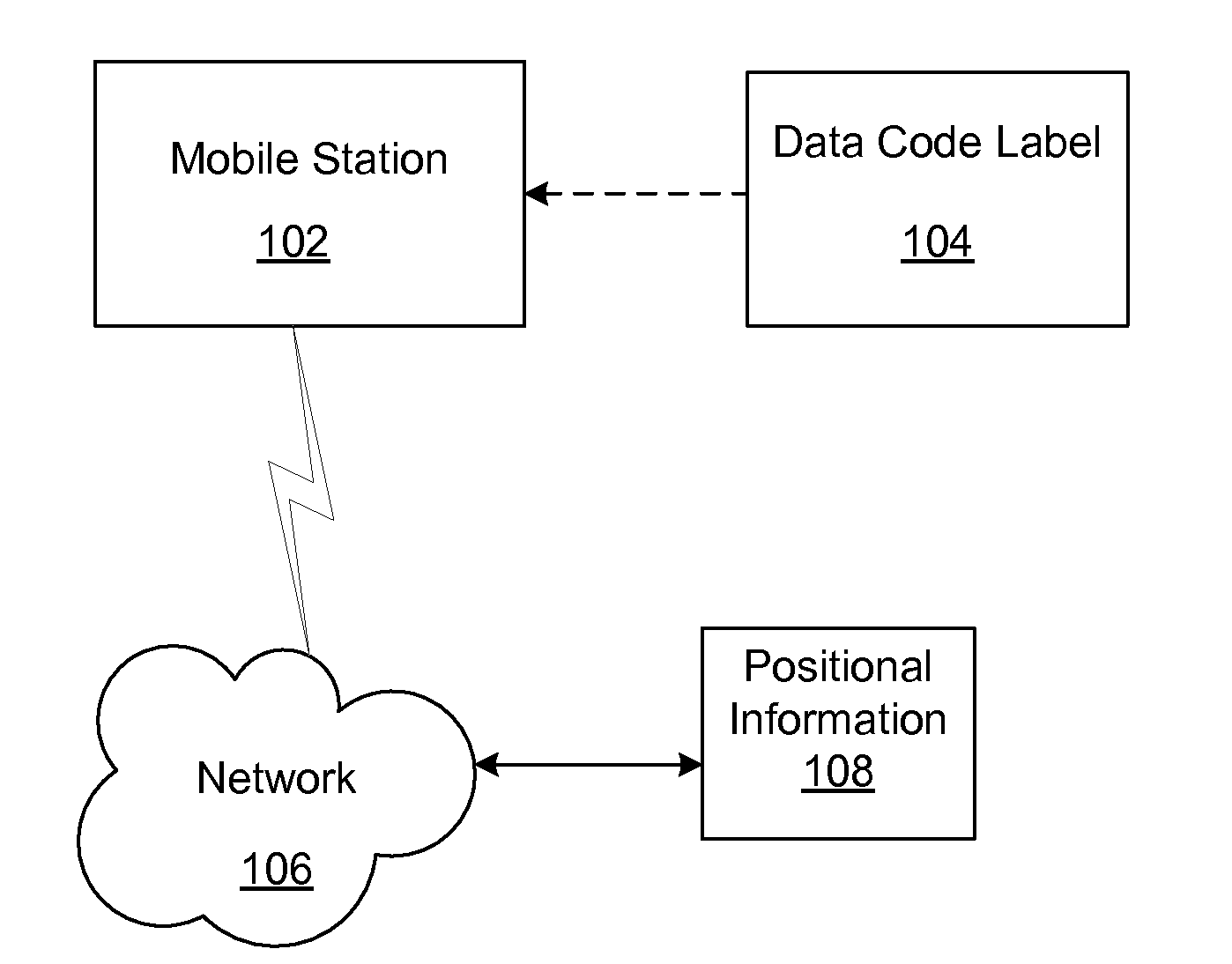
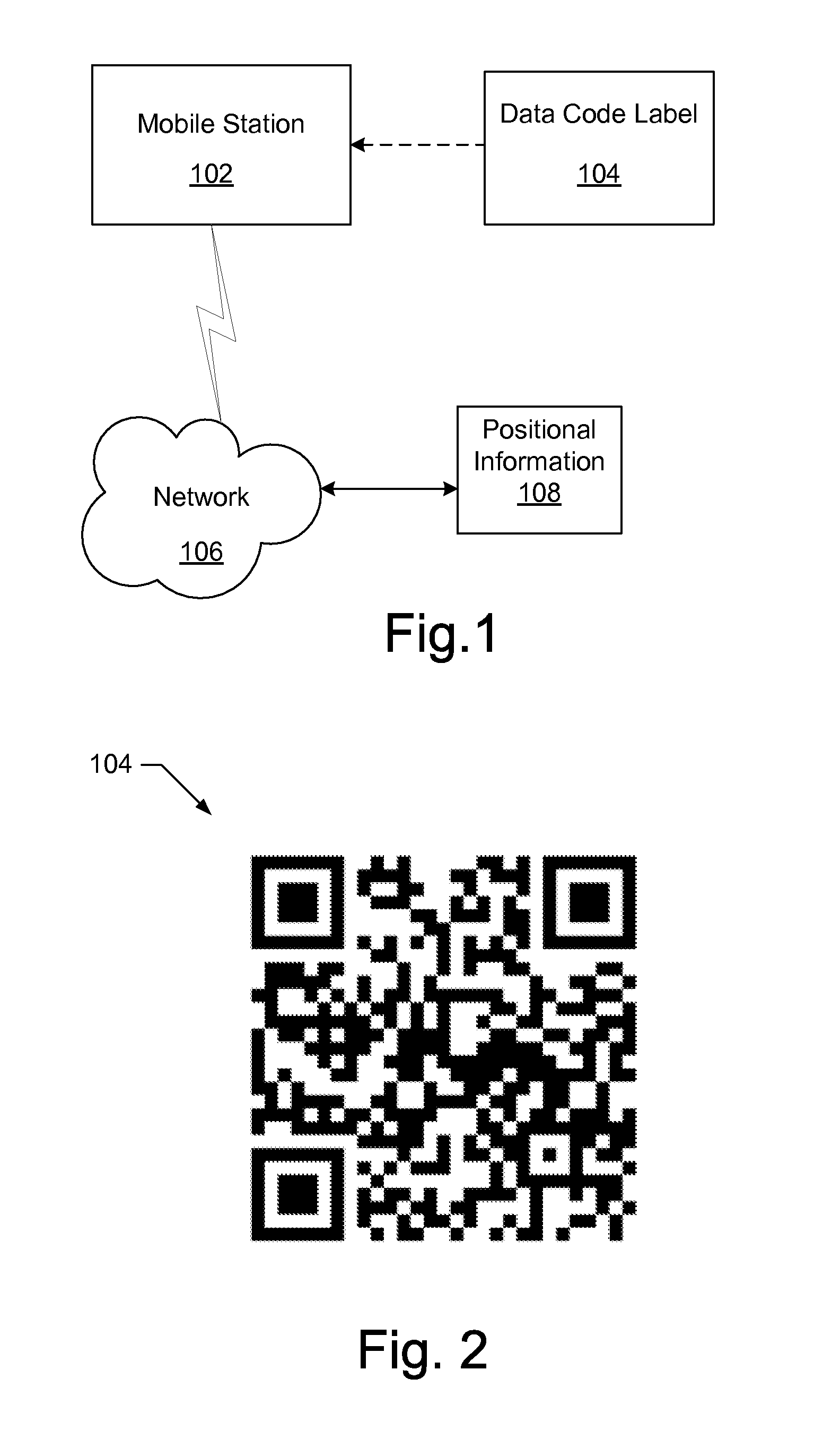
[0010]A system and method described herein uses a data code label to acquire positional information, which may be updated without the need for signals from an SPS. The system may include a mobile station that uses a data code label to acquire position information and uses internal sensors to update the positional information, such as the current position of the mobile station. The positional information may include a digital map with the position of the mobile station, navigation instructions or non-navigational information about the position of the mobile station. It should be understood that the positional information may be referenced to a local coordinate system or a generalized global coordinate system, such as the WGS84 coordinate system used with GPS.

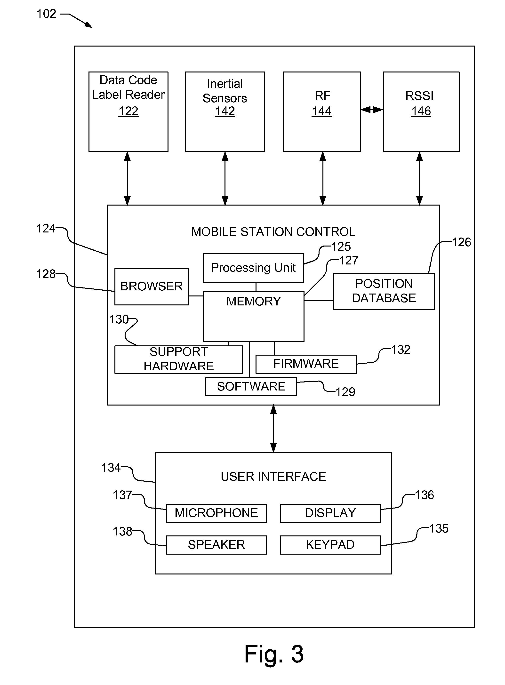
[0011]As used herein, a mobile station refers to a device such as a cellular or other wireless communication device, personal communication system (PCS) device, personal navigation device, Personal Information Manager (PIM), Pers...


PUM


Abstract

Positional information for a mobile station is acquired using a data code label and the positional information is updated as the mobile station moves without the need for signals from a Satellite Positioning System (SPS), such as the Global Positioning System (GPS). The data code label is read and information encoded within the data code label is used to obtain positional information, which may be, e.g., a digital map, directions, or non-navigational information, which may be provided via a display or speakers. The positional information may be referenced to a local coordinate system or a global coordinate system. The position of the mobile station is updated using inertial sensors within the mobile station and / or using a measured radio signal and a wireless access point almanac that may be obtained using the information encoded within the data code label. Updated positional information for the mobile station is then provided.

Description

BACKGROUND FIELD[0001]The present method and apparatus relates generally to positioning systems for mobile stations, such as cellular or other wireless communication devices, and more specifically to acquiring and updating positional information for a mobile station using data code labels.RELEVANT BACKGROUND[0002]Accurate position information of mobile station, such as cellular or other wireless communication devices, is becoming prevalent in the communications industry. A Satellite Positioning System (SPS), such as the Global Positioning System (GPS), offers an approach to providing wireless mobile station position determination. For example, a GPS user can derive precise navigation information including three-dimensional position, velocity and time of day through information gained from satellite vehicles (SVs) in orbit around the earth. The signals that are received from the SVs may be weak. Therefore, in order to determine the position of the receiver, the receiver must be suffi...

Claims


Application Information

Patent Timeline
Patent Type & Authority Applications(United States)
IPC IPC(8): H04W24/00G06V30/224H04W4/02H04W4/024H04W4/029H04W4/20H04W4/33H04W4/38
CPCG01C21/005G01C21/20H04W4/02H04W4/027H04L67/18H04W4/185H04W4/20H04L67/04H04L67/12H04W4/04H04W4/029H04W4/33H04W4/024H04W4/38H04L67/52H04W4/023H04W4/025H04W64/00H04W84/045H04W88/02
Inventor HARDIE, EDWARD THOMAS LINGHAM
Owner QUALCOMM INC
Why Eureka
Try Eureka