
Computer method and system for topographical representation of textual data

a textual data and computer method technology, applied in computing, instruments, electric digital data processing, etc., can solve the problems of not allowing user interaction, google books does not provide a geographic map-like interface to large collections of text, and google maps does not address text documents or bodies of tex

Active Publication Date: 2012-05-24
IBM CORP
View PDF8 Cites 2 Cited by
  • Summary
  • Abstract
  • Description
  • Claims
  • Application Information

AI Technical Summary

Benefits of technology

The patent proposes a new way to represent text using computer-based geographic mapping principles. The method involves converting text to a visual representation using a layout engine, which allows for panning and zooming of the text map. The text is segmented into tiles for different zoom levels, and features in the text are identified and stored for rendering with the visual representation. The method can also include adding markers like geometric shapes, indicators, and hyperlinks to the text map. The patent is a computer program product that implements this method.

Problems solved by technology

However, Google Maps does not address text documents or bodies of text.
The system does not however, allow for user interactions that are similar to those available in the context of a geographical map such as panning and zooming.
However, Google Books does not provide a geographic map-like interface to large collections of text along with highlighting of various features in the text.

Method used


Image

  • Computer method and system for topographical representation of textual data
  • Computer method and system for topographical representation of textual data
  • Computer method and system for topographical representation of textual data

Examples


Embodiment Construction

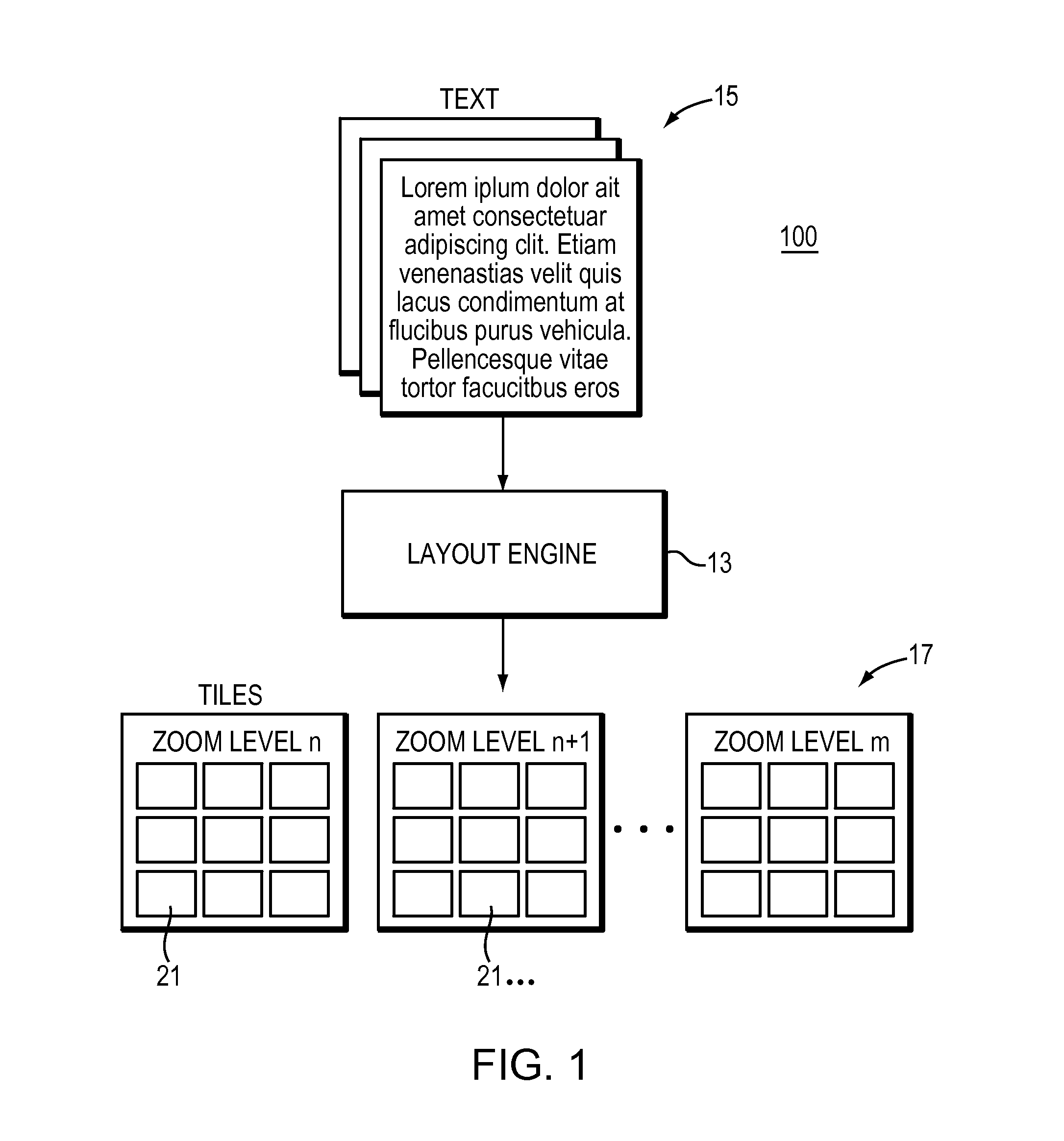
[0027]With reference now to FIG. 1, one embodiment of the present invention is shown and referred to herein as the “TextMaps” system 100. TextMaps is an innovative mapping system, making use of traditional geographic mapping concepts to represent, navigate and understand data and in particular text data.

[0028]Concepts

[0029]The following concepts will be used throughout the following description of the system 100:

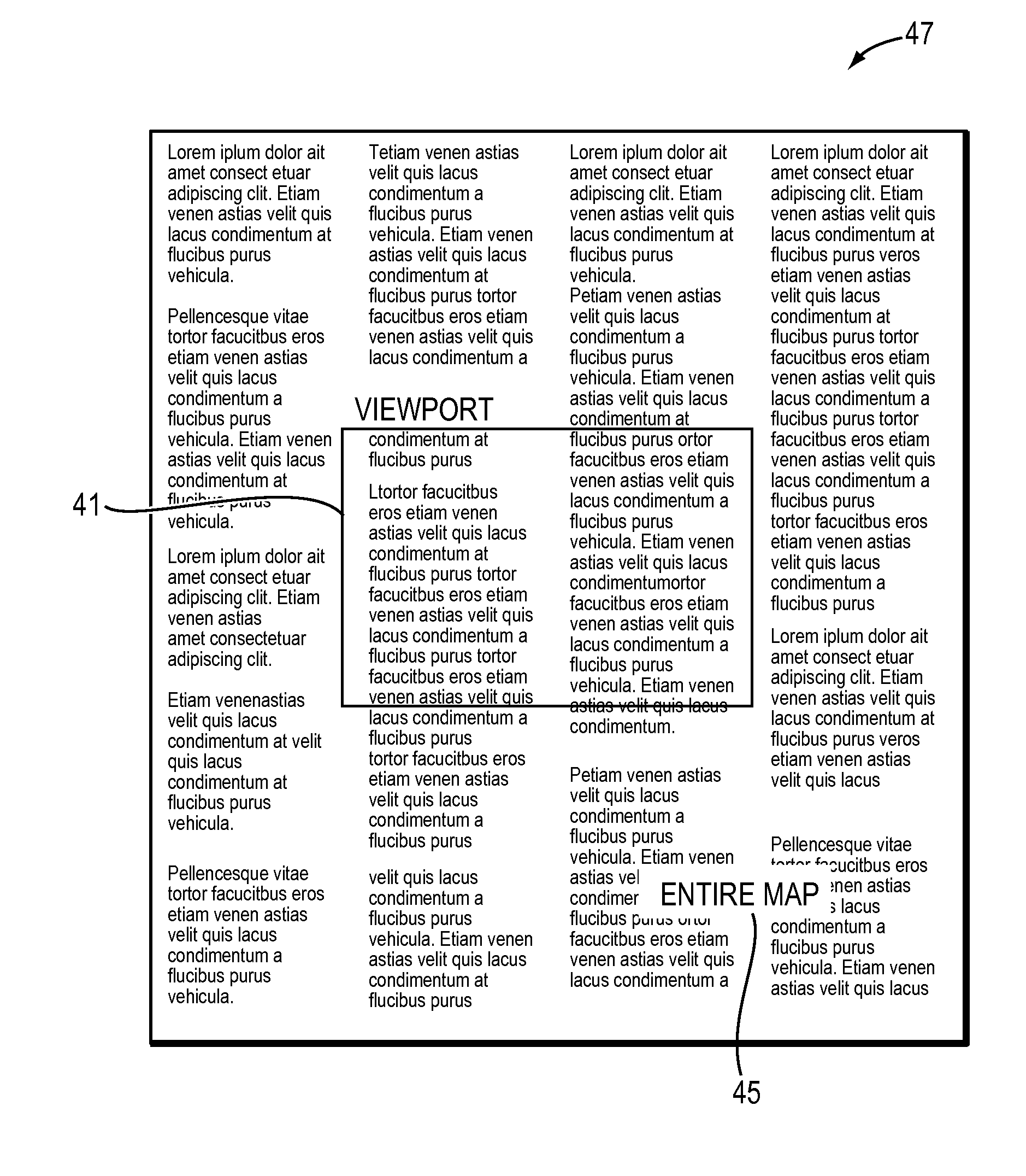
[0030]1. Map—A physical, usually but not limited to a two-dimensional representation of a plane, surface, and in our case, text. The terms “text document map” and “text map” are used interchangeably with “map” for the subject case.

[0031]2. Viewport—The region of a map that is visible; graphics outside this region will not appear even if drawn.

[0032]3. Panning—The act of re-centering the map in relation to a viewport that is represented by the user's browser window. The map object, which is often larger than can fit into a single screen, can thus be seen as its various parts ...


PUM


Abstract

Computer system, method and apparatus generate and display a graphical representation of a body of text. The graphical representation serves as a text map allowing navigation operations and other user interaction. The text map enables improved navigation of the body of text. Computer-based geographic mapping operations (e.g., zoom, pan, highlight, etc.) are used to navigate the text. The text map may have various graphical feature overlays also navigable by and interactive to the user.

Description

BACKGROUND[0001]As quantities of digitized information grow rapidly, the prevalence of data in a textual format becomes evident. From ever growing numbers of blog posts, to governments advancing from paper archives to using the internet to its full potential, the quantity of raw text available is increasing steadily. Traditionally, large bodies of text have been organized and classified in ways that allowed for easier traversal of the text. From books to websites, large collections have taken a form on line that replicates the physical manifestations they have previously embodied on paper. As the amount of data grows, however, it is becoming increasingly important to provide tools that allow for faster and higher level understanding and navigation of the underlying text, independent of its basic logical structure.[0002]Google Maps is a geographic map service that one views in a web browser. Depending on one's location, one can view basic or custom geographic-type maps and local busi...

Claims


Application Information

Patent Timeline
Patent Type & Authority Applications(United States)
IPC IPC(8): G06F3/048
CPCG06F3/048
Inventor FEINBERG, JONATHANROS, IRINAWATTENBERG, MARTIN M.VIEGAS, FERNANDA B.
Owner IBM CORP
Learn More