Method of estimating an ability of a vehicle to reach a target road segment, method of generating a database, and navigation system

a technology of vehicle and target road, applied in surveying and navigation, measuring devices, instruments, etc., can solve problems such as digital map data, and achieve the effect of reducing the size of the databas

Active Publication Date: 2014-01-16
HARMAN BECKER AUTOMOTIVE SYST
View PDF1 Cites 24 Cited by
  • Summary
  • Abstract
  • Description
  • Claims
  • Application Information

AI Technical Summary

Benefits of technology

[0055]Such a scenario may allow to adapt the accuracy of the estimating of the cruising range which is based on the generated database to the current amount of available resources. For example, if the approximated cruising range is comparably large, it may be possible to provide a comparably large first geographical area. On the other hand, if the approximated cruising range is comparably small, it may not be necessary to increase the size of the first geographical area and thereby provide more road segment data.
[0056]The method of generating the database may further comprise determining a third geographical area, wherein the third geographical area is a fragment of the second geographical area and has inner boundaries being defined by a lower threshold of costs associated with reaching the inner boundaries and has outer boundaries being defined by upper thresholds of costs associated with reaching the outer boundaries. The determined route information may be buffered and / or stored for those road segments being situated at the same time in a second and third geographical area. For example, the third geographical area may correspond to that geographical area where it is estimated that the amount of available resources runs low, i.e., falls below a given threshold. It may particularly be relevant to estimate the cruising range for those road segments based on the database. Therefore, storing of the route information may be restricted to those road segments being located in a third geographical area. This may allow the size of the database to be reduced further.

Problems solved by technology

In particular, the digital map data may comprise energy consumption costs associated with the road segments.

Method used


Image

  • Method of estimating an ability of a vehicle to reach a target road segment, method of generating a database, and navigation system
  • Method of estimating an ability of a vehicle to reach a target road segment, method of generating a database, and navigation system
  • Method of estimating an ability of a vehicle to reach a target road segment, method of generating a database, and navigation system

Examples


Embodiment Construction

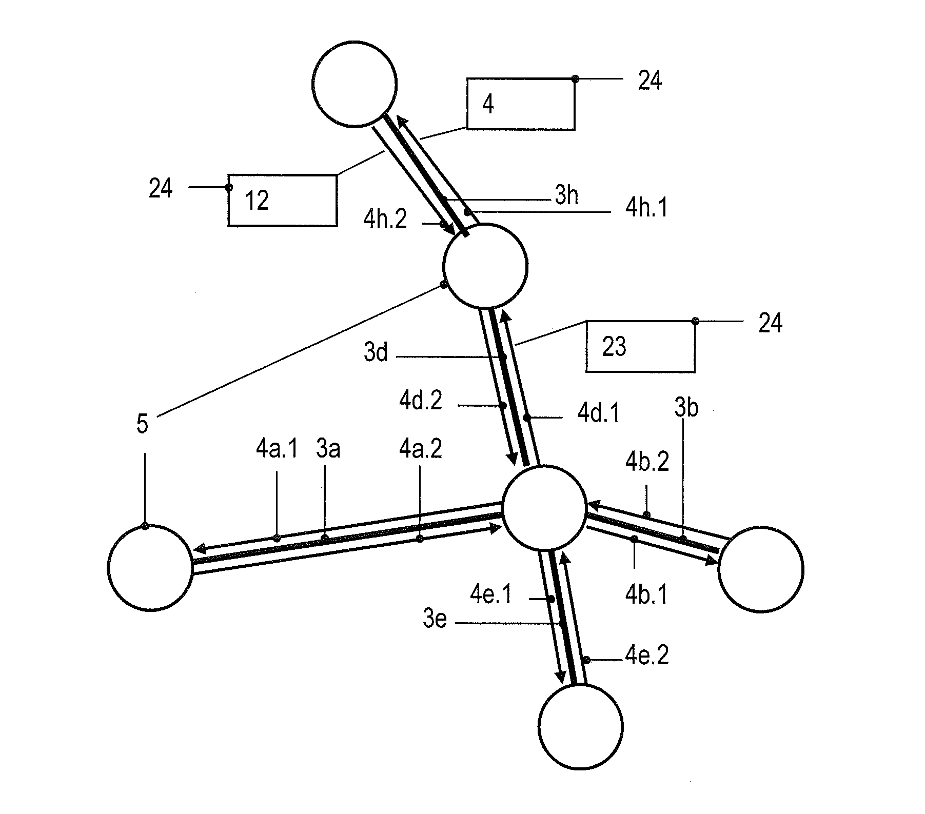
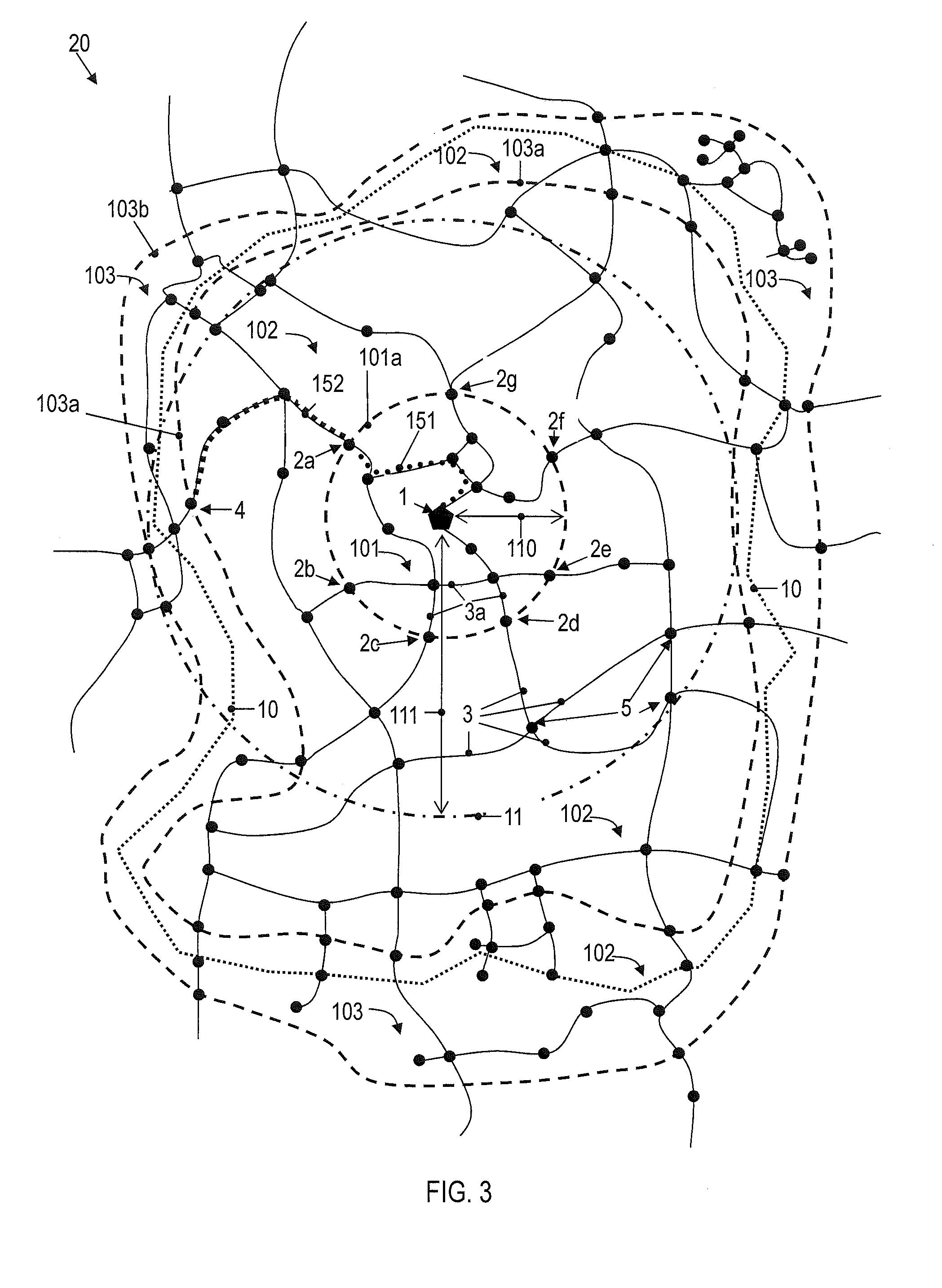
[0075]With reference to the drawings, techniques for estimating a cruising range of a vehicle will be discussed. While those techniques are discussed primarily with respect to the cruising range being associated with an amount of available energy / fuel of the vehicle, it is to be understood that, likewise, the techniques apply to the cruising range being associated with an amount of available travel time or an amount of available travel distance or a combination thereof. Such cruising ranges may indicate all locations which are reachable within a given time or are reachable by travelling a certain given distance.

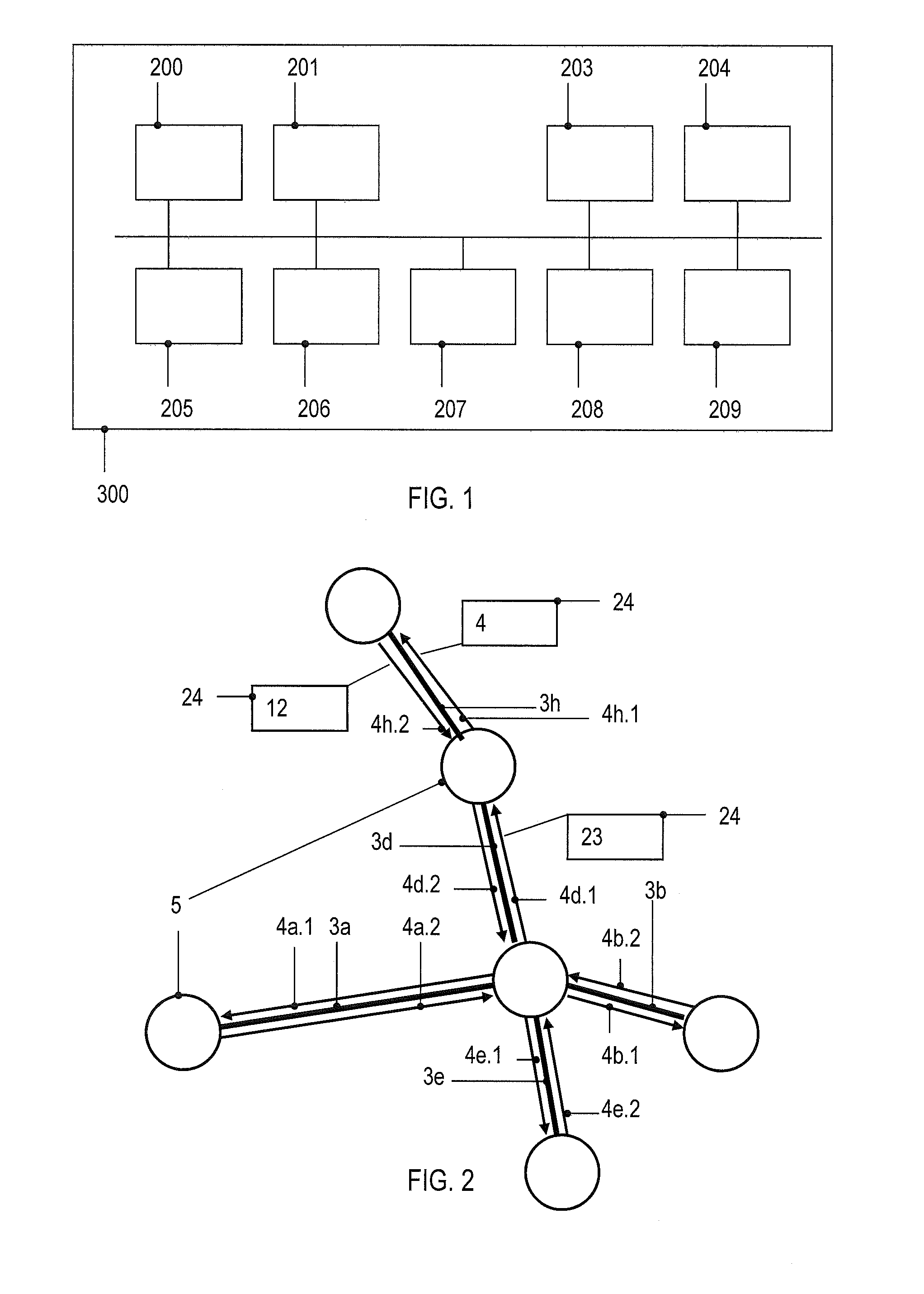
[0076]FIG. 1 schematically illustrates a navigation system 300. The navigation system 300 comprises a positioning unit 204 which is configured to determine a current location of the vehicle. For example, the positioning unit 204 may be a global positioning system (GPS) or the like. Furthermore, the navigation system 300 comprises a map database 200 provided on storage means. ...


PUM


Abstract

Various embodiments relate to a method of estimating an ability of a vehicle to reach a target road segment, comprising retrieving road segment data for road segments containing previously generated route information for routes connecting the road segments, the route information parameterizing costs associated for travelling along the respective route); and establishing first road segment data for the target road segment indicating a gateway road segment and indicating route information for a successive route from the gateway road segment to the target road segment. The method further comprises, based on the route information of the successive route, determining first costs for travelling along the successive route, and establishing, based on the indicated gateway road segment, second road segment data for the current road segment, the second road segment data indicating route information for an initial route from the current road segment to the gateway road segment. The method further comprises determining, based on the received route information for the initial route, second costs for travelling on the initial route and estimating, based on the determined first and second costs, the ability of the vehicle to reach the target road segment.

Description

CLAIM OF PRIORITY[0001]This patent application claims priority from EP Application No. 12 176 370.0 filed Jul. 13, 2012, which is hereby incorporated by reference.FIELD OF TECHNOLOGY[0002]Various embodiments relate to a method of estimating an ability of a vehicle to reach a target road segment, a method of generating a database for estimating a cruising range of the vehicle, and a navigation system. In particular, various embodiments relate to techniques for estimating a cruising range of the vehicle based on road segment data retrieved from the previously generated database.RELATED ART[0003]Navigation units in vehicles estimate a cruising range of the vehicle, i.e., determining the most remote geographical locations still being reachable by the vehicle given the available amount of resources, e.g., fuel or energy, or within a given maximum time. For example, for a cruising range relating to an amount of available energy / fuel cars powered by conventional fuel provide a comparably l...

Claims


Application Information

Patent Timeline
Patent Type & Authority Applications(United States)
IPC IPC(8): G01C21/34
CPCG01C21/3469
Inventor KLUGE, SEBASTIANENGELHARDT, HANS-PETER
Owner HARMAN BECKER AUTOMOTIVE SYST
Why Eureka
Try Eureka