Using Geographic Coordinates On A Digital Image Of A Physical Map

a technology of geographic coordinates and physical maps, applied in the direction of static indicating devices, editing/combining figures or text, instruments, etc., can solve the problems of gaps in information, user may not have the equipment necessary to navigate the physical map successfully, and the digital map retrieved by the mobile device or by the user

Inactive Publication Date: 2015-06-04
GOOGLE LLC
View PDF3 Cites 7 Cited by
  • Summary
  • Abstract
  • Description
  • Claims
  • Application Information

AI Technical Summary

Problems solved by technology

However, there may be problems with the digital map retrieved by the mobile device or by the user.
In another example, the retrieved map may have information relevant to the user, but there may be gaps in the informati

Method used


Image

  • Using Geographic Coordinates On A Digital Image Of A Physical Map
  • Using Geographic Coordinates On A Digital Image Of A Physical Map
  • Using Geographic Coordinates On A Digital Image Of A Physical Map

Examples


Embodiment Construction

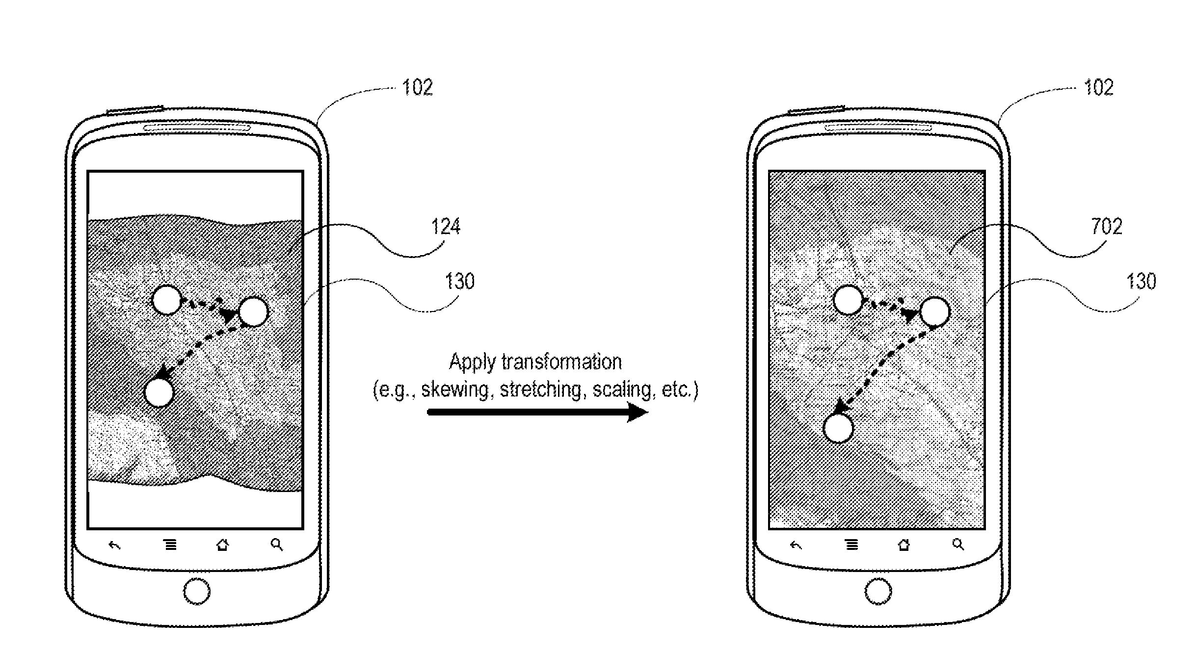
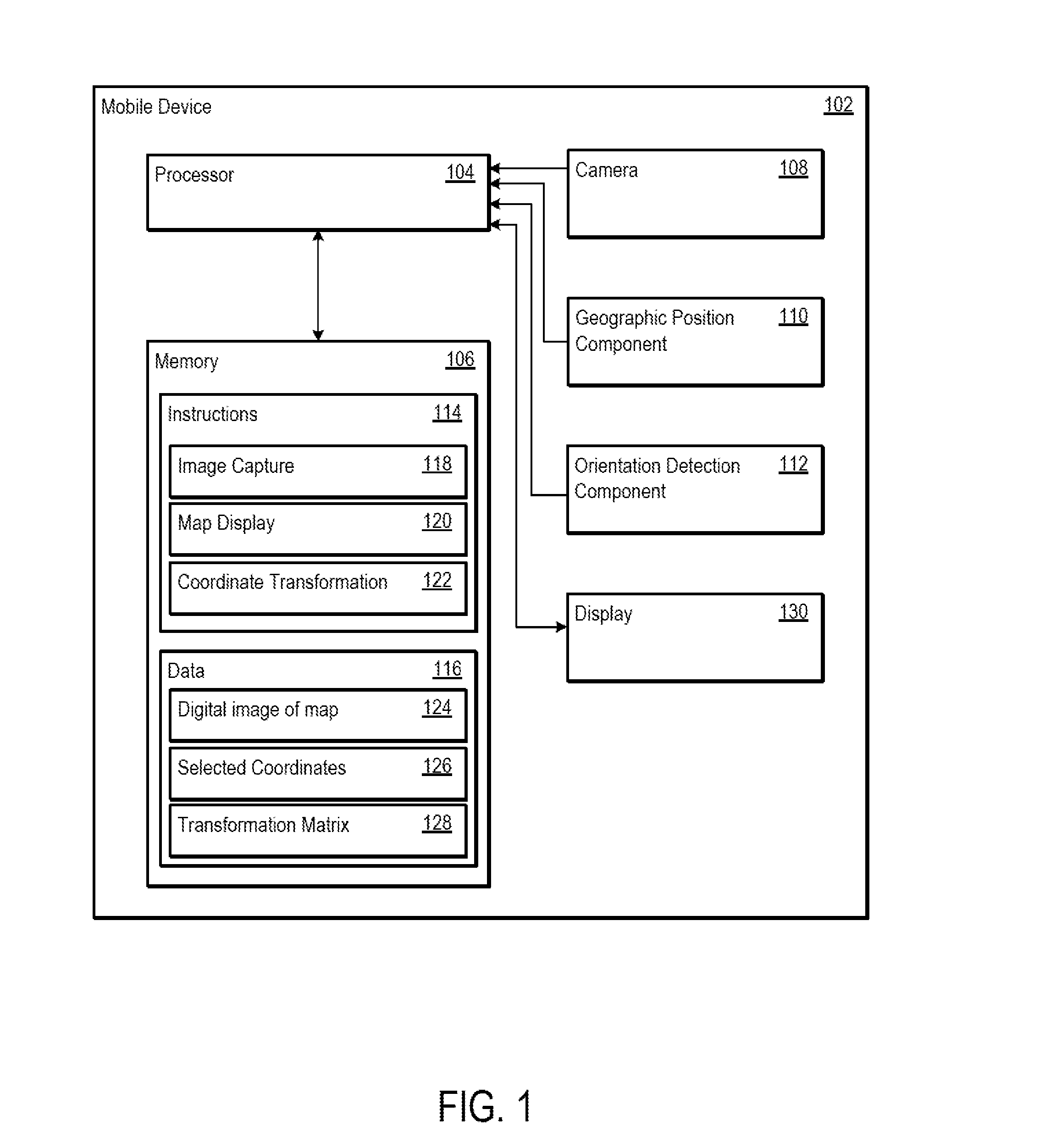
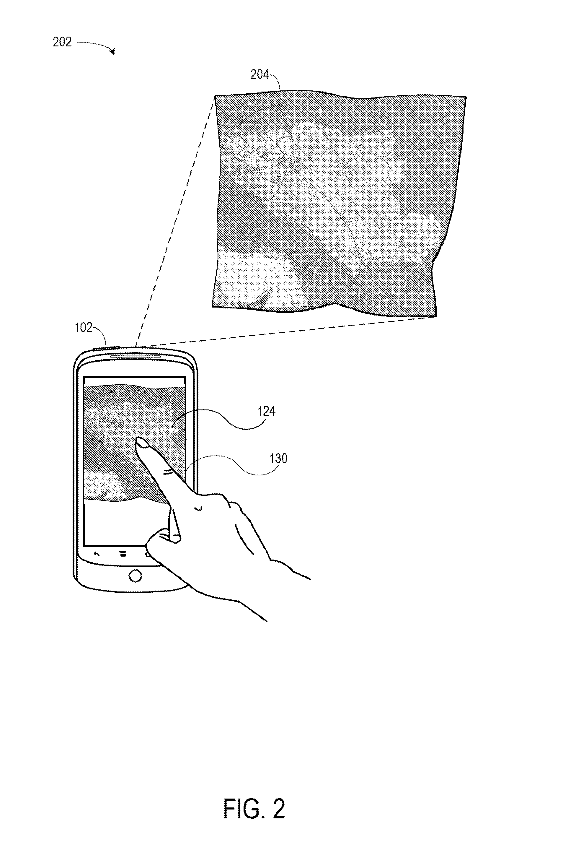
[0044]This disclosure provides for systems and methods for using geographic coordinates on a physical map. In particular, this disclosure provides for capturing a digital image of a physical map, calibrating a mobile device to use geographic coordinates on the digital image, and then using the mobile device to display a user's location on the digital image of the physical map using the geographic coordinates. In one embodiment, capturing an image of the physical map may be performed by taking a picture of the physical map, e.g., with a camera, or by scanning it, e.g., with a scanner. When the digital image is available on the mobile device, the user may then roughly identify his or her location on the digital image, such as by pointing at a location on the digital image. After moving from this first location, the user may then identify, e.g., by pointing, on the digital image where he or she is again. After recording a few identified locations, the mobile device may then rescale and...


PUM


Abstract

Systems and methods are disclosed for using geographic coordinates on a physical map. The system may include a mobile device having a processor and a display, where the processor receives a first input that instructs a camera to capture a digital image of a physical map. The mobile device may then display the digital image of the physical map. The mobile device may further receive a second input from a user interface, where the second input identifies a first location on the digital image of the physical map. The first location may be associated with an image pixel coordinate, and the mobile device may obtain a geographic coordinate based on this image pixel coordinate. The mobile device may then determine a transformation matrix based on the image pixel and geographic coordinates. Using the determined transformation matrix, the mobile device may determine further image pixel coordinates based on received geographic coordinates.

Description

BACKGROUND[0001]Mobile devices have become commonplace. For example, a user may have a laptop, a smartphone, a tablet computer, an Internet-capable camera, or other such mobile device. The mobile device may have a variety of capabilities such as phone calling, Internet browsing, picture taking, navigation assistance, and other such capabilities.[0002]With regard to navigation assistance, a mobile device may rely on an Internet connection to retrieve a digital map of a geographic region, and then may use geolocation techniques to navigate the user with the digital map. Alternatively, the user may visit a website using the mobile device to retrieve the digital map. The mobile device may then communicate geographic coordinates that it receives from one or more satellites to the website so that the user may identify his or her location on the digital map provided by the website.[0003]However, there may be problems with the digital map retrieved by the mobile device or by the user. For e...

Claims


Application Information

Patent Timeline
IPC IPC(8): G06T11/60
CPCG06T11/60G01C21/20
Inventor COSENZA, ROBERTOZANOLIN, LUCA
Owner GOOGLE LLC
Why Eureka
Try Eureka