

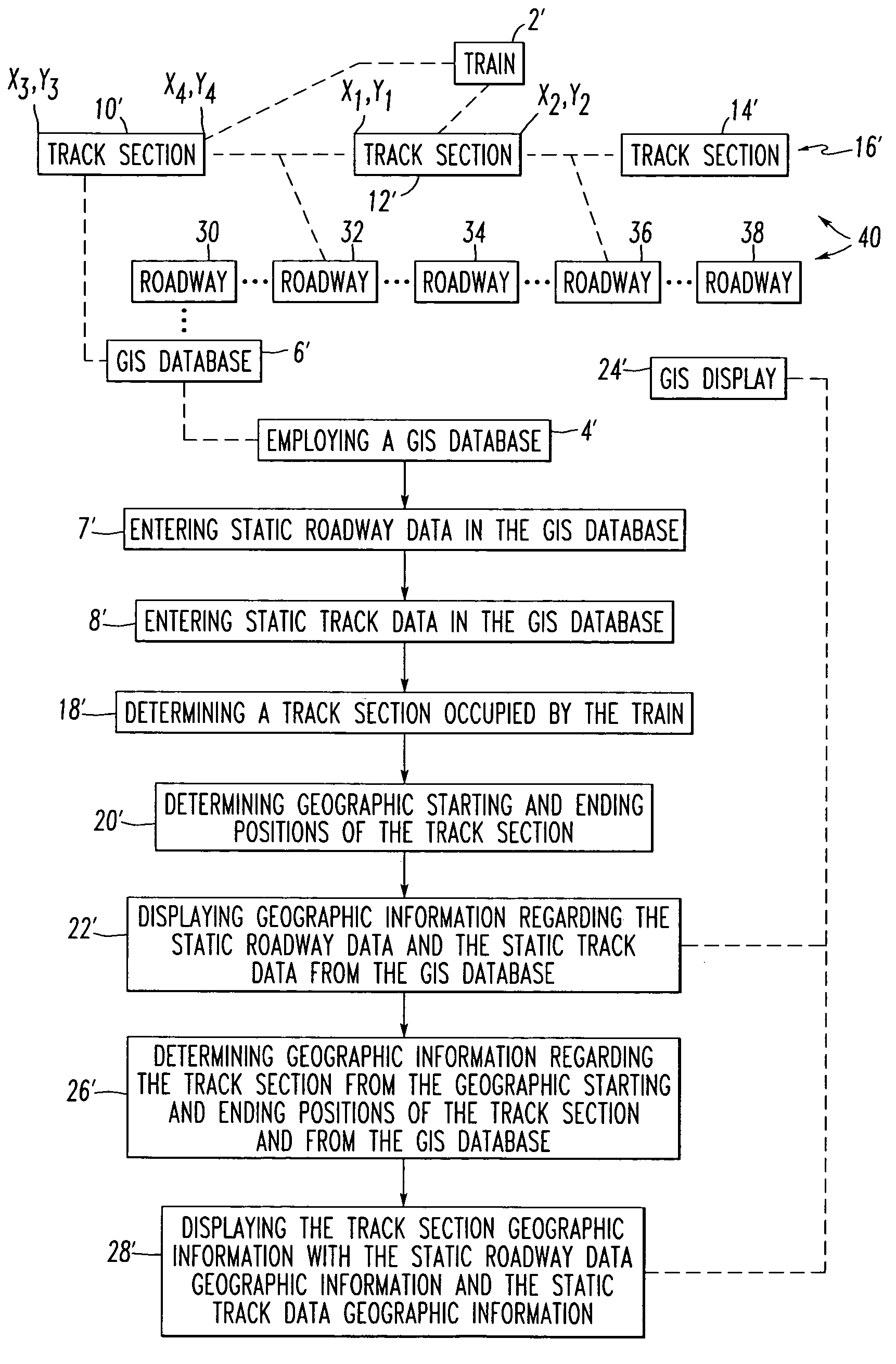
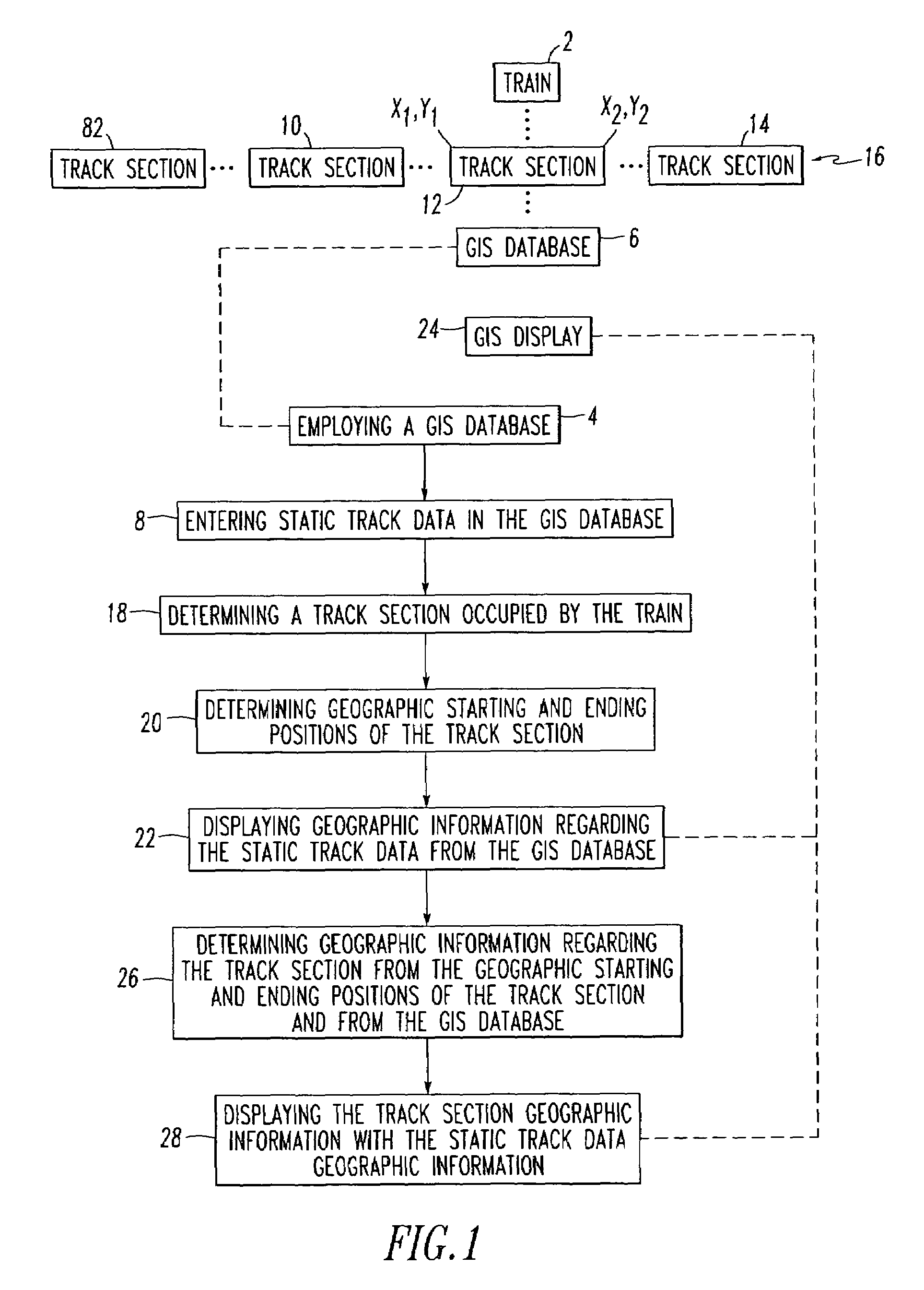
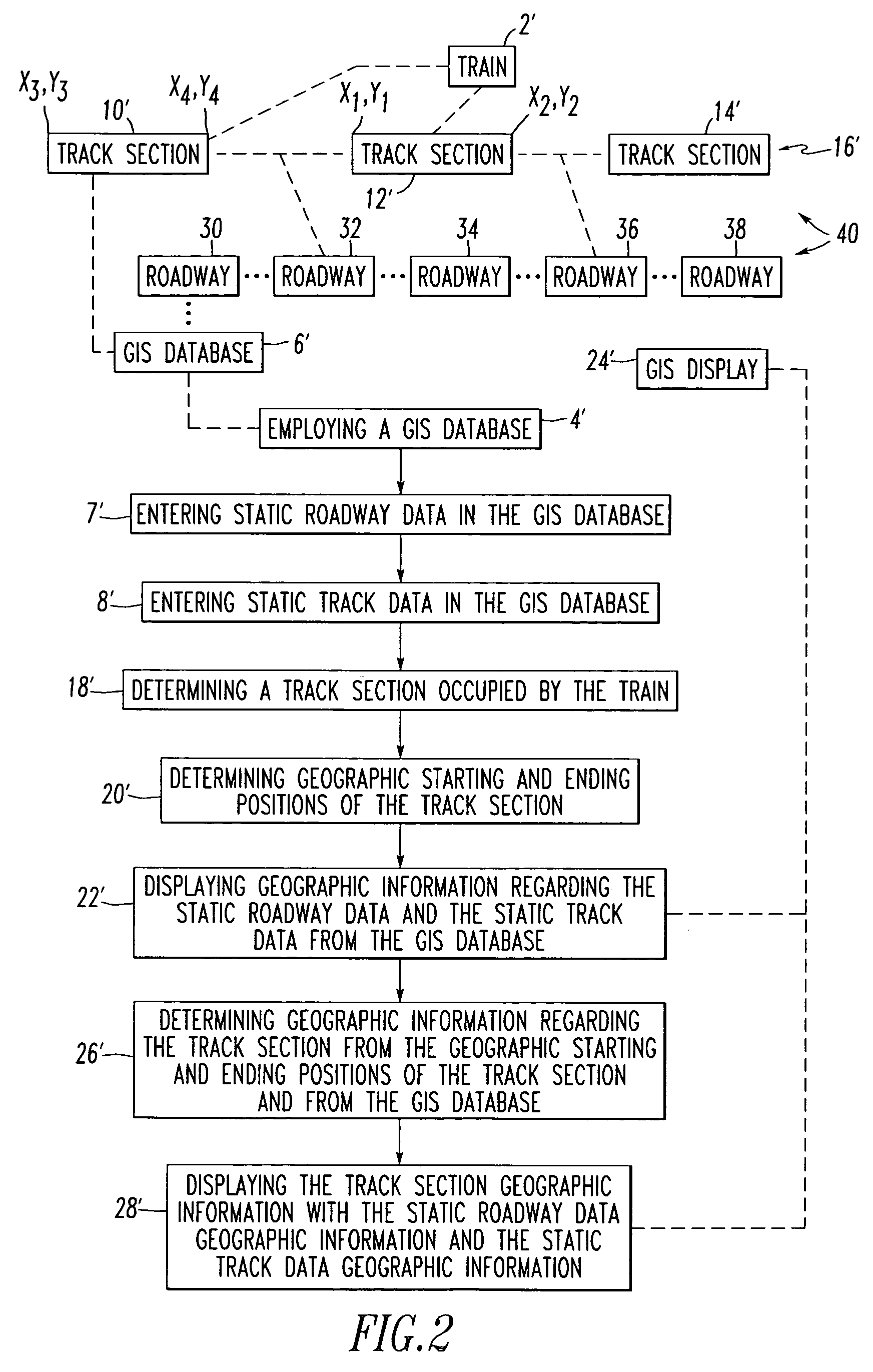
Geographic information system and method for monitoring dynamic train positions
a technology of geoinformation system and position monitoring, applied in the field of information systems, can solve problems such as poor railroad/municipal authority relationship, unfavorable, and problems such as the effect of preventing trains from crossing the road
- Summary
- Abstract
- Description
- Claims
- Application Information
AI Technical Summary
Problems solved by technology
Method used
Image

Examples
example 1
[0040]FIG. 3 shows a geographic information system (GIS) 50 including a server system 51, a communication network, such as the Internet 52, and a client system 53. The GIS 50 displays geographic roadway data, geographic track data, and geographic position data for a train, such as 2 of FIG. 1, on a GIS display 54 of the client system 53. Although the Internet 52 is shown, any suitable communication network (e.g., without limitation, a local area network (LAN); a wide area network (WAN); intranet; extranet; global communication network; wireless local area network (WLAN); wireless personal area network (WPAN)) may be employed.
[0041]The server system 51 includes a web server 55 and a Computer Aided Dispatching (CAD) system 56. The web server 55 includes a geographic information system (GIS) database (GIS DB) 57 including static roadway data and static track data. The CAD system 56 includes a routine 58 for determining one or more track sections occupied by one or more trains. An MSS t...
example 2
[0052]FIG. 4 shows example data transformations for track section occupancy (e.g., current or present train position) of the GIS 50 of FIG. 3 and the train position system 64, which converts information from a track infrastructure database 93 to GIS coordinates. The track infrastructure database 93 contains the configuration of a plurality of track circuits, such as 95,95A, associated with corresponding track sections, such as the track sections 10, 12, 14, 82 of the railroad 16 (FIG. 1) to be controlled or monitored. The track infrastructure database 93 includes a plurality of configuration records, such as 96, 98, describing each of the track circuits 95, 95A, respectively. Each of these records, such as 96, includes a record identifier (TK) 100 and a track identifier (ID) 102. The record 96 also includes fields for starting latitude (SLAT) 104, starting longitude (SLON) 106, ending latitude (ELAT) 108, and ending longitude (ELON) 110 of the corresponding track section. These fiel...
example 3
[0059]Preferably, the train position system 64 determines when a train moves within a geographic area corresponding to a train position layer 136 of the GIS database 94 of FIG. 8 and responsively enters the dynamically determined geographic information (e.g., the vector defined by the points 118) in that layer 136. For example, the GIS database 94 may correspond to one GIS map 86, which is bounded by known, predetermined geographic coordinates.
PUM
 Abstract
Description
Claims
Application Information