System and method for enabling continuous geographic location estimation for wireless computing devices

a wireless computing and geographic location technology, applied in direction finders using radio waves, navigation instruments, instruments, etc., can solve problems such as difficulty in continuously obtaining signals, difficulty in confined areas, and difficulty in obtaining signals

Active Publication Date: 2008-07-08
TRUE POSITION INC
View PDF33 Cites 351 Cited by
  • Summary
  • Abstract
  • Description
  • Claims
  • Application Information

AI Technical Summary

Problems solved by technology

The first technique suffers from the difficulty in continuously obtaining signals, e.g., from a network of satellite, to enable the position of the computing device to be determined.
It is recognized that such difficulties commonly arise in enclosed areas and confined areas, such as in areas with a large concentration of tall buildings and in tunnels.

Method used


Image

  • System and method for enabling continuous geographic location estimation for wireless computing devices
  • System and method for enabling continuous geographic location estimation for wireless computing devices
  • System and method for enabling continuous geographic location estimation for wireless computing devices

Examples


Embodiment Construction

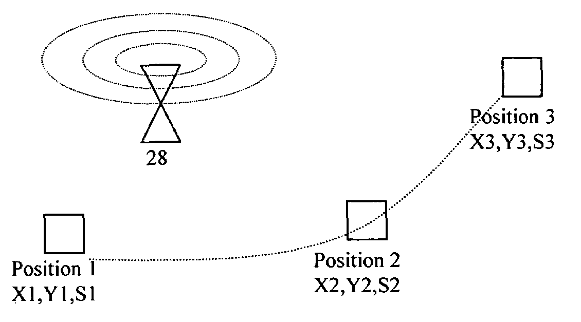
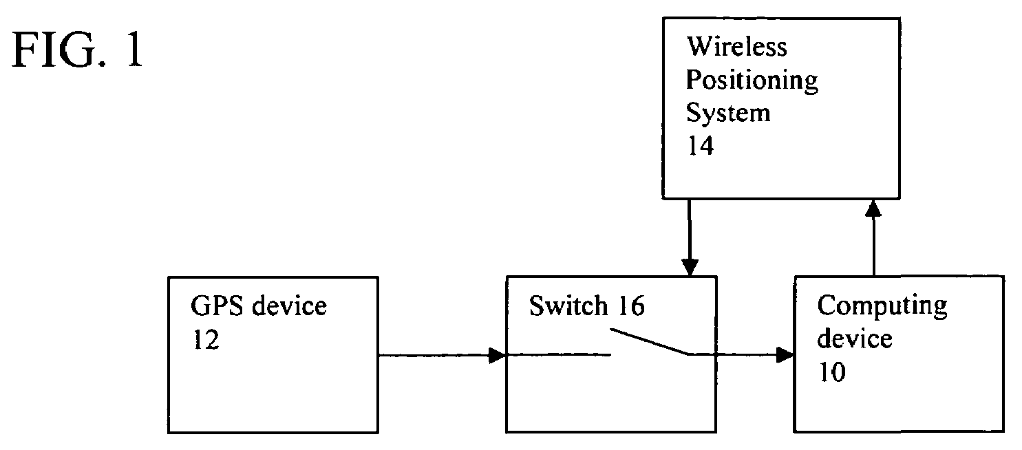
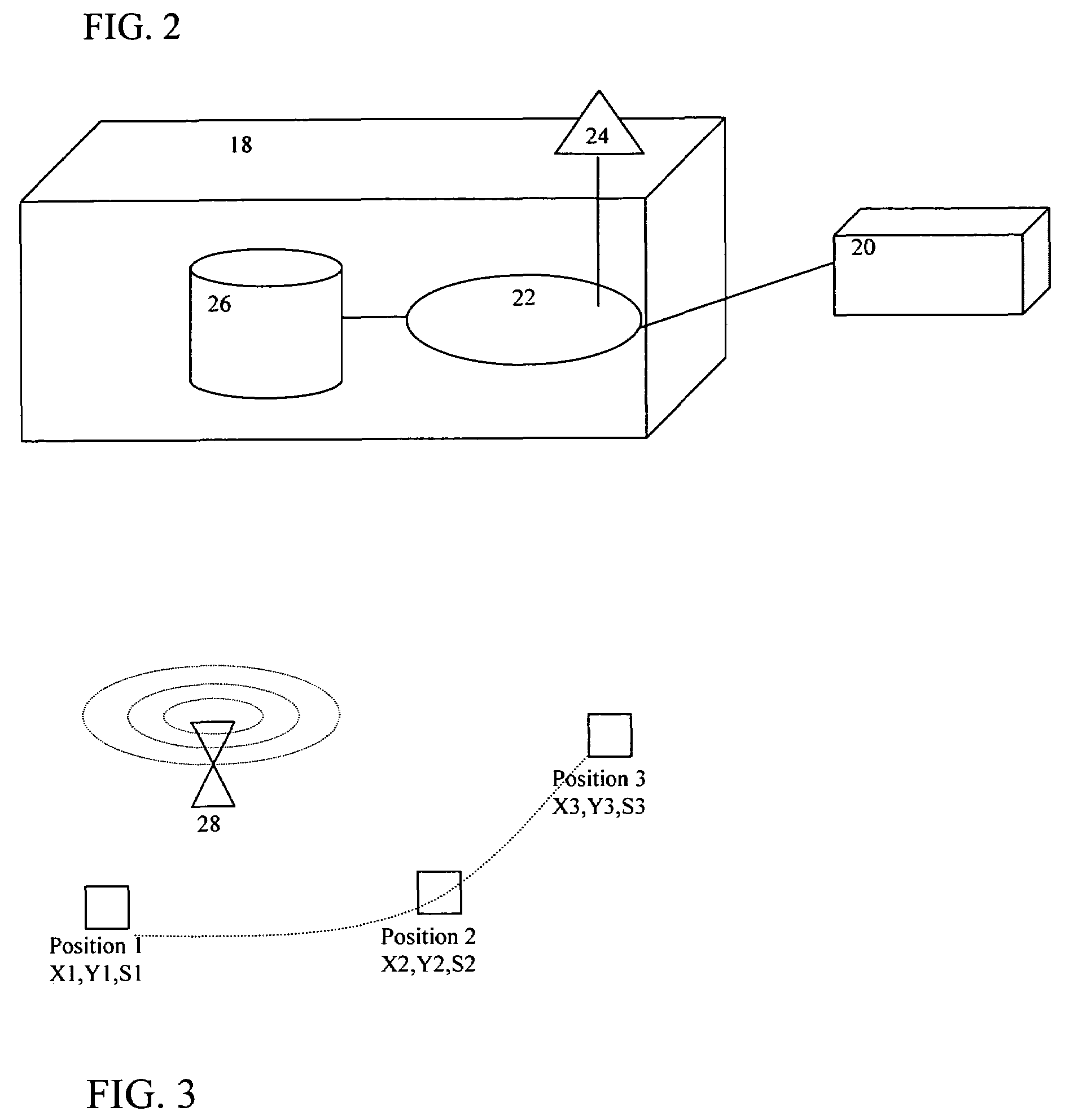
[0027]Referring first to FIG. 1, to provide a system and method for enabling a wireless computing device to determine its position using a wireless and / or satellite-based positioning system irrespective of the reception of positioning signals therefrom by the computing device, each computing device 10 is coupled to a wireless or satellite-based positioning systems such as a GPS device 12 such that the computing device 10 and GPS device 12 are effectively collocated. Using positional data provided by the GPS device 12 and data about wireless beacons, Wi-Fi access points, cell phone towers or other comparable systems (hereinafter referred to as beacons) within reception range of the computing device 10, the computing device 10 creates a database of wireless beacons within a wireless positioning system 14 including the geographic location of each beacon (the exact manner in which such a database is formed is described below).

[0028]A software switch 16 is interposed between the GPS devi...


PUM


Abstract

System and method for enabling a wireless computing device to continuously determine its position includes a wireless computing device and a wireless positioning system substantially collocated therewith. The wireless positioning system has a first positioning mode in which it communicates with a wireless positioning network to enable the geographic location of the computing device to be determined upon reception of signals from the positioning network and a second positioning mode in which it enables the geographic location of the wireless computing device to be determined upon reception of signals from one or more of the wireless beacons and analysis of the signals in light of positional information about wireless beacons contained in a database. The wireless positioning system switches between the positioning modes depending on reception of signals from the wireless positioning network.

Description

CROSS REFERENCE TO RELATED APPLICATION[0001]This application claims priority under 35 U.S.C. §119(e) of U.S. provisional patent application Ser. No. 60 / 649,180 filed Feb. 3, 2005, the specification of which is incorporated by reference herein.FIELD OF THE INVENTION[0002]The present invention relates generally to a system and method for enabling a wireless computing device to determine its position using a wireless positioning network, e.g., a satellite-based positioning system, irrespective of the reception of positioning signals from the wireless positioning network by the computing device.[0003]The present invention also relates to a system and method for passively building a database of wireless beacons by means of wireless computing devices equipped with positioning systems and disseminating the database to other computing devices.[0004]The present invention also relates to a system and method ascertaining the geographical locations of wireless computing devices based on a datab...

Claims


Application Information

Patent Timeline
Patent Type & Authority Patents(United States)
IPC IPC(8): G01S5/14G01C21/00H04Q7/20G01S19/09G01S5/02G01S19/46
CPCG01S5/0242G01S5/0263G01S5/0252G01S19/48
Inventor HOURI, CYRIL
Owner TRUE POSITION INC
Why Eureka
Try Eureka