

Marine surveys
- Summary
- Abstract
- Description
- Claims
- Application Information
AI Technical Summary
Benefits of technology
Problems solved by technology
Method used
Image

Examples
Embodiment Construction
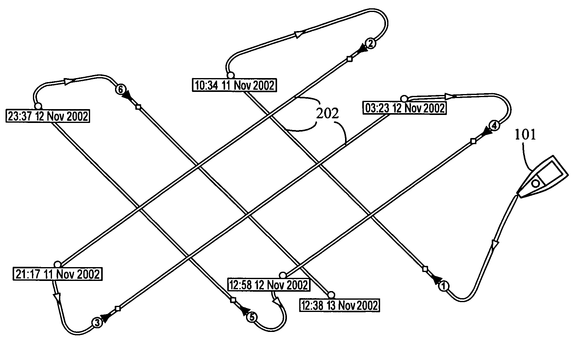
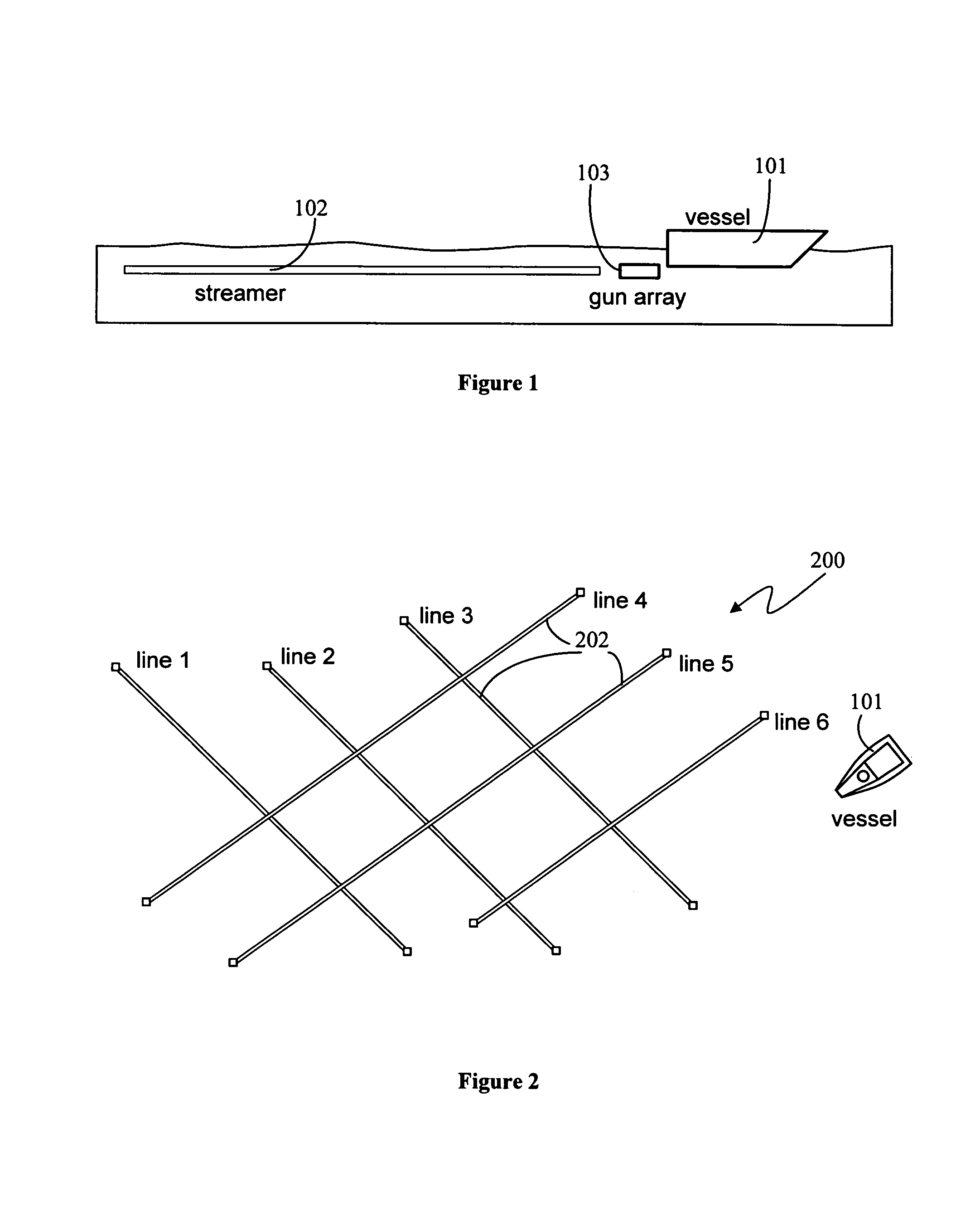
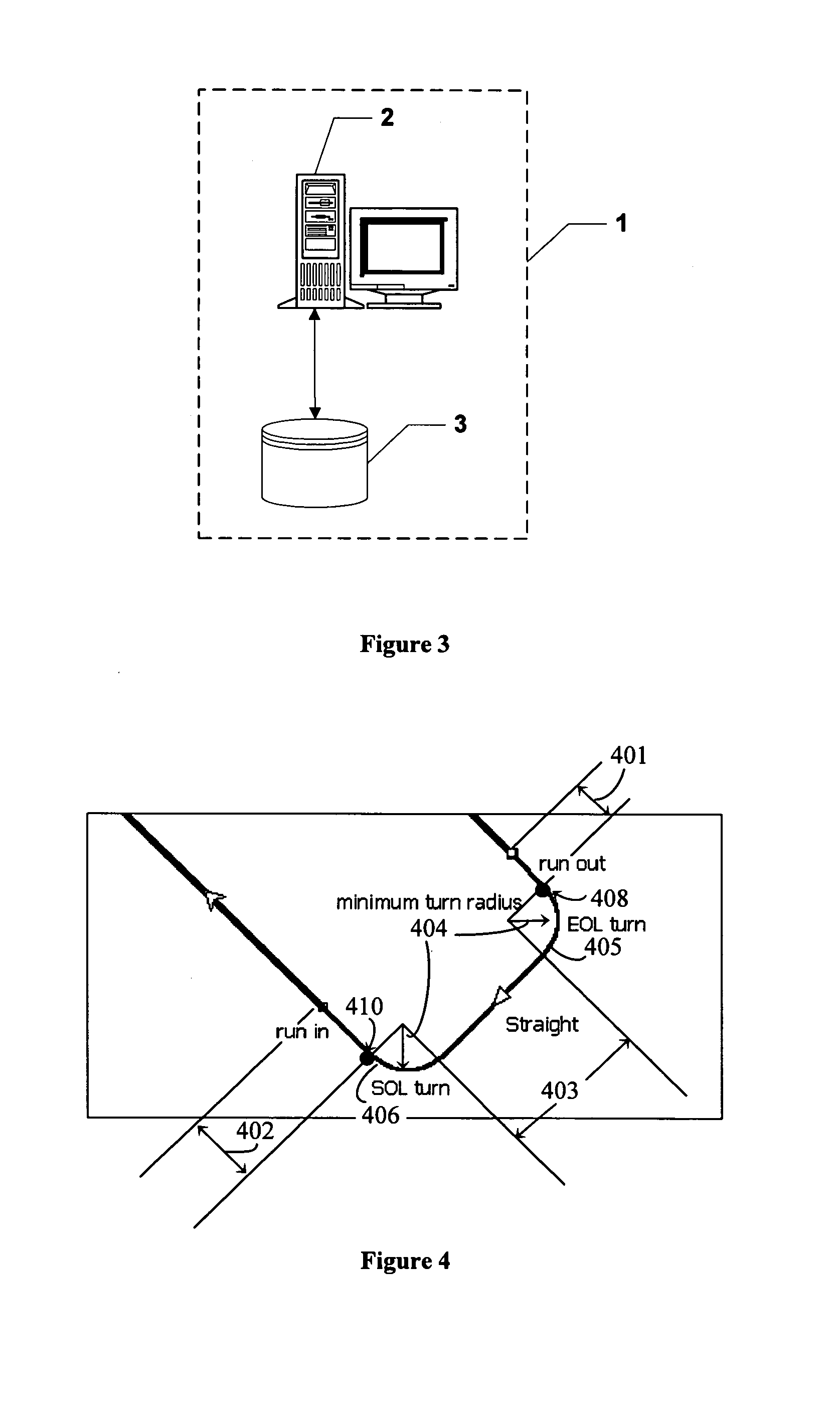
[0036]A survey planning system (SPS) 1, as shown in FIG. 3, executes a survey planning process that determines the overheads of a large number of possible marine seismic survey routes, based on supplied survey line coordinates and other constraints, and determines the most efficient routes from the set of generated routes; i.e., those traversing the shortest distance or requiring the least time. An implementation of the SPS 1 is described below and includes a standard computer system 2 with disk storage 3 having components provided by software modules stored and executed on the computer system 2, which may be a personal computer running a Microsoft Windows™ operating system. It will be apparent to those skilled in the art that the components of the SPS 1 may be distributed on one or more different computer systems in different locations connected by a communications network. Also at least some of the steps executed by the software modules of the SPS 1 may be executed by hardware cir...
PUM
 Abstract
Description
Claims
Application Information