System and method for collecting and updating geographical data

a technology for geographical data and system and method, applied in the field of data collection, can solve problems such as no record of who collected data

Active Publication Date: 2011-07-12
PROSTAR GEOCORP INC
View PDF8 Cites 109 Cited by
  • Summary
  • Abstract
  • Description
  • Claims
  • Application Information

AI Technical Summary

Problems solved by technology

However, there is no record made of who collected data, when the data was collected or modified, and how (including what actions) the operator arrived at the final result.

Method used


Image

  • System and method for collecting and updating geographical data
  • System and method for collecting and updating geographical data
  • System and method for collecting and updating geographical data

Examples


Embodiment Construction

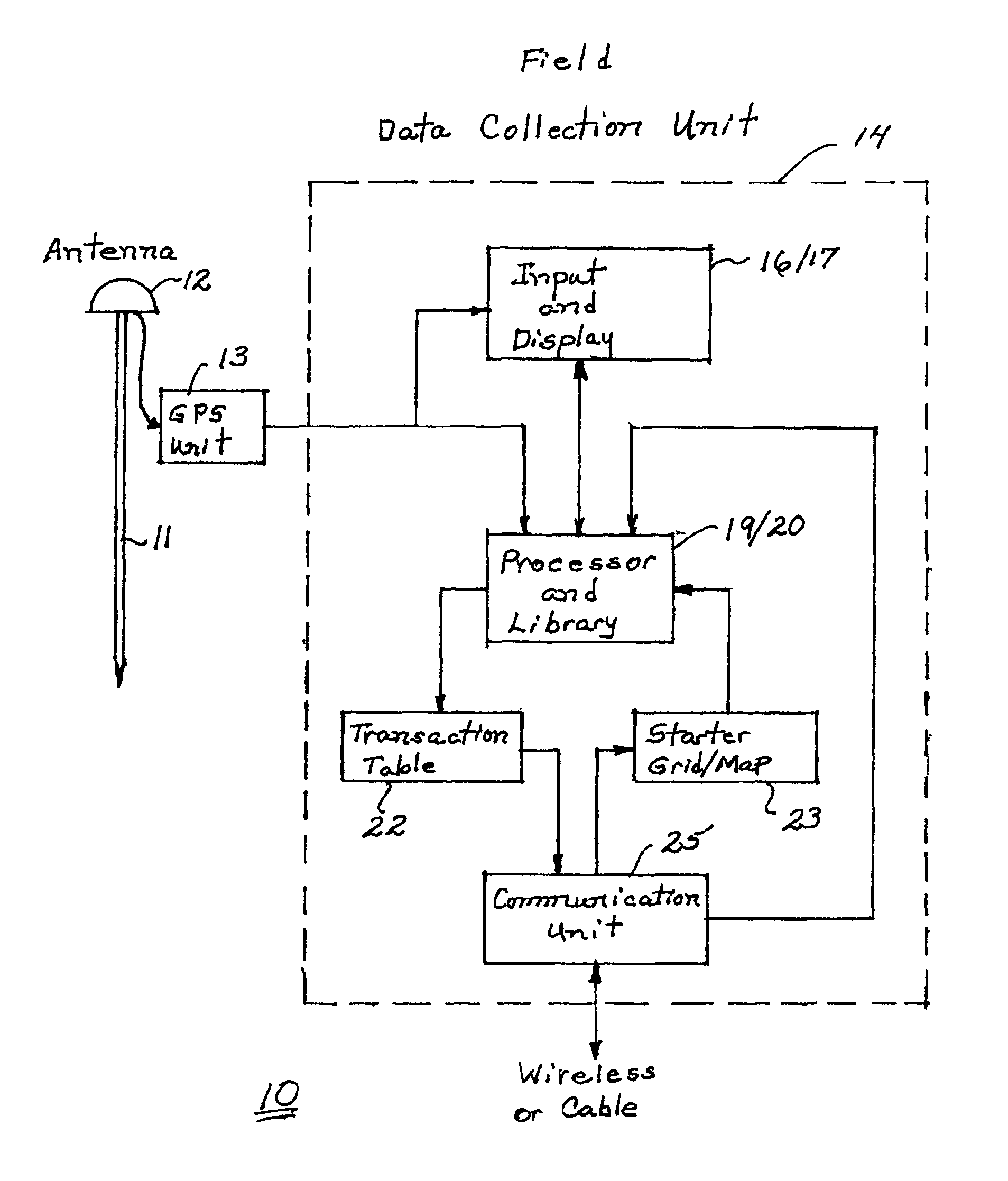
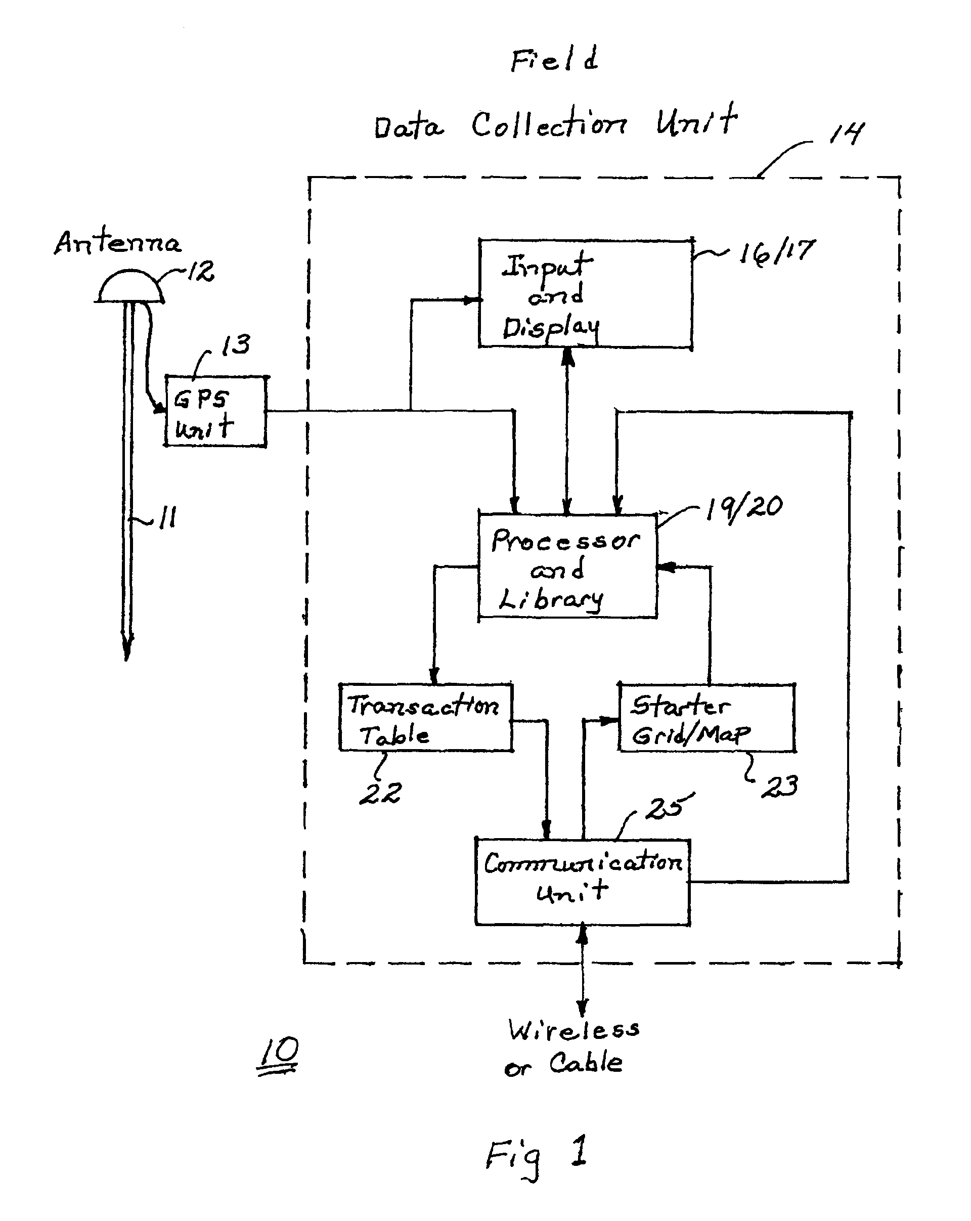
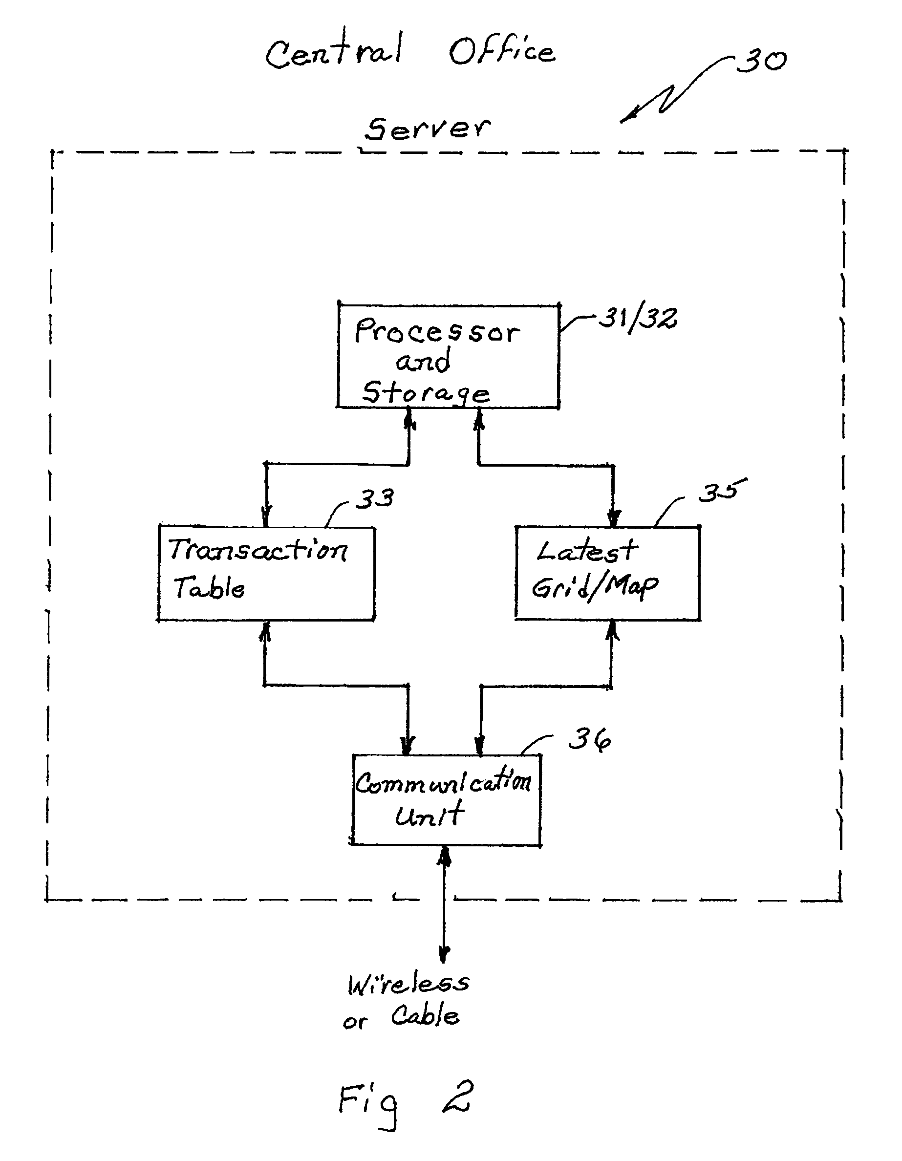
[0018]In one embodiment, the present invention is a system and method for collecting and recording data representative of the location, and characteristics of utilities and infrastructure in the field for creating a grid.

[0019]A record of the transactions by an operator in the field during data collection may be useful to a project manager to observe the progress of a project or to observe the conduct of the operator. Further, such information may be useful if there is an accident in the area that is covered by the map. One type of accident that has occurred in the past is the accidental contact or fracturing of a utility line such as a gas line or a communication, fiber optic line. It will be useful to know if the utility line was properly located on the topography or map in use or whether it had one time been deleted from the map or moved on the map and who was responsible for the revisions. Thus, to provide a data transaction record for use during the collection of the data or as...


PUM


Abstract

A system and method for generating a GIS data transaction including information about a topography of a region and utilities within the region. The method and system include providing information about the topography of the region; receiving information about a user collecting data related to one or more utilities in the region; receiving information about time and date of the collected data; receiving information about each of the utilities; receiving information about location of each of the utilities; and receiving information about the manner of collecting data. The system and method further include receiving information about revisions made to the information about the map; and integrating the received information with the information about the topography of the region into a GIS data transaction.

Description

CROSS-REFERENCE TO RELATED APPLICATION[0001]This Patent Application claims the benefit of the filing date of U.S. Provisional Patent Application Ser. Nos. 60 / 781,719, filed on Mar. 14, 2006 and entitled “DATA COLLECTION TRANSACTION RECORD,” and 60 / 868,502, filed on Dec. 4, 2006 and entitled “SYSTEM AND METHOD FOR INTEGRATION AND DISTRIBUTION OF GEOGRAPHICAL INFORMATION,” the entire contents of which is hereby expressly incorporated by reference.FIELD OF THE INVENTION[0002]The present invention relates generally to collection of data representative of the location of utilities and infrastructure in the field for creating a grid and more particularly for establishing a record of each transaction during data collection.BACKGROUND OF THE INVENTION[0003]Data collection devices typically include a global positioning system (GPS) unit, a pole carrying a GPS antenna coupled to the GPS unit, a computer (an input device, display, memory and operating software) and power supplies for the GPS u...

Claims


Application Information

Patent Timeline
Patent Type & Authority Patents(United States)
IPC IPC(8): G01S19/11
CPCG01C15/00
Inventor SAWYER, JR., TOM Y.BECKNER, MARKTUCKER, PAGEJONES, SCOTT AUSTIN
Owner PROSTAR GEOCORP INC
Why Eureka
Try Eureka