
Navigation method
A navigation method and technology of a navigation device are applied in the field of navigation to achieve the effects of accurate dead reckoning and accurate positioning information
Patent Information
- Authority / Receiving Office
- CN · China
- Patent Type
- Applications(China)
- Current Assignee / Owner
- Publication Date
- 2010-08-25
- Estimated Expiration
- Not applicable · inactive patent
Smart Images
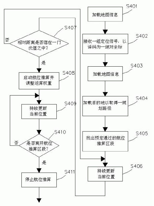
Figure 1 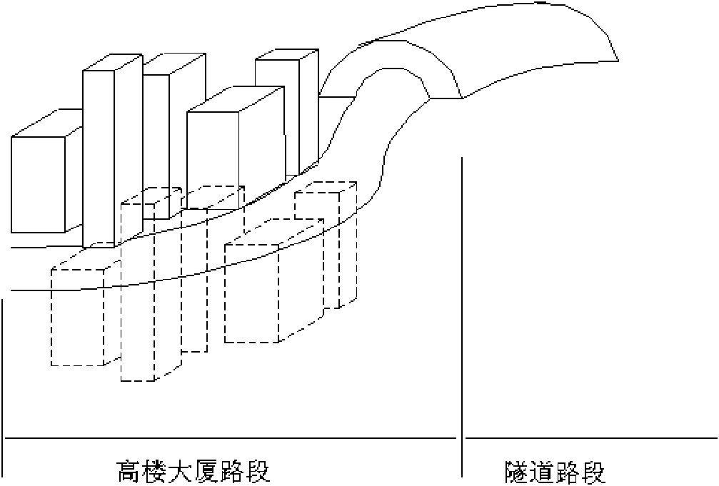
Figure 2 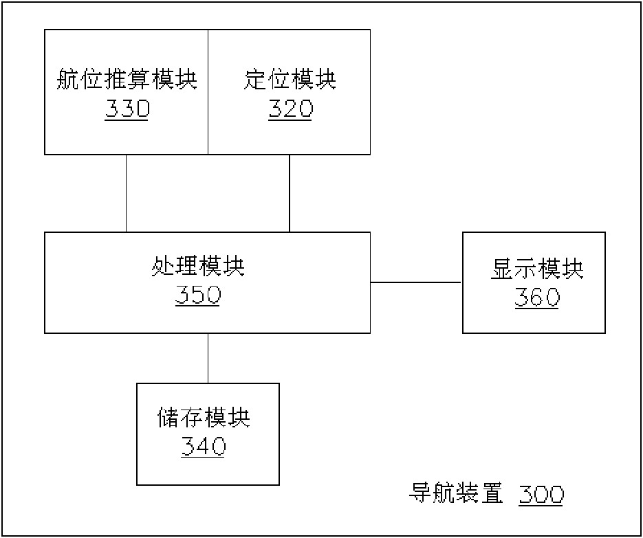
Figure 3
Abstract
Description
Technical field
[0001] The present invention relates to a navigation method, in particular to a navigation method capable of pre-adjusting calculation weights of a Global Positioning System (GPS) module and a Dead Reckoning (DR) module.
Background technique
[0002] The positioning system sends positioning signals from multiple positioning signal sources, and then the receiving end receives the positioning signals, and calculates the position of the receiving end by means of triangulation and other methods. Take the Global Positioning System (GPS) as an example. In the GPS system, 24 satellites are set in the geosynchronous orbit, which send positioning signals relative to the fixed satellites on the surface, and the navigation device on the surface receives at least three satellites. The positioning signal, the longitude and latitude coordinates of the navigation device can be calculated by the triangulation method. In the past, GPS was limited to military and industri...
Examples
Embodiment Construction
[0017] Embodiments of the present invention provide a navigation device and the implementation thereof, which will be described in detail below through specific embodiments.
[0018] Referring to FIG. 2 , it is a navigation device 300 applying the navigation method of the present invention, which includes a positioning module 320 , a dead reckoning module 330 , a storage module 340 , and a processing module 350 .
[0019] The positioning module 320 can operate based on different positioning systems, including Global Positioning System (Global Positioning System, GPS), Assisted Global Positioning System (Assisted Global Positioning System, AGPS), Differential Global Positioning System (Differential Global Positioning System, DGPS), Carrier Phase Differential Global Positioning System (Carrier Phase Differential Global Positioning System, CDGPS), Galileo Positioning System (Galileo Positioning System) and GLONASS system (Global navigation satellite system, GLONASS).
[0020] The...