Video monitoring display method and device based on GIS (Geographic Information System) map

A GIS map and video monitoring technology, applied in the directions of maps/plans/charts, CCTV systems, instruments, etc., can solve the problems of fixed video, low work efficiency, inconvenient signal switching, etc., and achieve the effect of improving work efficiency

Inactive Publication Date: 2012-04-25
GUANGDONG VTRON TECH CO LTD
View PDF9 Cites 23 Cited by
  • Summary
  • Abstract
  • Description
  • Claims
  • Application Information

AI Technical Summary

Problems solved by technology

Conventional video surveillance based on a large screen is to drag the required surveillance video into the display unit for display; although the number of video surveillance is large, the video is relatively fixed, it is not convenient to switch signals at will, and the work efficiency is low

Method used


Image

  • Video monitoring display method and device based on GIS (Geographic Information System) map
  • Video monitoring display method and device based on GIS (Geographic Information System) map
  • Video monitoring display method and device based on GIS (Geographic Information System) map

Examples


Embodiment Construction

[0024] In order to facilitate the understanding of the present invention, the following will be described in conjunction with the accompanying drawings.

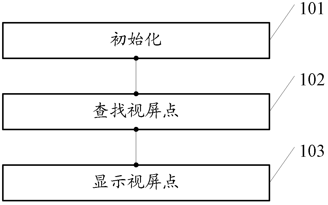
[0025] First introduce the inventive method, please refer to figure 1 , a kind of video surveillance display method based on GIS map, comprises steps:

[0026] 101. Initialize;

[0027] Assign a unique first identifier to each video point on the map; connect the surveillance video signal corresponding to each video point to the large screen, and assign a second identifier containing the first identifier to each surveillance video signal, wherein the second The identifier is used to indicate the name of the place where the view point is located and its own number. Specifically, the first identification can be the number of the video point itself; the second identification can be: the number of the video point itself + the name of the location where the video point is installed;

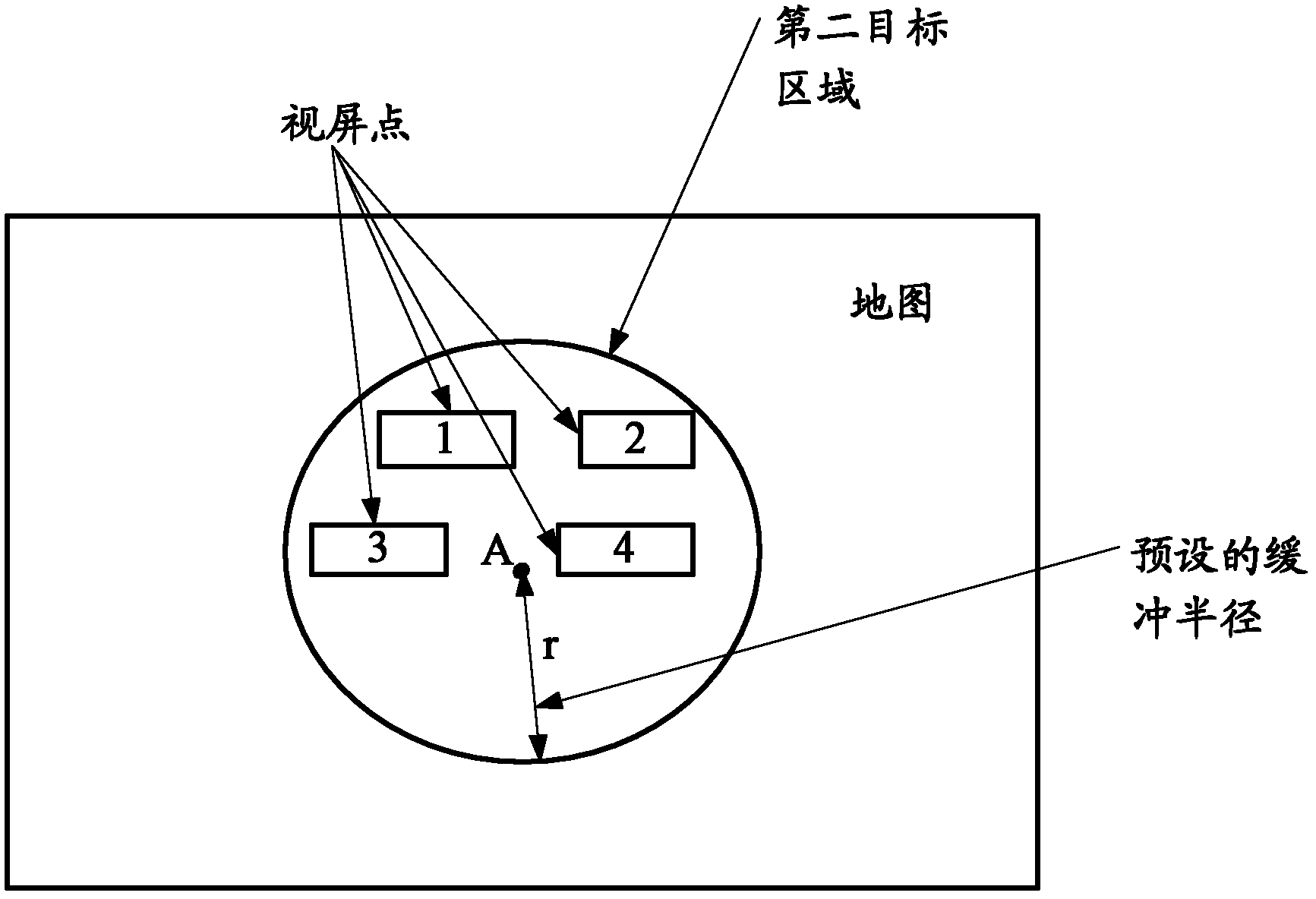
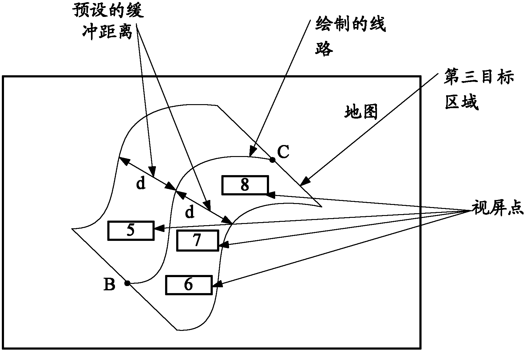
[0028] 102. Find the video point;

[0029]...


PUM


Abstract

The invention discloses a video monitoring display method based on a GIS (Geographic Information System) map, and belongs to the field of spliced large-screen display. By adopting the method, monitored video signals can be switched conveniently so as to improve the operating efficiency. The video monitoring display method comprises the following steps: distributing sole first identification to each video point on the map; allowing the monitored video signal corresponding to each video point to be accessed to a large screen, and distributing second identification containing the first identification to each monitored video recording signal, wherein, the second identification is used for showing the name of the place in which each video point is located as well as the number of each video point; on the map, selecting the video point which needs to be displayed, and gating the corresponding monitored video signal according to the second identification of the video point which needs to be displayed; and on the large screen, displaying the monitored video corresponding to the video point which needs to be displayed. The invention further discloses a video monitoring display device based on the GIS map; and by adopting the device, the monitored video can be switched optionally so as to improve the operating efficiency.

Description

technical field [0001] The invention relates to the field of large-screen splicing display, in particular to a GIS map-based video monitoring display method and device. Background technique [0002] At present, video surveillance is widely used in various fields of urban management, including security, traffic police, emergency command and other fields. In some big cities or megacities, the number of surveillance video points can reach tens of thousands or even hundreds of thousands, covering almost every corner of the city. Conventional video surveillance based on a large screen is to drag the required surveillance video into the display unit for display; although there are many video surveillances, the video is relatively fixed, which is not convenient for random signal switching, and the work efficiency is low. Contents of the invention [0003] The purpose of the present invention is to provide a video monitoring and display method based on GIS map, which can realize ...

Claims


Application Information

Patent Timeline
Patent Type & Authority Applications(China)
IPC IPC(8): H04N7/18G09B29/10
Inventor 周虎唐永木韦文杰王喜咏
Owner GUANGDONG VTRON TECH CO LTD
Why Eureka
Try Eureka