Three-dimensional geological tunnel modeling method based on spatial data structure system

A technology of spatial data and 3D geology, applied in the field of mines

Inactive Publication Date: 2013-07-31
北京建筑工程学院
View PDF2 Cites 23 Cited by
  • Summary
  • Abstract
  • Description
  • Claims
  • Application Information

AI Technical Summary

Problems solved by technology

The present invention proposes a data structure that can reflect the roadway system is a three-dimensional network space domain characteristics, and establis

Method used


Image

  • Three-dimensional geological tunnel modeling method based on spatial data structure system
  • Three-dimensional geological tunnel modeling method based on spatial data structure system
  • Three-dimensional geological tunnel modeling method based on spatial data structure system

Examples


Embodiment Construction

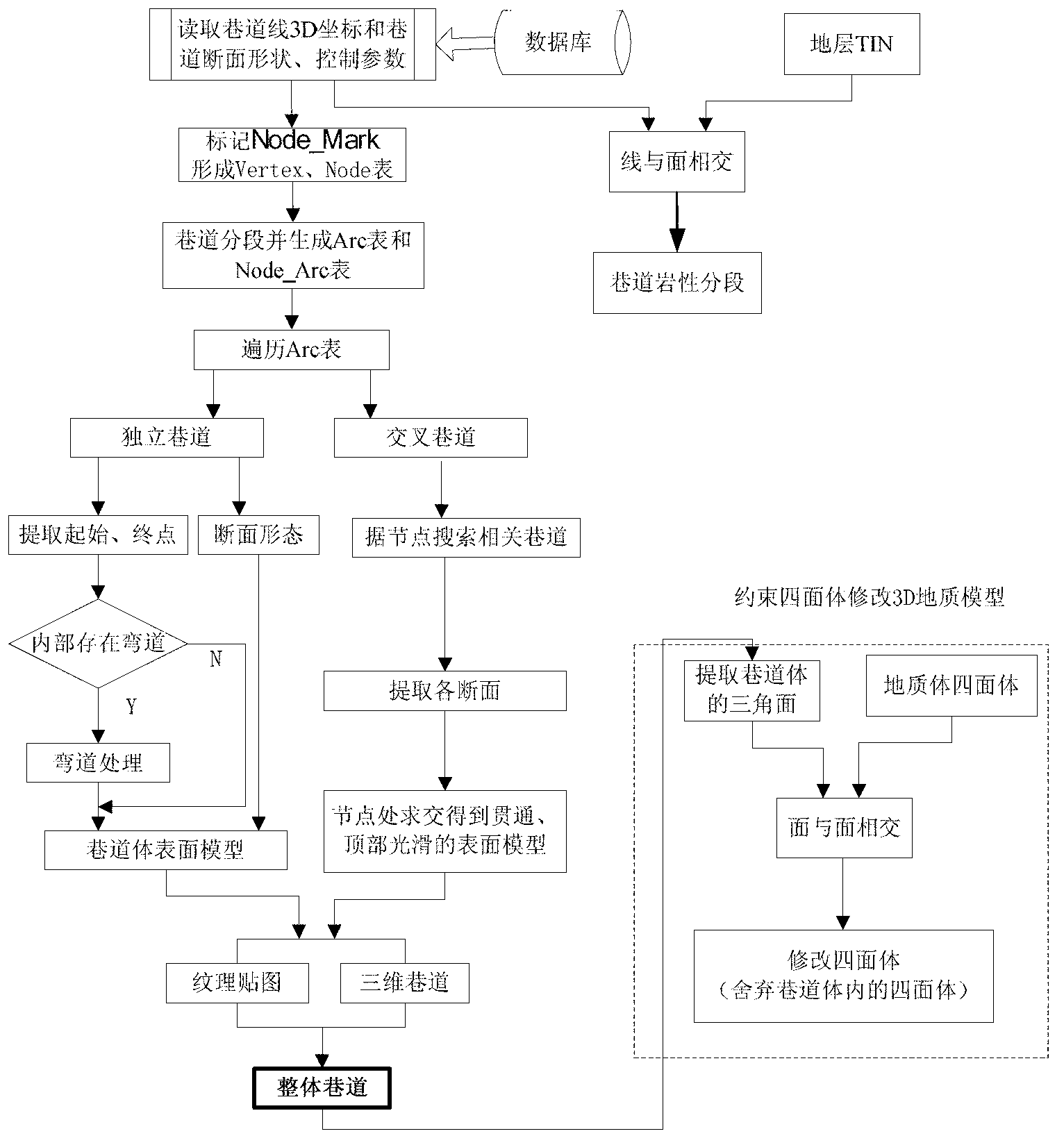
[0052] The present invention will be further described in detail below in conjunction with the accompanying drawings, so that those skilled in the art can implement it with reference to the description.

[0053] The present invention provides a kind of three-dimensional geological roadway modeling method, and main implementation steps are:

[0054] Step 1, measure the three-dimensional coordinate value of the point on the center line of the top of the mine roadway and the shape parameters of the mine roadway section width w, height h, radius r and roadway azimuth angle α;

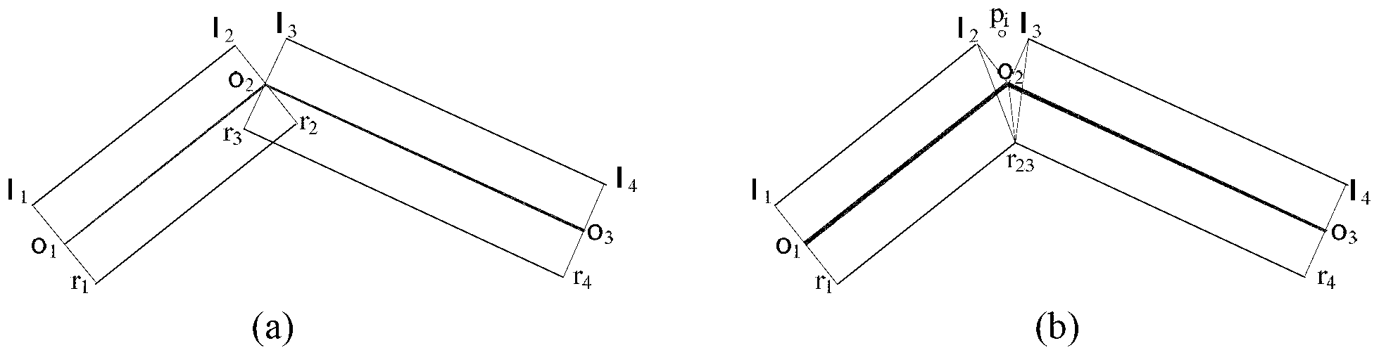
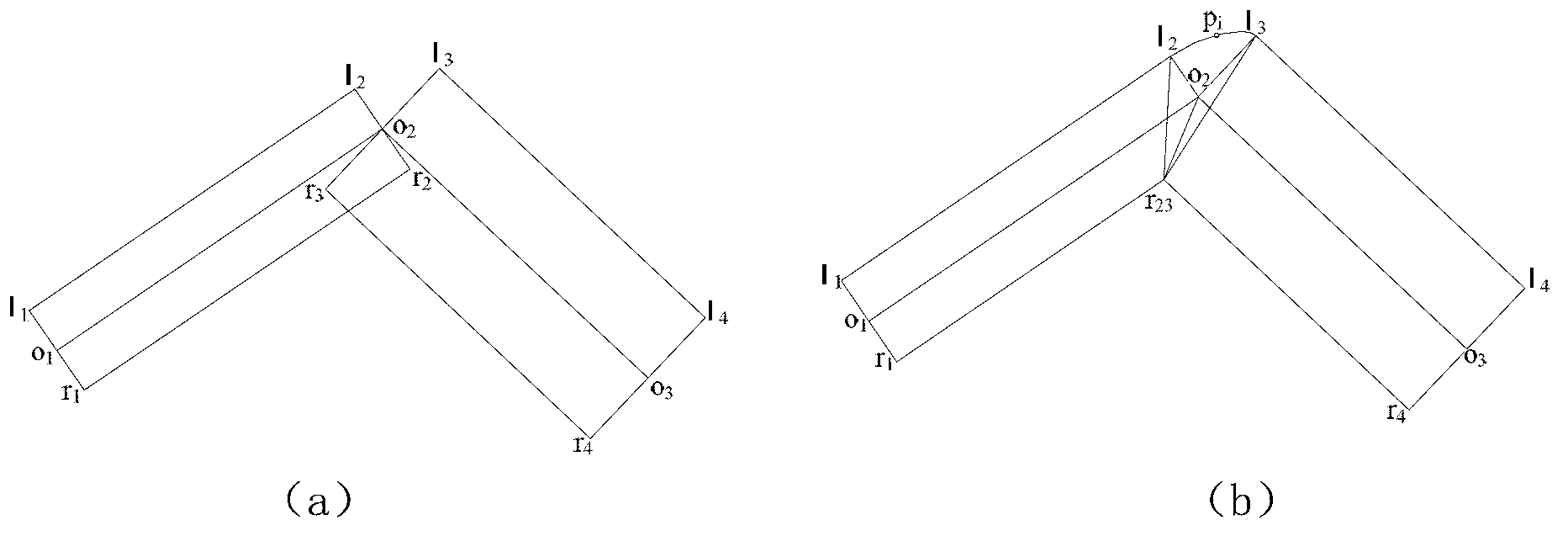
[0055] Step 2, read the three-dimensional coordinate value of the point on the central line of the roadway top collected from the database, that is, the three-dimensional coordinate value of the apex, and form an apex table; the roadway is divided into two or more segments by other roadways. The endpoint is a node, and in the vertex table, whether the vertex is the intersection of multiple roadways, that is...


PUM


Abstract

The invention discloses a three-dimensional geological tunnel modeling method based on a spatial data structure system. The method mainly comprises the following steps of: measuring the three-dimensional coordinate value of points on a top central line of the mine tunnel and the section shape parameter of the mine tunnel; reading the acquired three-dimensional coordinate values (namely vertex three-dimensional coordinate values) of points on the top central line of the tunnel from a database, to obtain the relation between the nodes and segmental arcs of the crossed tunnels according to the vertex three-dimensional coordinate values of multiple tunnels; calculating the feature point coordinate value of a three-dimensional surface model of a tunnel body according to the tunnel section shape parameter and the relation between the nodes and the segmental arcs and by using the top-bottom central line of the tunnel as a benchmark; and constructing the surface triangulation networks of the tunnel body according to the feature point coordinate value of the three-dimensional surface model of the tunnel body so as to establish the three-dimensional surface model of the whole tunnel body. By providing the 'section-node-segmental arc' spatial data structure, the effects that the curve of the tunnel is smooth and the crossed tunnels are through are achieved.

Description

technical field [0001] The invention relates to the technical field of mines, in particular to a three-dimensional geological roadway modeling method. Background technique [0002] The roadway is the artery of mine production, which directly affects the economic benefits and production safety of coal mine production. Establishing a true three-dimensional roadway model is of great significance for guiding mine mining design plans, engineering construction and safety rescue. Traditional mine information management is based on manual management based on paper media maps such as geology and roadways. There are mainly two ways to simulate and express geological information. One is to use plan and section diagrams to express (such as floor contour maps, excavation engineering plans, geological profiles, borehole profiles, etc.), and its essence is to use 3D The strata, ore bodies and geological phenomena in the geological environment are projected onto a 2D plane (XY plane, XZ pl...

Claims


Application Information

Patent Timeline
IPC IPC(8): G06T17/00
Inventor 黄明王晏民
Owner 北京建筑工程学院
Why Eureka
Try Eureka