A visualization method for personal geotagged data

A geo-tagging and data technology, applied in electrical digital data processing, special data processing applications, instruments, etc., can solve the problems of easily disturbing users' quick perception, unable to find information of their own interest, etc., and achieve the effect of simple display

Active Publication Date: 2018-02-09
THE PLA INFORMATION ENG UNIV
View PDF2 Cites 0 Cited by
  • Summary
  • Abstract
  • Description
  • Claims
  • Application Information

AI Technical Summary

Problems solved by technology

[0004] The purpose of the present invention is to provide a visualization method suitable for personal geographic marking data, so as to solve the problems existing in existing visualization methods that users cannot use the spatial location as an entry to find the information they are interested in and that too many geographical elements on the map easily interfere with users. quick perception problem

Method used


Image

  • A visualization method for personal geotagged data
  • A visualization method for personal geotagged data
  • A visualization method for personal geotagged data

Examples


Embodiment Construction

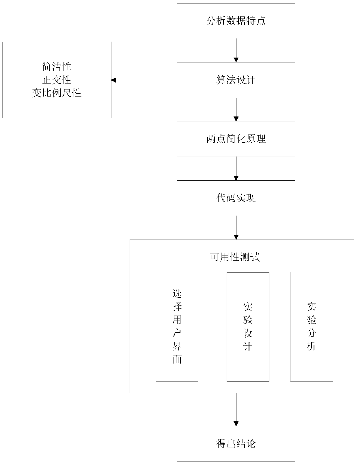
[0026] The specific embodiments of the present invention will be further described below in conjunction with the accompanying drawings.

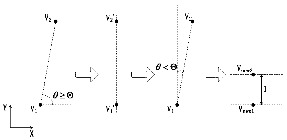
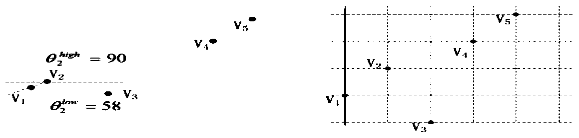
[0027] A visualization method suitable for personal geographic mark data proposed by the present invention is a visualization method (referred to as a marker topology map) suitable for personal geographic mark data (mainly text and photo data), the purpose of which is to remove the map background and abandon the original The accuracy of the data, only the relative positional relationship of the data is retained, the points in the dense area are stretched, and the points in the sparse area are compressed, and finally a marked topological map with a distance of 1 between any two points on the X and Y axes is obtained. The specific implementation process of the method is as follows.

[0028] The proposal of the tag topological map is mainly based on the basic theory of cognitive map. Under the guidance of the basic theory of cognitive map, the ...


PUM


Abstract

The invention relates to a visualization method suitable for personal geographical mark data, belonging to the technical field of data visualization processing. When processing personal geographical mark data, the present invention removes the background map, stretches the points in the dense area and compresses the points in the sparse area under the premise of keeping the azimuth orthogonality unchanged, and then obtains that all geographical locations are in the A labeled topology map shown on a graph. Through the above process, the present invention can realize simple display of personal geographical mark data, and ensure that the transformed geographical points still maintain the original relative positional relationship, and finally all position points can be displayed under the same map frame. And compared with the text list and the common map, it is found that the present invention is better than the common map in terms of search efficiency; when the personal geographical mark data has a large amount of data, it is better than the text list.

Description

technical field [0001] The invention relates to a visualization method suitable for personal geographical mark data, belonging to the technical field of data visualization processing. Background technique [0002] Personal geotagging data is published by individuals through devices such as laptops, tablets, or mobile phones, including geographic location, personal-related texts, photos, and videos (such as Tencent WeChat Moments or Sina Weibo, etc.). At present, mature commercial websites mainly have two visualization methods for these data. One is to organize text and photo information by publication time, and the other is to overlay geotagged data on a common map for display. [0003] The first method only displays the spatial location in the list in the form of text or illustrations, and users cannot use the spatial location as an entry to find the information they are interested in. The second method is a traditional thematic data visualization method, but due to the c...

Claims


Application Information

Patent Timeline
Patent Type & Authority Patents(China)
IPC IPC(8): G06F17/30
Inventor 李响赵婷王丽娜张晶王培
Owner THE PLA INFORMATION ENG UNIV
Why Eureka
Try Eureka