A conversion method from autocad data to gis spatial data

A technology of spatial data and conversion methods, applied in electrical digital data processing, special data processing applications, instruments, etc., can solve the problems of large amount of intermediate data, large data redundancy, memory consumption, etc., to expand the scope of application and efficient conversion. , the effect of data sharing

Active Publication Date: 2018-06-01
CHONGQING SURVEY INST
View PDF5 Cites 0 Cited by
  • Summary
  • Abstract
  • Description
  • Claims
  • Application Information

AI Technical Summary

Problems solved by technology

[0018] 1. Data conversion needs the help of third-party tools, which cannot realize timely conversion and sharing of spatial data from AutoCAD to GIS;
[0019] 2. During data conversion, there are a lot of intermediate data and memory consumption, and the converted data has a large redundancy;
[0020] 3. Layers, colors, line types, precision, etc. are lost after data conversion;
[0021] 4. Custom extended attributes are lost after data conversion

Method used


Image

  • A conversion method from autocad data to gis spatial data
  • A conversion method from autocad data to gis spatial data
  • A conversion method from autocad data to gis spatial data

Examples


Embodiment Construction

[0054] Embodiments of the present invention are described in detail below, examples of which are shown in the drawings, wherein the same or similar reference numerals designate the same or similar elements or elements having the same or similar functions throughout. The embodiments described below by referring to the figures are exemplary only for explaining the present invention and should not be construed as limiting the present invention.

[0055] The invention provides a kind of conversion method from AutoCAD data to GIS spatial data, comprises the following steps:

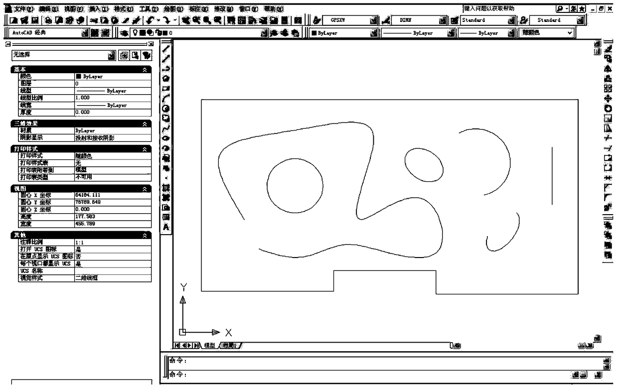
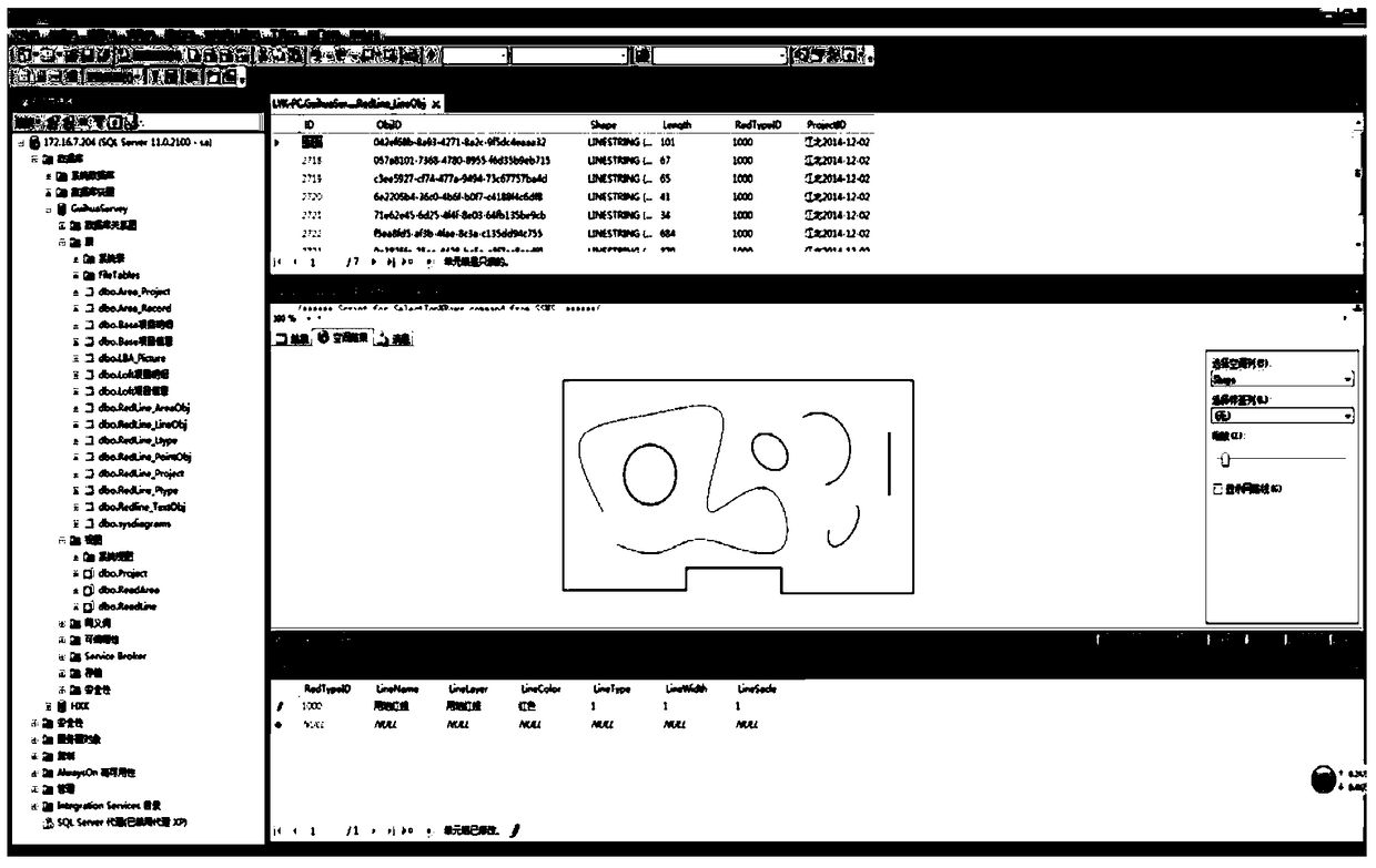
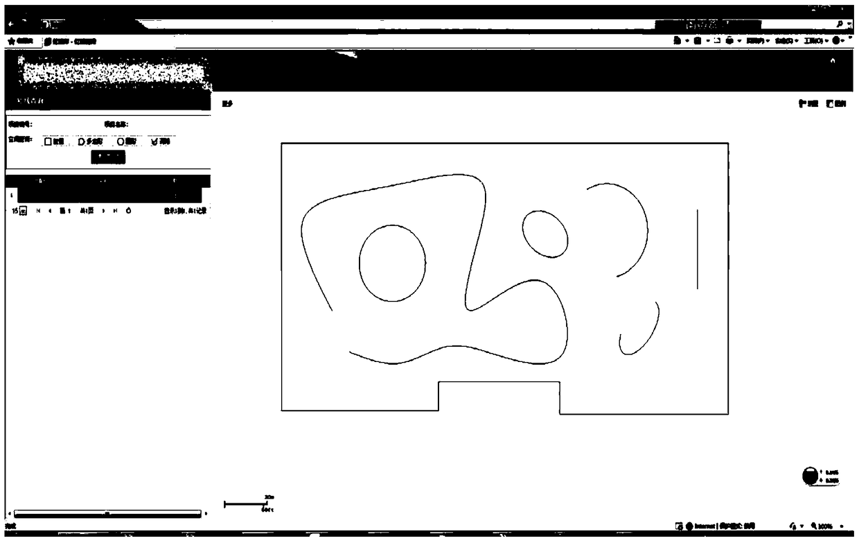
[0056] S1, open the graphic file to be processed in the AutoCAD software, and carry out ID identification for all graphic objects in the graphic file. In this embodiment, AutoCAD graphic object ID identification can be realized by means of a globally unique identifier (GUID, Globally Unique Identifier), and the GUID value is randomly generated through the System.Guid.NewGuid() class under the .NET platform, an...


PUM


Abstract

The invention discloses a method for converting AutoCAD data into GIS spatial data. The method comprises the following steps: 1, opening a graphic document to be processed in AutoCAD software, and performing ID marking on all graphic objects in the graphic document; 2, performing text marking on the graphic objects; 3, acquiring the basic attribute of the graphic objects; 4, establishing spatial databank conversion, and storing the data. As the AutoCAD data are converted into GIS spatial data and are shared in time, all information (including the basic attribute and the expansion attribute) in AutoCAD is maintained in the converted graphs, the data amount to be converted can be controlled according to different precision requirements, and the application range of the AutoCAD data is widened.

Description

technical field [0001] The invention relates to a data conversion method, in particular to a conversion method from AutoCAD data to GIS spatial data. Background technique [0002] WKT (Well-known text) is a text markup language used to represent vector geometric objects, spatial reference systems, and conversion between spatial reference systems. Its binary representation, WKB (well-known binary), is better than storing the same information in transmission and in the database. The format was developed by the Open Geospatial Consortium (OGC). [0003] Geometric objects that can be represented by WKT include: points, lines, polygons, TIN (triangular irregular network) and polyhedrons. Geometric objects of different dimensions can be represented by means of geometric collections. The coordinates of geometric objects can be 2D(x,y), 3D(x,y,z), 4D(x,y,z,m), plus an m value belonging to the linear reference system. [0004] The following is a sample geometry WKT string: [00...

Claims


Application Information

Patent Timeline
Patent Type & Authority Patents(China)
IPC IPC(8): G06F17/30
CPCG06F16/258
Inventor 张平陈翰新向泽君周志军朱清海刘远凯陈华刚周召兵汪蓓潘成军郑持辉张凤英王昌翰刘洪海杨本廷冉瑞华朱伟刘洋河廖中林滕德贵肖兴国岳仁宾郑佳孙宇汪剑云肖先华张杰谢文敏王刚氚栗龙张立祥彭文代强张天勤李彦聪徐定建杨勇吴凡俞跃
Owner CHONGQING SURVEY INST
Why Eureka
Try Eureka