Method for making average sea surface height products from satellite altimetry data based on network function interpolation

A technology for satellite altimetry and production methods, applied in electrical digital data processing, special data processing applications, instruments, etc., can solve the problems of not considering the physical characteristics of sea level, production accuracy defects, etc. The effect of improving accuracy and spatial resolution

Inactive Publication Date: 2017-08-25
CHINA UNIV OF PETROLEUM (EAST CHINA)
View PDF4 Cites 0 Cited by
  • Summary
  • Abstract
  • Description
  • Claims
  • Application Information

AI Technical Summary

Problems solved by technology

[0006] At present, there are many algorithms for gridding, such as distance-weighted least squares method, surface fitting method, Shepard algorithm and harmonic kernel function method, etc. These are general methods in mathematics, and do not consider the physical characteristics of sea level, but only with interpolation Only when the object maintains a function with good physical properties (for example, a periodic function is suitable for fluctuation phenomena) can high-precision interpolation results be obtained. Therefore, these algorithms still have defects in the production accuracy of the average sea surface height product

Method used


Image

  • Method for making average sea surface height products from satellite altimetry data based on network function interpolation
  • Method for making average sea surface height products from satellite altimetry data based on network function interpolation
  • Method for making average sea surface height products from satellite altimetry data based on network function interpolation

Examples


Embodiment Construction

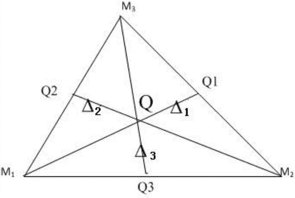
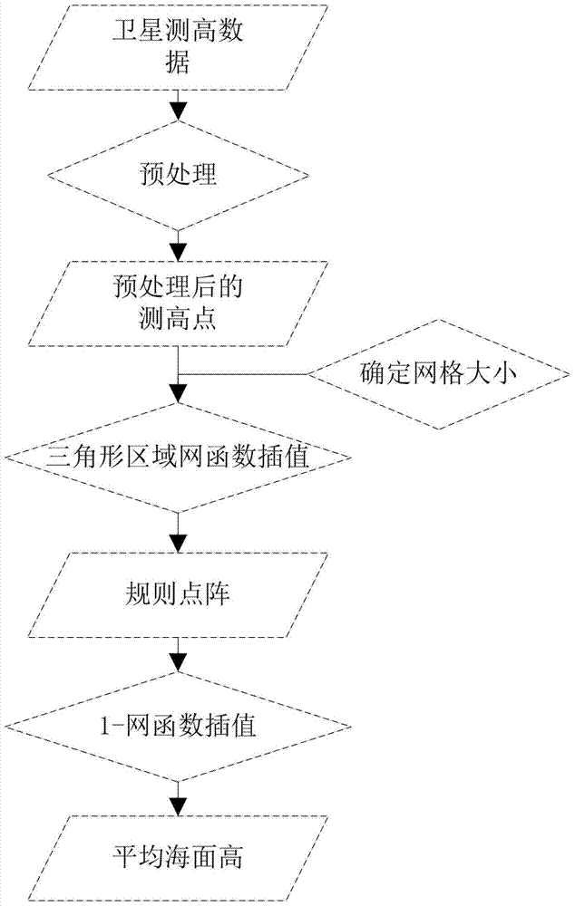
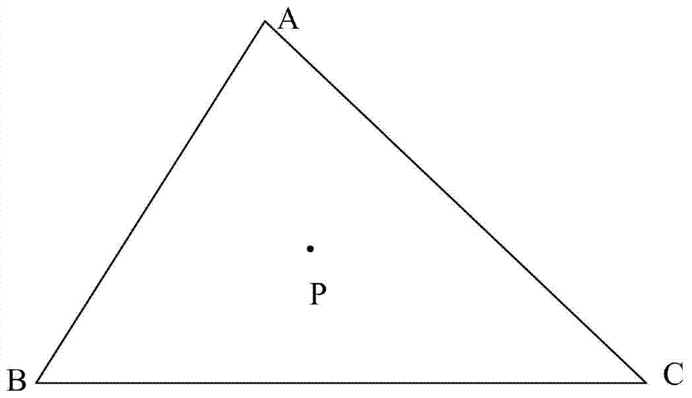
[0030] The production flow chart of the present invention is as figure 1 As shown, in view of the discrete characteristics of satellite altimetry data, combined with the analysis of satellite orbit spacing to determine a reasonable grid size and center point position, a grid interpolation algorithm based on triangular area network function interpolation algorithm is carried out to form regularly arranged sea surface height data points On this basis, the rectangular area network function interpolation algorithm is used to carry out fine interpolation to produce a higher spatial resolution mean sea level dataset.

[0031] The specific production method steps are as follows:

[0032] a. Data preprocessing

[0033] Carry out format conversion and data editing according to the data manuals of each altimetry satellite, and then carry out collinear processing and intersection adjustment to form preprocessed altimetry points;

[0034] b. Determination of grid size and center point ...


PUM


Abstract

The invention discloses a method for making satellite altimetry data average sea surface height products based on network function interpolation. The specific steps include: data preprocessing, grid size and center point determination, grid interpolation, and fine interpolation. The invention is convenient for the computer to automatically divide the grid, has obvious statistical characteristics, and can reflect the spatial distribution law of the ocean gravity field in terms of physical characteristics, and the ocean gravity field is positively correlated with the average sea surface height, fully considering the physical characteristics of the sea level, and can Improved accuracy and spatial resolution of mean sea height products.

Description

technical field [0001] The invention relates to a production method, in particular to a production method of an average sea surface height product of satellite altimetry data based on network function interpolation. Background technique [0002] The mean sea level height refers to the average value of the water level in a certain period of time, and the time scale should be long enough to eliminate all physical vibrations and stabilize the mean sea level. [0003] The average sea surface height product refers to the gridded average sea surface height dataset obtained by processing multi-source satellite altimetry data. [0004] The high-precision and high-resolution average sea surface height data is an important basis for the study of ocean dynamic environment changes, and is an important supporting data for the study of global sea level changes and climate changes. Explanation of environmental changes. [0005] With the continuous launch of altimetry satellites and the a...

Claims


Application Information

Patent Timeline
Patent Type & Authority Patents(China)
IPC IPC(8): G06F19/00
Inventor 刘善伟万剑华曾喆李家军管一鹤孙蓓佳
Owner CHINA UNIV OF PETROLEUM (EAST CHINA)
Why Eureka
Try Eureka