Method for marking points of interest, terminal, navigation server and navigation system

A technology of navigation server and points of interest, which is applied to road network navigators, instruments, special data processing applications, etc., can solve the problems of labeling cover, unfavorable POI data usage, difficulty in processing speed and display effect, etc. The effect of reducing the time required, reducing the pressure of data processing, and improving rendering efficiency

Active Publication Date: 2018-09-11
NAVINFO
View PDF5 Cites 0 Cited by
  • Summary
  • Abstract
  • Description
  • Claims
  • Application Information

AI Technical Summary

Problems solved by technology

[0005] However, in the above method, since each POI signage is independently drawn and capped, it is not conducive to the use of POI data in performance-limited devices
The signage cap adjustment algorithm is an NP-hard problem. It is difficult to achieve both processing speed and display effect. Usually, the display effect is sacrificed for processing performance, resulting in a large number of mark caps.

Method used


Image

  • Method for marking points of interest, terminal, navigation server and navigation system
  • Method for marking points of interest, terminal, navigation server and navigation system
  • Method for marking points of interest, terminal, navigation server and navigation system

Examples


Embodiment Construction

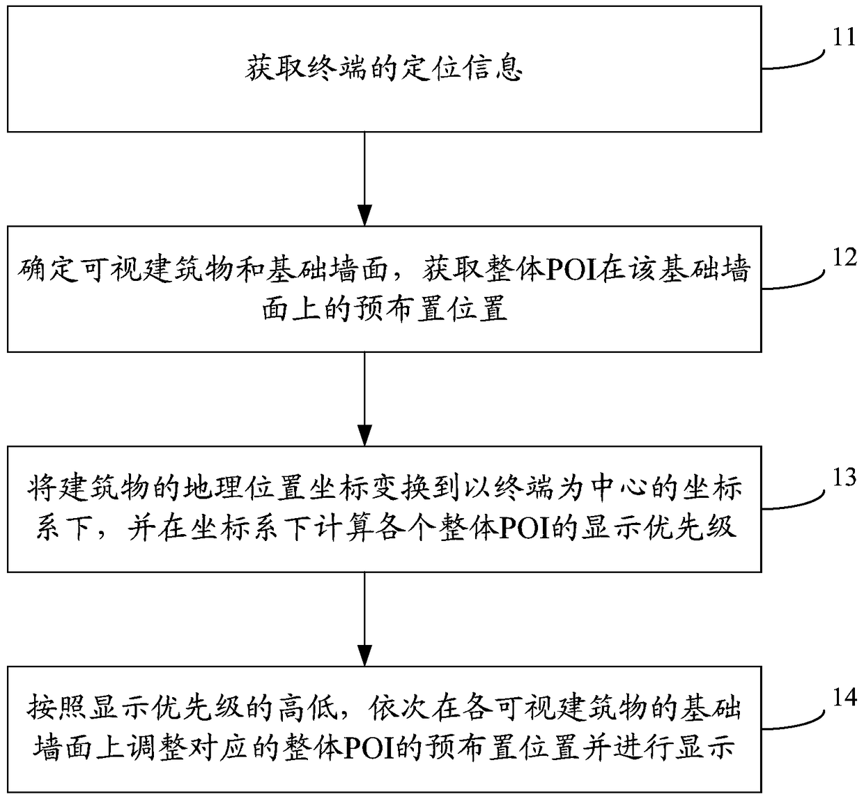
[0056] In order to make the technical problems, technical solutions and advantages to be solved by the present invention clearer, the following will describe in detail with reference to the drawings and specific embodiments.

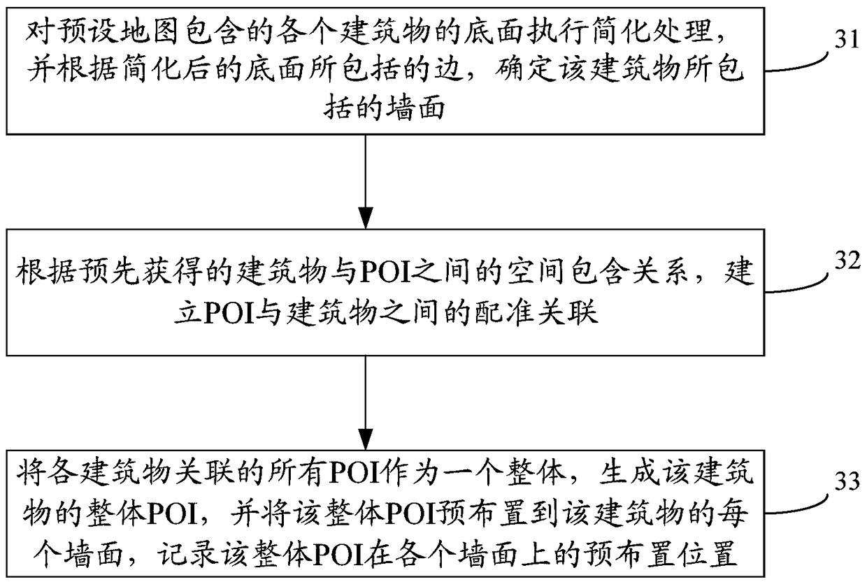
[0057] In the embodiment of the present invention, POIs are merged as a whole according to buildings, and POI data are preprocessed according to building walls, which can reduce the pressure of POI capping processing during online navigation, and can be applied to map navigation systems, especially augmented reality Navigation System. Please refer to figure 1 , a POI labeling method provided by an embodiment of the present invention, comprising steps:

[0058] Step 11, acquiring the positioning information of the terminal.

[0059] Here, the positioning information of the terminal can be obtained through a positioning module (such as a GPS module) of the terminal itself. Specifically, the positioning information may include location information and vi...


PUM


Abstract

The invention provides a point of interest (POI) marking method, a terminal, a navigation server and a navigation system, and relates to the technical field of navigation. The marking method comprises the following steps: synthesizing all POIs of a building into an integral POI; and adjusting the pre-arrangement position of a corresponding integral POI on the basic wall face of each visible building in sequence according to display priorities, and performing displaying in a way that covering does not exist among the integral POIs. The integral POIs are taken as objects to perform position adjustment and display, so that the data processing stress during covering processing can be relieved. Moreover, more POIs can be displayed on a screen of mobile equipment through horizontal / vertical axial rotational adjustment when covering exists.

Description

technical field [0001] The present invention relates to the technical field of map navigation, in particular to a point of interest (POI, Point of Interest) labeling method, terminal, navigation server and navigation system. Background technique [0002] Augmented reality (AR, Augmented Reality) is a new technology developed on the basis of virtual reality, also known as mixed reality. AR is a technology that increases the user's perception of the real world through the information provided by the computer system, applies virtual information to the real world, and superimposes computer-generated virtual objects, scenes or system prompt information on the real scene, so as to realize the real world. enhanced. [0003] How to better present POI annotations in complex scenes to users on terminals (such as mobile devices) has always been a hot issue in the navigation field. Especially in complex space scenes (such as large shopping malls), the spatial relationship between POIs...

Claims


Application Information

Patent Timeline
Patent Type & Authority Patents(China)
IPC IPC(8): G06F17/30G01C21/32
Inventor 张韵庞哲
Owner NAVINFO
Why Eureka
Try Eureka