Road information remote sensing extraction method based on pulse coupling neural network method

A pulse-coupled neural and road information technology, applied in the field of remote sensing extraction of high-resolution urban road information, can solve the problems of difficult road extraction and poor applicability

Inactive Publication Date: 2015-12-23
深圳市数字城市工程研究中心 +1
View PDF3 Cites 17 Cited by
  • Summary
  • Abstract
  • Description
  • Claims
  • Application Information

AI Technical Summary

Problems solved by technology

[0005] In view of the difficulty of road extraction and the poor applicability of existing road extraction methods, the present

Method used


Image

  • Road information remote sensing extraction method based on pulse coupling neural network method
  • Road information remote sensing extraction method based on pulse coupling neural network method
  • Road information remote sensing extraction method based on pulse coupling neural network method

Examples


Embodiment Construction

[0026] The "a method for extracting road information remote sensing based on coupled impulse neural network method" of the present invention will be further elaborated below in conjunction with the accompanying drawings.

[0027] (1) Image preprocessing

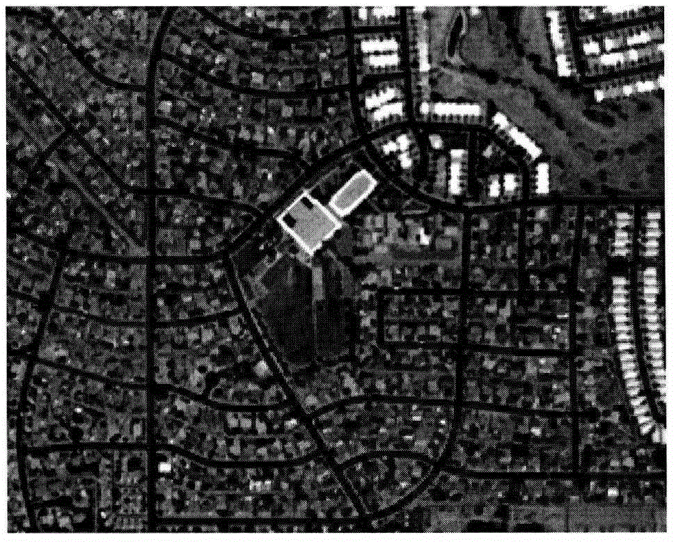
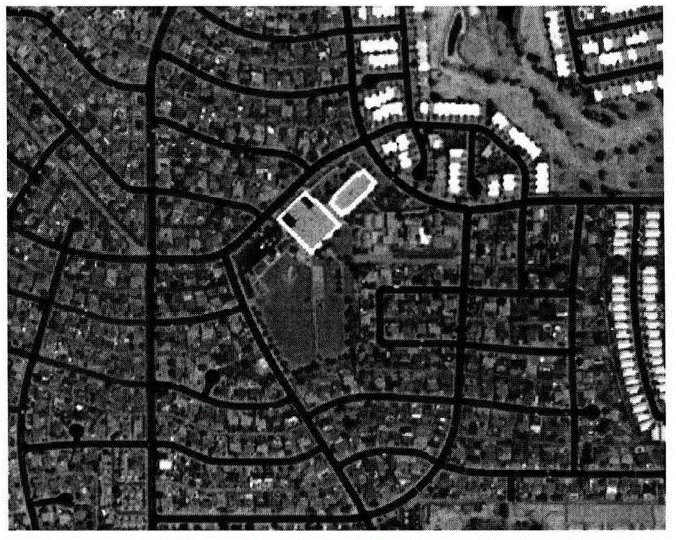
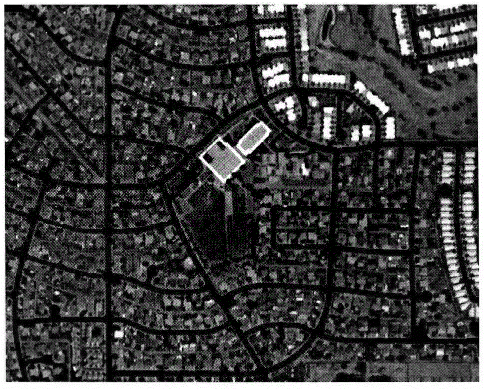
[0028] First, the original multi-band remote sensing image ( figure 1 ) into another set of independent components. After the original image undergoes principal component transformation, the information content of each component in the principal component image is largely different, so some ground objects are more prominent in some components. In addition, the components are perpendicular to each other, increasing the class. The spacing reduces the difference within the class and improves the classification accuracy. The first principal component produced by principal component transformation is equivalent to the weighted sum of the original bands, which contains a large amount of information and is minimally disturbed by n...


PUM


Abstract

The invention discloses a road information remote sensing extraction method based on a pulse coupling neural network method. The extraction method comprises the following steps: the step 1): preprocessing an original remote sensing image, that is, utilizing the principal component analysis method to acquire the image of the first component of the original high resolution image, and using a self-adaptation histogram equalization method to perform image enhancement processing; the step 2): utilizing a pulse coupling neural network method to perform segmentation processing of the enhanced image; the step) 3: acquiring a normalized differential vegetation index diagram from the original image, and using the segmented image to subtract the normalized differential vegetation index diagram to eliminate the influence of the vegetation on the segmented image; and the step 4): using a mathematical morphology method or other methods to perform postprocessing to acquire the final road information.

Description

technical field [0001] The invention relates to a remote sensing extraction method of high-resolution urban road information based on a coupled impulse neural network. Background technique [0002] With the rapid development of satellite remote sensing and computer technology, the resolution of remote sensing images is getting higher and higher. How to quickly and accurately extract target features has become an important proposition in remote sensing image processing. As an important ground object, urban roads are an important part of geographic information databases. At the same time, the real-time update of urban roads is of great significance for vehicle navigation, traffic management, urban planning and urban research. Therefore, it is of great scientific significance and practical value to carry out research on high-resolution remote sensing extraction of urban roads. [0003] Urban roads are often difficult to accurately extract due to the interference of various g...

Claims


Application Information

Patent Timeline
IPC IPC(8): G06K9/00
CPCG06V20/182
Inventor 孟庆岩孙震辉顾行发杨健占玉林孙云晓
Owner 深圳市数字城市工程研究中心
Why Eureka
Try Eureka