Map navigation method, and apparatus and system thereof

A navigation method and map technology, applied in the field of communication, can solve problems such as low navigation efficiency, positioning distance error, unsatisfactory navigation effect, etc., and achieve the effect of improving navigation efficiency

Active Publication Date: 2016-02-10
TENCENT TECH (SHENZHEN) CO LTD
View PDF3 Cites 40 Cited by
  • Summary
  • Abstract
  • Description
  • Claims
  • Application Information

AI Technical Summary

Problems solved by technology

[0004] However, in the above-mentioned prior art, there is a certain distance error in positioning, which leads to insufficient positioning accuracy and unsatisfactory navigation effect, and the navigation route is not intuitive enough. Users need to analyze the map and their own position to determine the direction of travel, resulting in navigation low efficiency

Method used


Image

  • Map navigation method, and apparatus and system thereof
  • Map navigation method, and apparatus and system thereof
  • Map navigation method, and apparatus and system thereof

Examples


no. 1 example

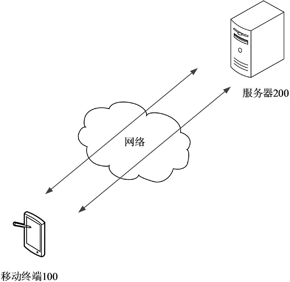
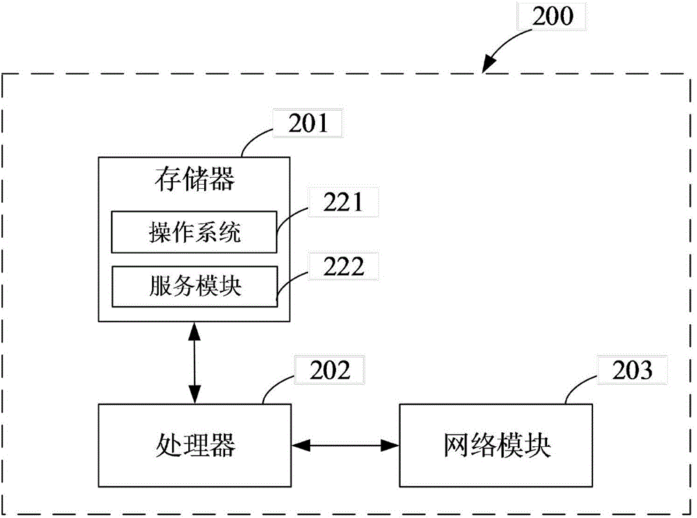
[0033] see Figure 1 to Figure 3 , figure 1 It is a schematic structural diagram of the map navigation system provided by the first embodiment of the present invention. Such as figure 1 As shown, the map navigation system 10 provided in this embodiment includes: a mobile terminal 100 and a server 200 . The mobile terminal 100 and the server 200 are located in a wired or wireless network, and through the wired or wireless network, the mobile terminal 100 and the server 200 perform data interaction to complete map navigation.

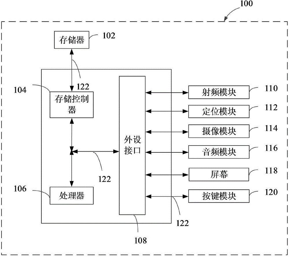
[0034]The mobile terminal 100 can include: a smart phone with network, positioning and camera functions, a tablet computer, an e-book reader, an MP3 player (MovingPictureExpertsGroupAudioLayerIII, moving picture expert compression standard audio level 3), MP4 (MovingPictureExpertsGroupAudioLayerIV, moving picture expert compression standard Audio Level 4) Players, Laptops, Car PCs, Wearables, etc.

[0035] Specifically, the mobile terminal 100 is conf...

no. 2 example

[0057] see Figure 4 , Figure 4 It is a flow chart of the map navigation method provided by the second embodiment of the present invention. This embodiment can be applied to figure 1 In the map navigation system 10 shown, map navigation based on real-time images captured by the user is implemented. The following is a specific description of the map navigation method provided in this embodiment from the server 200 side, as Figure 4 As shown, the map navigation method provided in this embodiment includes the following steps:

[0058]Step S21, the server receives the real-time image sent by the mobile terminal and the navigation condition information for confirming the navigation route, the navigation condition information includes the information of the navigation destination;

[0059] In this embodiment, the real-time image and the navigation condition information for confirming the navigation route are acquired by the mobile terminal 100 according to the navigation instr...

no. 3 example

[0070] see Figure 5 , Figure 5 It is a flow chart of the map navigation method provided by the third embodiment of the present invention. This embodiment can be applied to figure 1 In the map navigation system 10 shown, map navigation based on real-time images captured by the user is realized. The following is a specific description of the map navigation method provided in this embodiment from the server 200 side, as Figure 5 As shown, the map navigation method provided in this embodiment includes the following steps:

[0071] Step S31, the server receives the current fuzzy location information of the mobile terminal, the real-time image and the navigation condition information for confirming the navigation path sent by the mobile terminal, the navigation condition information includes the information of the navigation destination;

[0072] In this embodiment, the current fuzzy position information, real-time images and navigation condition information for confirming th...


PUM


Abstract

The invention provides a map navigation method. The method comprises the following steps: a server receives a real time image sent by a mobile terminal and navigation condition information for confirming a navigation path, wherein the navigation condition information includes information of a navigation destination; comparing the real time image with a data image in an image database, and determining the current position and direction of the mobile terminal; calculating a navigation path from the current position to the navigation destination according to the navigation condition information; and obtaining the traveling direction identifier information of the navigation path according to the navigation path, the traveling direction of the navigation path and the current position and direction of the mobile terminal, and sending the traveling direction identifier information to the mobile terminal. The invention also provides a map navigation apparatus and a system thereof. The map navigation method, the apparatus and the system realize map navigation of the real time image shot by a user, and can improve the navigation efficiency.

Description

technical field [0001] The present invention relates to the field of communication technology, in particular to a map navigation method, device and system. Background technique [0002] Navigation is the method of guiding a device from one point to another on a specified course. With the development of Internet and mobile terminal technology, more and more map navigation applications (APP, APPlication) based on various intelligent mobile terminal platforms are used by people to make people travel more convenient. [0003] At present, the navigation APP commonly used in smart mobile terminals generally adopts Global Positioning System (GPS, Global Positioning System) positioning technology, receives signals from positioning satellites, obtains necessary navigation and positioning information, and completes navigation and positioning through data processing. [0004] However, in the above-mentioned prior art, there is a certain distance error in positioning, which leads to in...

Claims


Application Information

Patent Timeline
Patent Type & Authority Applications(China)
IPC IPC(8): G01C21/34G01C21/32G06F17/30
Inventor 侯鑫陈杰汪伟郑海源何锦潮卢莎莎侯维苇
Owner TENCENT TECH (SHENZHEN) CO LTD
Why Eureka
Try Eureka