A precision calibration method for a ship-borne integrated measurement system in a pool

A measurement system, ship-borne technology, applied in the direction of radio wave measurement system, measurement device, electromagnetic wave re-radiation, etc.

Active Publication Date: 2017-10-03
SHANDONG UNIV OF SCI & TECH
View PDF4 Cites 0 Cited by
  • Summary
  • Abstract
  • Description
  • Claims
  • Application Information

AI Technical Summary

Problems solved by technology

There are few reports on the overall calibration method of the integrated measurement system at home and abroad. Therefore, it is necessary to study and implement the overall calibration method of the "shipborne water surface and underwater integrated measurement system" to ensure the integrated measurement accuracy.

Method used

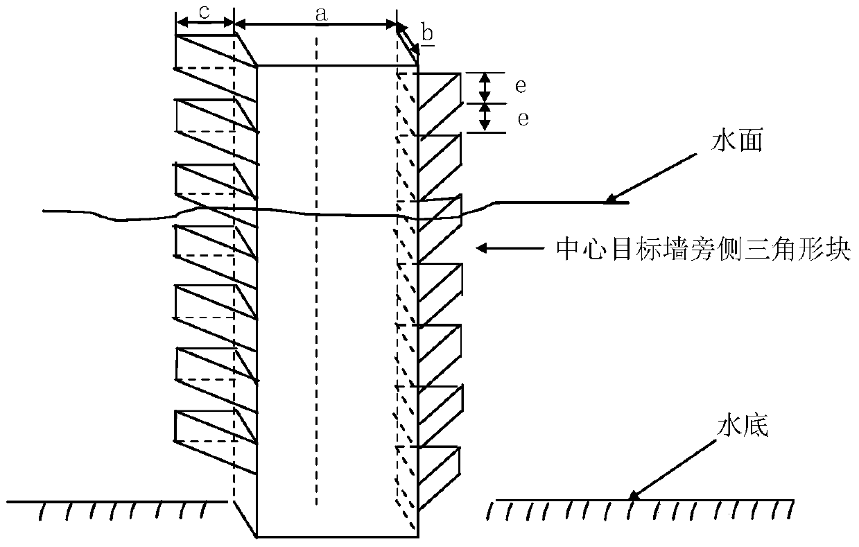
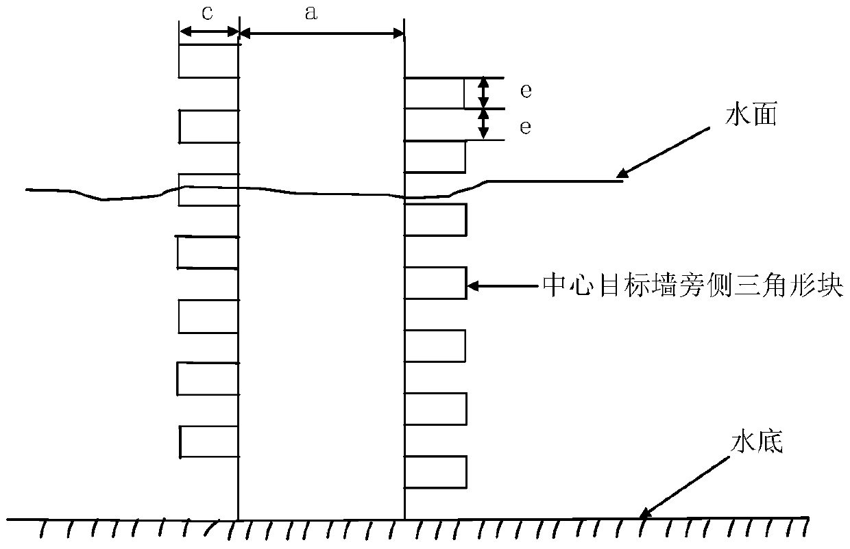
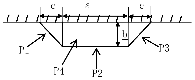

Image

  • A precision calibration method for a ship-borne integrated measurement system in a pool
  • A precision calibration method for a ship-borne integrated measurement system in a pool
  • A precision calibration method for a ship-borne integrated measurement system in a pool

Examples


Embodiment Construction

[0050] At first introduce the required theoretical basis of the present invention:

[0051] 1. Plane fitting theory

[0052] Plane formula:

[0053] ax+by+cz-d=0

[0054] The solution process is as follows:

[0055] 1) n scanning points to be fitted (x i ,y i ,z i ), the fitted plane equation is:

[0056] ax+by+cz=d

[0057] The conditions are:

[0058] a 2 +b 2 +c 2 = 1

[0059] Then the distance from any data point to the plane:

[0060] d i =|ax i +by i +cz i -d|

[0061] 2) To get the best fit plane, make Get the minimum value, the condition is a 2 +b 2 +c 2 =1, get the formula

[0062]

[0063] 3) Calculate the partial derivative of f to four unknown parameters d, a, b, c respectively:

[0064] Taking a partial derivative of d gives:

[0065]

[0066] Find the first argument:

[0067]

[0068] Then the distance from any data point to the plane:

[0069]

[0070] make:

[0071] but

[0072] make:

[0073] 4) Deriving a, b, an...


PUM


Abstract

The invention discloses a precision calibration method for a ship-borne integrated measurement system carried out in a water pool, which belongs to the technical field of marine surveying and mapping. Carried out on the basis, the present invention can be used as the accurate spatial point cloud data of the target object according to the laser scanner measurement data after precise inspection, and based on this, by comparing the multi-beam measurement data with the laser scanner measurement data, the obtained by rough calibration The offset and rotation angle of the coordinate system of the multi-beam echo sounder relative to the coordinate system of the inertial navigation system are used as initial values, and the precise correction of the offset and rotation angle of the coordinate system of the multi-beam echo sounder relative to the coordinate system of the inertial navigation system is obtained value to achieve overall calibration of the measurement system. The invention integrates a laser scanner and a multi-beam depth sounder, can simultaneously acquire seabed topography and near-shore water topography data, and realizes precise overall calibration of a ship-borne multi-sensor measurement system in a pool.

Description

technical field [0001] The invention relates to the technical field of marine surveying and mapping, in particular to a precision calibration method for a ship-borne integrated measurement system in a water pool. Background technique [0002] The laser scanning system can quickly obtain a large amount of point cloud data above the water surface, and the multi-beam depth sounder can quickly obtain large-area seabed topographic information on the seabed. The integrated laser scanner and multi-beam depth sounder are "ship-borne underwater and underwater integrated measurement systems" It can simultaneously acquire submarine topography and near-shore water topographic data, and solve the topographic measurement problems of near-shore coastal zones and tidal flats. The overall calibration of the "ship-borne integrated water and underwater measurement system" is an important aspect to ensure the measurement accuracy. There are few reports on the overall calibration method of the ...

Claims


Application Information

Patent Timeline
Patent Type & Authority Patents(China)
IPC IPC(8): G01S17/89G01S7/497
CPCG01S7/497G01S17/89
Inventor 石波刘云鹏马跃张从跃阳凡林景冬卢秀山刘振
Owner SHANDONG UNIV OF SCI & TECH
Why Eureka
Try Eureka