A method for calibrating UAV runway heading and center coordinates

A technology of center coordinates and calibration method, applied in the field of aviation drones, can solve the problems of calibration, difficult operation, and inability to carry out runways.

Active Publication Date: 2019-10-22
CHINA ACAD OF AEROSPACE AERODYNAMICS
View PDF3 Cites 0 Cited by
  • Summary
  • Abstract
  • Description
  • Claims
  • Application Information

AI Technical Summary

Problems solved by technology

This method is not easy to operate, and the UAV itself must be used to calibrate the runway. When the UAV has not deployed at the newly deployed airport or needs to make an emergency landing on a temporarily selected runway, the runway calibration cannot be performed.

Method used


Image

  • A method for calibrating UAV runway heading and center coordinates
  • A method for calibrating UAV runway heading and center coordinates
  • A method for calibrating UAV runway heading and center coordinates

Examples


Embodiment

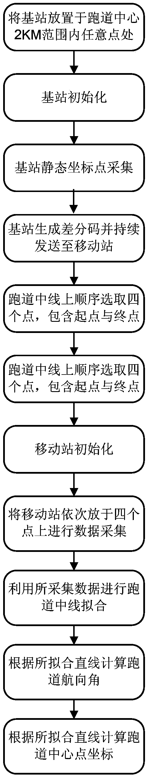
[0071] (1) Place the base station at any point within 2km from the center of the runway;

[0072] (2) Initialize the base station, configure serial communication parameters, baud rate 9600, 8 data bits, 1 stop bit, no parity check;

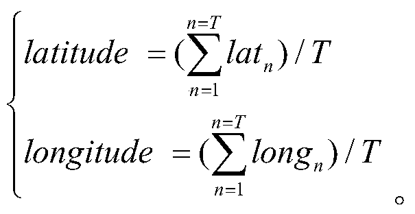
[0073] (3) Set the base station to collect 900 static coordinate points for itself, so as to obtain the values ​​of longitude, latitude, and altitude;

[0074] (4) After the base station obtains the static coordinate point, the differential code can be generated and sent to the mobile station through the UHF radio station at a frequency of once every 5 seconds;

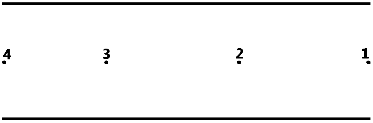
[0075] (5) Select four points sequentially on the center line of the runway, including the start point, end point and any two points on the center line of the runway, such as figure 2 shown.

[0076] (6) Initialize the mobile station, configure serial communication parameters, baud rate 9600, 8 data bits, 1 stop bit, no parity;

[0077] (7) Place the mobile station on the four selecte...


PUM


Abstract

The invention discloses an unmanned aerial vehicle runway course and center coordinate calibration method, for realizing rapid calibration of a runway course and center coordinate points when an unmanned aerial vehicle does not yet perform or needs to perform an emergent landfall on a temporarily selected runway in a new disposition airport. According to the invention, a runway course and center coordinates can be rapidly obtained without operation by professional personnel and subsequent data processing, and efficient takeoff and landfall of the unmanned aerial vehicle are guided.

Description

technical field [0001] The invention relates to a method for calibrating the heading and center coordinates of a runway of an unmanned aerial vehicle, which is used for the rapid deployment and emergency backup of the unmanned aerial vehicle, and belongs to the field of aviation unmanned aerial vehicles. Background technique [0002] Before the drone flies, it is necessary to calibrate the runway and obtain the longitude, latitude and heading information of the runway. The runway calibration process is usually carried out using airborne differential GPS. During calibration, humans need to push the drone from one end of the runway to the other for sampling, and then use computing tools to solve the problem. This method is not easy to operate, and the UAV itself must be used to calibrate the runway. It cannot be demarcated when the UAV has not yet deployed at the newly deployed airport or needs to make an emergency landing on a temporarily selected runway. Contents of the in...

Claims


Application Information

Patent Timeline
Patent Type & Authority Patents(China)
IPC IPC(8): H04W4/02H04W64/00G01C21/00
Inventor 吕松天嵇治刚丛晖张新革梁凤麒
Owner CHINA ACAD OF AEROSPACE AERODYNAMICS
Why Eureka
Try Eureka