

A Method for Forming Two-Dimensional Contour Clutter Map of Ground Radar
A two-dimensional contour and clutter map technology, which is applied to radio wave measurement systems, instruments, etc., can solve the problem that the two-dimensional contour clutter map has not been retrieved, and achieve the effect of reducing the probability of target false alarm
Inactive Publication Date: 2014-05-14
LEIHUA ELECTRONICS TECH RES INST AVIATION IND OF CHINA
View PDF0 Cites 8 Cited by
- Summary
- Abstract
- Description
- Claims
- Application Information
AI Technical Summary
Problems solved by technology
At present, no public literature has been retrieved about obtaining the 2D contour clutter map of the surrounding surface objects and environments of the radar position
Method used
View moreImage
Smart ImageViewing Examples

Examples
Embodiment 1
Embodiment 2
Embodiment 3
Login to View More PUM
 Abstract
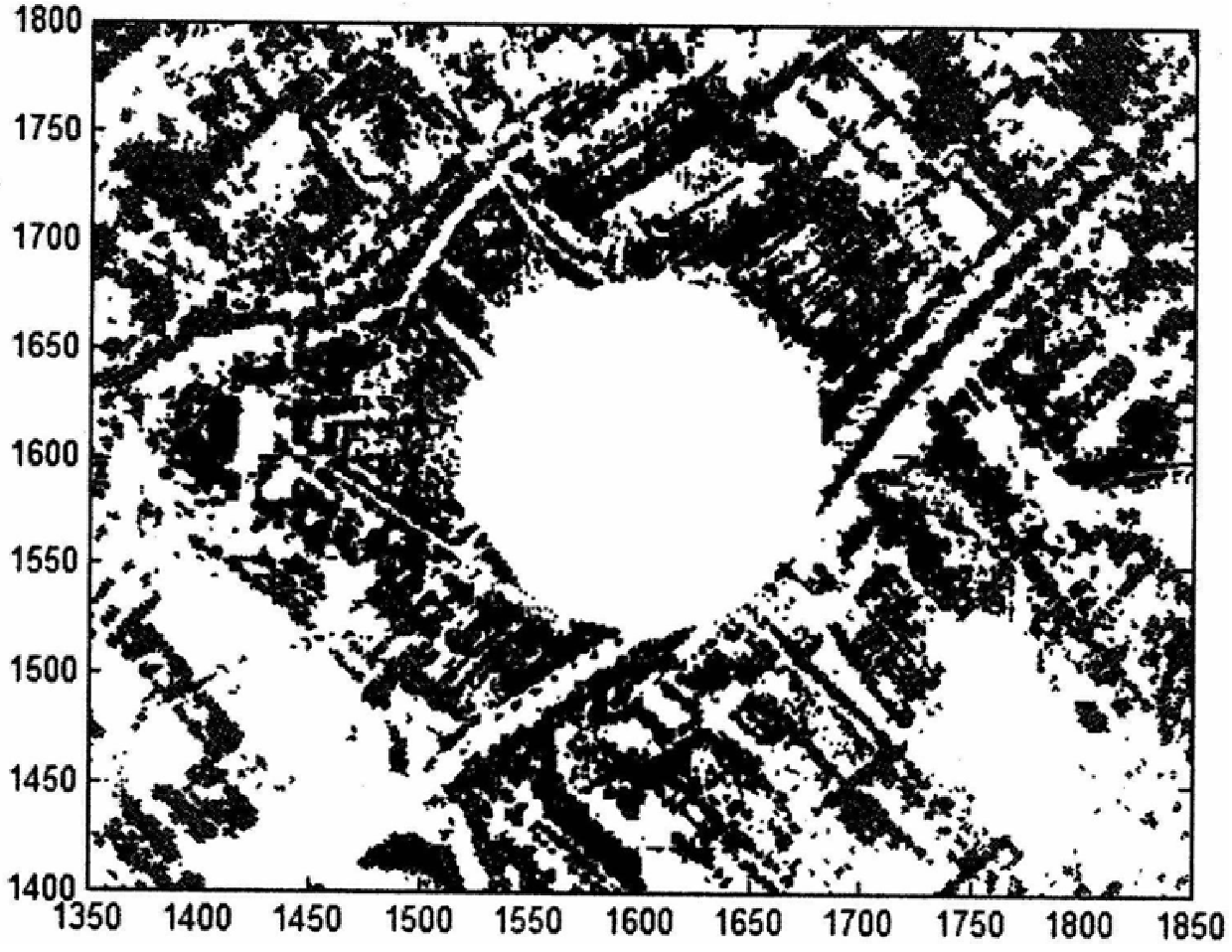
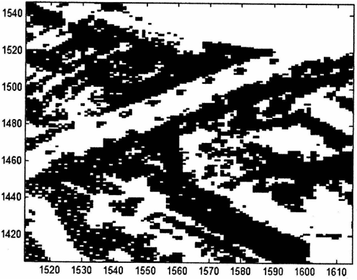
The invention belongs to the field of radar signal processing, and relates to a method for forming a two-dimensional profile clutter map of a fixed platform radar for earth observation. The steps of forming a two-dimensional contour clutter map are as follows: range-wise pulse compression processing; double-pole filtering; performing range-dimensional clutter detection to form a range-azimuth two-dimensional matrix; forming a range-azimuth two-dimensional matrix for multiple scan cycles; Range-azimuth two-dimensional mean matrix; forms two-dimensional contour clutter map. The present invention proposes a method for forming a two-dimensional contour clutter map of a fixed platform radar for earth observation, using the formed two-dimensional contour clutter map to suppress the clutter of fixed buildings and other fixed reflectors on the ground, reducing the Target false alarm probability.
Description
A Method for Forming Two-Dimensional Contour Clutter Map of Ground Radar technical field The invention belongs to the field of radar signal processing, and relates to a method for forming a two-dimensional profile clutter map of a fixed platform radar for earth observation. Background technique For the fixed platform earth observation two-coordinate radar, except for the specific target to be observed, the fixed buildings and other fixed reflectors on the ground are all clutter. In order to reduce or even eliminate the influence of this kind of special clutter on the normal detection of targets, clutter suppression processing is required, and clutter suppression needs to obtain the two-dimensional contour clutter map of the surrounding ground object environment of the radar position first. At present, there is no public literature about obtaining the two-dimensional contour clutter map of the ground object environment around the radar position. Contents of the invention ...
Claims
Login to View More Application Information
Patent Timeline
 Patent Type & AuthorityPatents(China)
IPC IPC(8): G01S7/41G01S7/40
Inventor刘洋涛郝志梅罗美方
OwnerLEIHUA ELECTRONICS TECH RES INST AVIATION IND OF CHINA