Navigation enhancing method based on low track satellite

A low-orbit satellite and navigation method technology, which is applied in the field of satellite positioning and navigation, can solve the problems of positioning and navigation accuracy impact, algorithm pathology, and high complexity, and achieve the effect of fast and high-precision calculation and efficient and accurate distance

Active Publication Date: 2017-05-10
UNIV OF ELECTRONIC SCI & TECH OF CHINA
View PDF9 Cites 15 Cited by
  • Summary
  • Abstract
  • Description
  • Claims
  • Application Information

AI Technical Summary

Problems solved by technology

[0006] The purpose of the present invention is: to overcome in the prior art, adopt difference mode its location and navigation precision is influenced by baseline length, and the modeling mode of high accuracy is often

Method used


Image

  • Navigation enhancing method based on low track satellite
  • Navigation enhancing method based on low track satellite
  • Navigation enhancing method based on low track satellite

Examples


Embodiment Construction

[0029] The present invention will be further described in detail below in combination with specific embodiments. However, it should not be understood that the scope of the above subject matter of the present invention is limited to the following embodiments, and all technologies realized based on the content of the present invention belong to the scope of the present invention.

[0030] The present invention is based on low-orbit satellite enhanced navigation method, and it comprises the following steps:

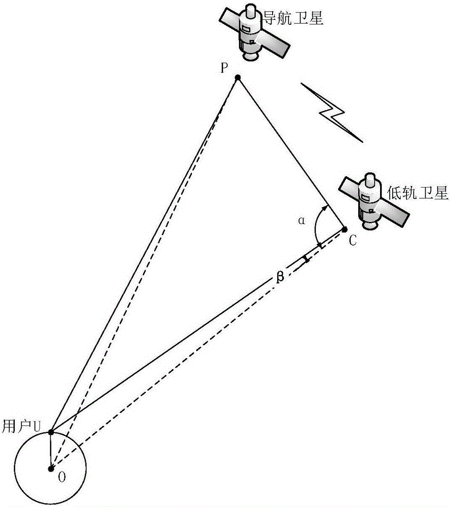
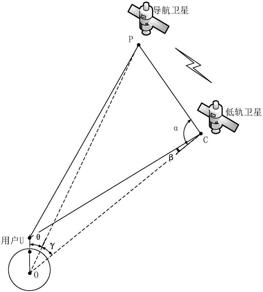
[0031] S1: Calculate the low-orbit satellite S c with Navsat-S p The interstellar distance D PC ; Among them, the low-orbit satellite S c According to the satellite clock correction parameters sent by the ground injection station, its clock is connected with the navigation satellite S p The navigation system is time-synchronized and transmits time t according to the navigation positioning signal 1 and low orbit satellite receiving navigation positioning time t 2 , and ...


PUM


Abstract

The invention discloses a navigation enhancing method based on low track satellite. Through the calculation of the distance between a low track satellite to a navigation satellite, the influence of the troposphere and the ionosphere can be avoided and a more diagonal variance-covariance matrix is created so that the calculated distance from the low track satellite to the ground becomes more effective and accurate. According to the invention, through the use of the fact that the geometrical position of a low track satellite changes greatly and through the geometrical relationship to indirectly realize the rapid, effective and accurate calculation of pseudo range, the effect of enhanced navigation is realized.

Description

technical field [0001] The invention belongs to the field of satellite positioning and navigation, in particular to an enhanced navigation method for improving navigation accuracy and accelerating positioning. Background technique [0002] In today's society, all walks of life have higher and higher requirements for navigation and positioning, especially in the military field, the use of precision-guided weapons must be based on real-time high-precision navigation and positioning. The pursuit of higher navigation and positioning accuracy is a trend in recent years. [0003] There are roughly two traditional positioning methods: pseudo-range positioning and carrier phase positioning. Among them, carrier phase positioning has higher positioning accuracy, but it is also more difficult in the process of solving the ambiguity of the whole circle. The higher the positioning accuracy, the longer the time required for the receiver to observe the received satellite ephemeris, and t...

Claims


Application Information

Patent Timeline
IPC IPC(8): G01S19/44
CPCG01S19/44
Inventor 杨波朱立东况鸿凤
Owner UNIV OF ELECTRONIC SCI & TECH OF CHINA
Why Eureka
Try Eureka