Multi-surface mark fusion-based lane level locating method

A positioning method, a technology of ground marking, applied in the direction of instruments, character and pattern recognition, computer parts, etc., can solve the problem of unable to continue to estimate the position of the vehicle

Active Publication Date: 2017-05-31
BEIJING UNION UNIVERSITY
View PDF2 Cites 24 Cited by
  • Summary
  • Abstract
  • Description
  • Claims
  • Application Information

AI Technical Summary

Problems solved by technology

Previously, most positioning methods relied on GNSS and INS, but when GPS loses signal under certain circumstances, they cannot continue to estimate the position of the vehicle

Method used


Image

  • Multi-surface mark fusion-based lane level locating method
  • Multi-surface mark fusion-based lane level locating method
  • Multi-surface mark fusion-based lane level locating method

Examples


Embodiment Construction

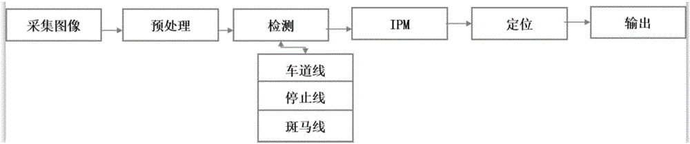
[0044] The embodiment of the present invention provides a lane-level positioning method based on the fusion of multiple ground signs, using the images collected by the AVT camera installed directly under the rearview mirror of the smart car to provide the lateral deviation distance of the vehicle and the longitudinal distance at the intersection in real time information, and then know the real-time position of the vehicle in the lane, such as figure 1 Shown, the present invention has taken following technical scheme:

[0045] Step 1: Sensor Installation and Calibration

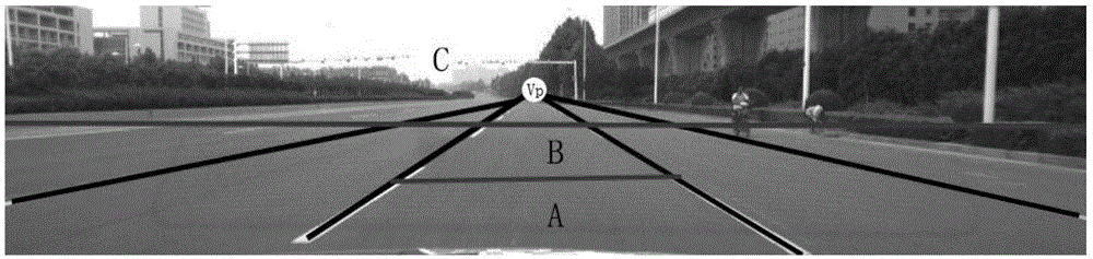
[0046] Install the camera directly below the rearview mirror of the smart vehicle and parallel to the longitudinal coordinate axis of the vehicle body. When installing the camera, ensure that clear lane line images on both sides of the vehicle can be collected; calibrate the camera, and the calibrated field of view is : Width 1500cm, far 2000cm.

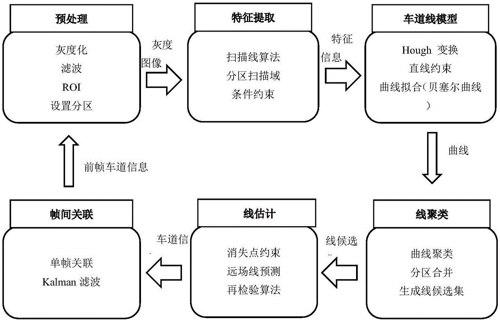
[0047] Step 2: Image preprocessing

[0048] According to the...


PUM


Abstract

The invention discloses a multi-surface mark fusion-based lane level locating method. The method comprises the steps of 1, obtaining a vehicle road image; 2, performing grayscale processing and filtering processing on the road image; 3, performing lane line detection on the processed road image in the step 2; 4, performing stop line detection on the road image; 5, performing zebra crossing detection on the road image; and 6, locating the position of a vehicle in a lane in real time according to a lane line, a zebra crossing and a stop line. According to the method, information of multiple mark lines of a road is fused for performing accurate road lane line locating; and the method not only can be suitable for a driving safety pre-warning function of the vehicle but also can be fused in a pure vision system in unmanned driving to perform lane line patrol and turning at the intersection.

Description

technical field [0001] The invention belongs to the field of intelligent assisted driving technology and automatic driving technology, and in particular relates to a lane-level positioning method based on fusion of multiple ground signs. Background technique [0002] In recent years, advancements in autonomous driving technology have attracted the attention and interest of researchers, the media, and the general public. In 2015, Google's self-driving car officially drove on the roads of California, USA for testing. Other major automakers and companies have generally acknowledged that it is only a matter of time before self-driving cars enter people's lives and profoundly affect people's living conditions. Vehicle localization plays a fundamental and critical role in intelligent transportation systems as it is a higher level pre-mission operation. Previously, most positioning methods relied on GNSS and inertial navigation systems, but when GPS loses signal under certain cir...

Claims


Application Information

Patent Timeline
Patent Type & Authority Applications(China)
IPC IPC(8): G06K9/00G06K9/62
CPCG06V20/588G06F18/253
Inventor 刘宏哲袁家政李超宣寒宇牛小宁
Owner BEIJING UNION UNIVERSITY
Why Eureka
Try Eureka