Quasigeoid detection method and device

A geoid and detection method technology, applied in the field of geographic surveying and mapping, can solve complex operations, inability to objectively and truly evaluate the quality of quasi-geoid refinement, and difficulty in grasping the reliability and accuracy of quasi-geoid refinement results, etc. question

Inactive Publication Date: 2017-07-28
湖北省测绘工程院 +1
View PDF1 Cites 7 Cited by
  • Summary
  • Abstract
  • Description
  • Claims
  • Application Information

AI Technical Summary

Problems solved by technology

[0008] At present, the quasi-geoid detection technology in the existing technology is complex in operation, low in calculation efficiency, low in accuracy, and cann

Method used


Image

  • Quasigeoid detection method and device
  • Quasigeoid detection method and device
  • Quasigeoid detection method and device

Examples


Embodiment

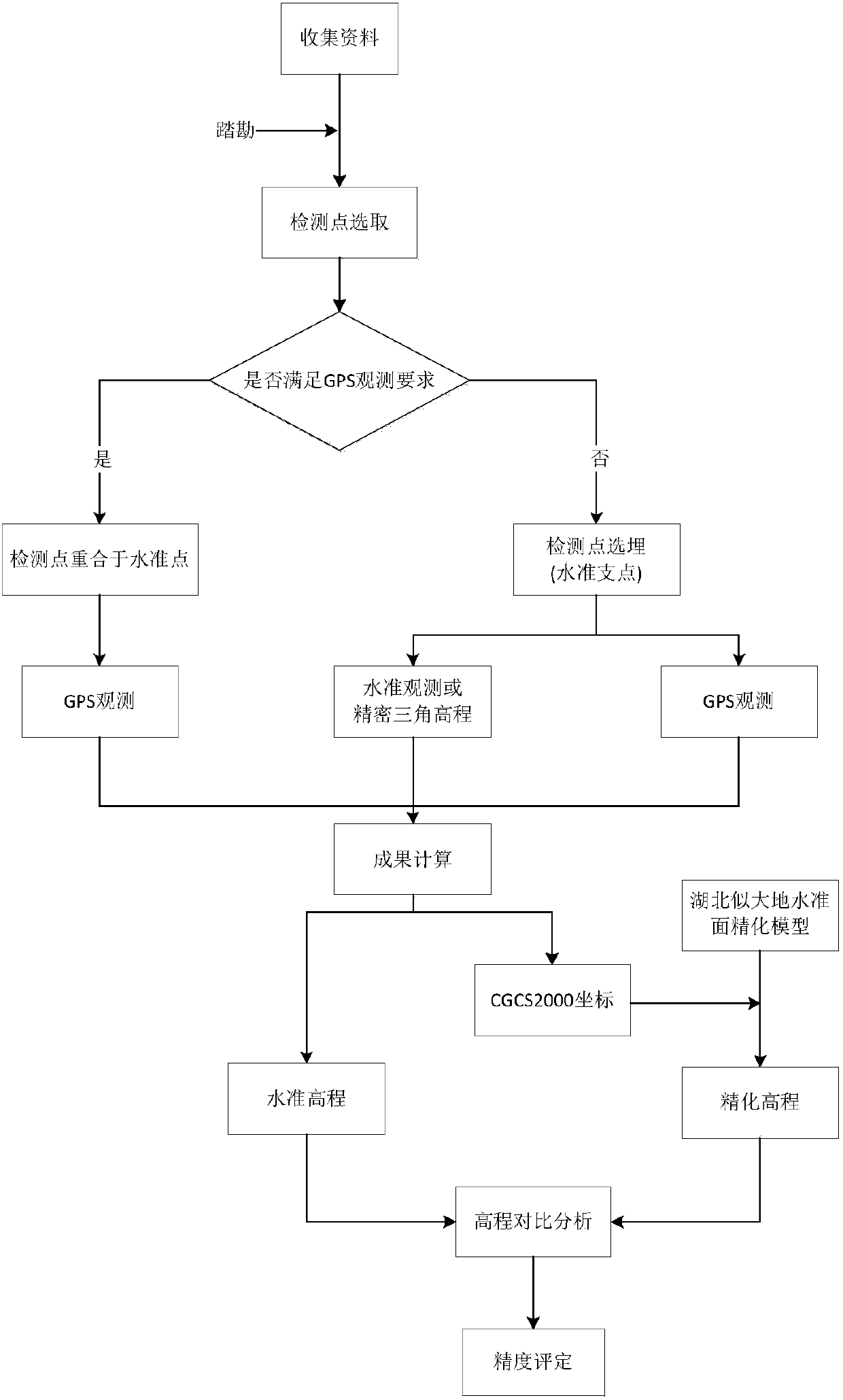
[0025] The method of the present invention will be described in detail below.

[0026] 1. Layout and selection principles of detection points

[0027] The detection points are required to be evenly distributed within the scope of administrative divisions, basically covering the mountains, hills, plains and water network areas of the whole province. The total number of detection points shall not be less than 50, among which the urban quasi-geoid area has been implemented, and the results of existing high-precision three-dimensional control points are used for direct inspection.

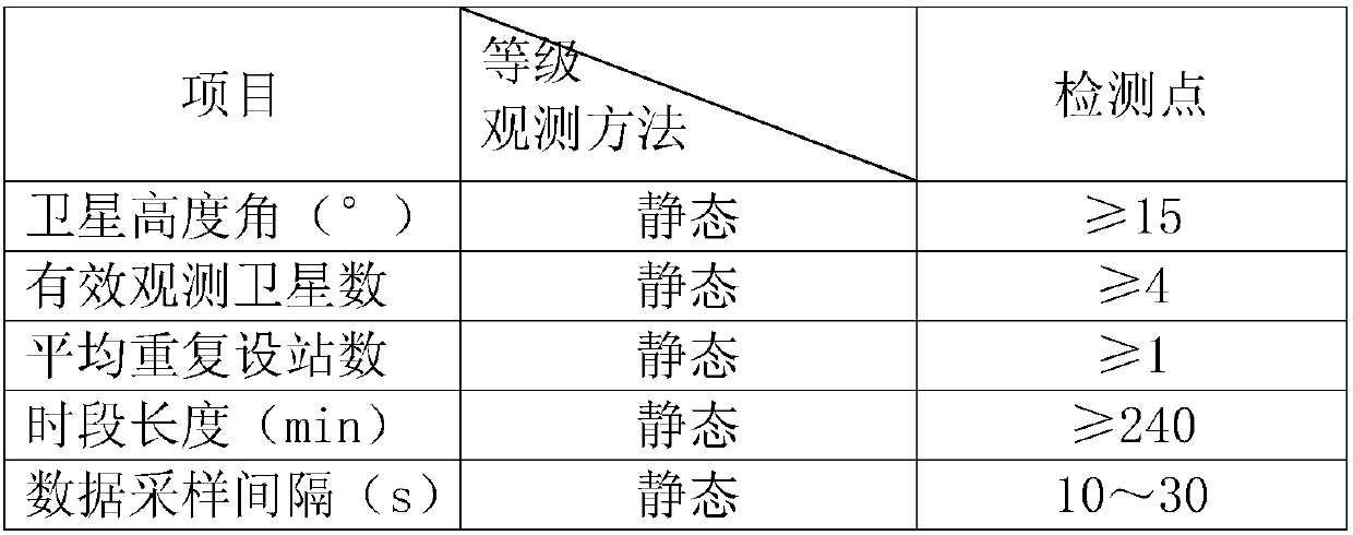
[0028] Among them, (1) the number of detection points can be increased for areas with large elevation anomalies, and the requirements for point layout can be reduced for areas with small elevation anomalies; (2) the location of detection points should be able to meet the conditions of GNSS and leveling observation at the same time, and the national second-class is preferred The above level points are ...


PUM


Abstract

The invention relates to a geoid detection method and device, belongs to the field of geographical mapping, and particularly relates to a quasigeoid detection method and device. According to the method and device, detection point elevations adopt elevation starting points not lower than national second-class leveling points, detection is implemented according to second-class leveling accuracy, observation is performed by the aid of a digital level or a precise triangle elevation, altitude differences between two detection points can be compared for the area with high abnormal variation of the elevations and without leveling starting points, leveling elevations of the detection points and elevations acquired through quasigeoid refinement can be compared, the errors in the elevations of the detection points are counted, the quality of the quasigeoid refinement can be objectively and really evaluated, and reliability and accuracy of quasigeoid refinement results are mastered.

Description

technical field [0001] The invention relates to a method and a device for detecting a water level, belonging to the field of geographical surveying and mapping, in particular to a method and a device for detecting a quasi-geoid. Background technique [0002] Quasi-geoid—a closed surface formed by the endpoints of the normal height measured from the ground point along the normal gravity line. [0003] Strictly speaking, the quasi-geoid is not a water level, but it is close to the water level, and it is only an auxiliary surface for calculation. It does not exactly coincide with the geoid, and the difference is the difference between the normal height and the orthographic height. The difference between the orthometric height and the normal height is related to the elevation of the point and the mass distribution inside the earth. In the western high-altitude areas such as the Qinghai-Tibet Plateau in my country, the difference between the two can reach up to 3 meters. In the ...

Claims


Application Information

Patent Timeline
IPC IPC(8): G01C5/00
CPCG01C5/00
Inventor 张士柱祁信舒厉芳婷胡菡范学峰倪峰
Owner 湖北省测绘工程院
Why Eureka
Try Eureka