A method for rapid collection of agricultural land status data

A collection method and data collection technology, applied in the field of geographic information, can solve the problems that the automatic interpretation technology of remote sensing images cannot meet the requirements of classification requirements for data collection accuracy, cannot effectively integrate multi-source data and accurately interpret land use types, and cannot be realized. Improve efficiency, accuracy and objectivity of data, practical methods, and easy maintenance

Active Publication Date: 2022-03-04
EAST CHINA NORMAL UNIV
View PDF8 Cites 0 Cited by
  • Summary
  • Abstract
  • Description
  • Claims
  • Application Information

AI Technical Summary

Problems solved by technology

An important reason is that the visual interpretation uses a stand-alone version of professional remote sensing software, which is inefficient and cannot effectively integrate multi-source data to support accurate interpretation of land use types
When dealing with the interpretation of large-area complex land types, the automatic interpretation technology of remote sensing images cannot meet the requirements of finer classification and higher data collection accuracy (Srivastava, Han et al.2012, Mulla 2013)
For example, it is not currently possible to identify detailed land use classifications such as grain fields, vegetable fields, orchards, and to collect and update data on farmland plots whose accuracy is not greater than 1 mu.

Method used


Image

  • A method for rapid collection of agricultural land status data
  • A method for rapid collection of agricultural land status data
  • A method for rapid collection of agricultural land status data

Examples


Embodiment Construction

[0028] The following describes several preferred embodiments of the present invention with reference to the accompanying drawings, so as to make the technical content clearer and easier to understand. The present invention can be embodied in many different forms of embodiments, and the protection scope of the present invention is not limited to the embodiments mentioned herein.

[0029]In the drawings, components with the same structure are denoted by the same numerals, and components with similar structures or functions are denoted by similar numerals. The size and thickness of each component shown in the drawings are shown arbitrarily, and the present invention does not limit the size and thickness of each component. In order to make the illustration clearer, the thickness of parts is appropriately exaggerated in some places in the drawings.

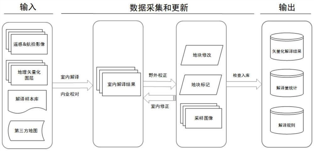
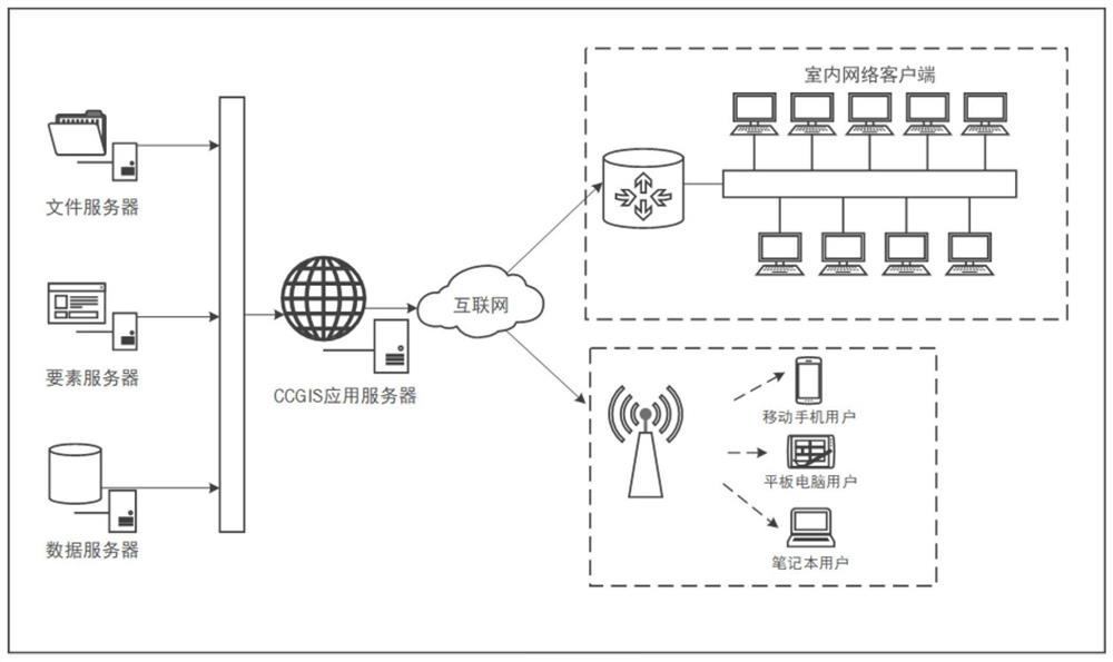
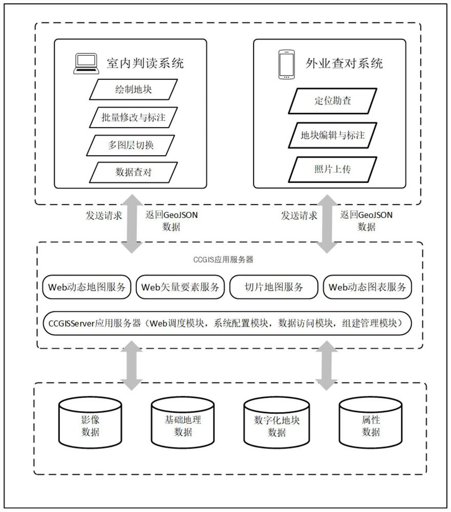
[0030] Such as figure 1 with figure 2 As shown, the present invention provides a kind of agricultural land current situation data...


PUM


Abstract

The invention discloses a method for quickly collecting data on the current situation of agricultural land, and relates to the field of geographic information. The invention designs the technology and system for collecting current data on agricultural land by integrating the Internet geographic information system and remote sensing technology, and establishes remote sensing interpretation signs of agricultural land. On the basis of the Internet-based remote sensing image interactive interpretation, and the collection, update and checking of agricultural land status data, it is realized based on the database and sample database. Compared with the traditional field mapping method for data collection and automatic interpretation of remote sensing images, the technical method and system of the present invention have the characteristics of fast, efficient and accurate, short data collection cycle, low cost, and easy maintenance.

Description

technical field [0001] The invention relates to the field of geographic information, in particular to a method for quickly collecting agricultural land current data. Background technique [0002] At present, the current data collection methods of agricultural land status mainly include field mapping and visual interpretation based on remote sensing images. At present, the technology and application of land resources investigation based on remote sensing images are becoming more and more mature. my country's land and resources department has used high-resolution satellite images for land and resources law enforcement monitoring (Yi, Ma et al. 2016). This technology is based on image change detection technology, assists manual interactive judgment, and realizes law enforcement inspection of illegal construction land. [0003] Some studies have adopted automatic interpretation based on remote sensing data, using methods such as object-based and support vector machines (Pena, G...

Claims


Application Information

Patent Timeline
Patent Type & Authority Patents(China)
IPC IPC(8): G06F16/29G06K9/62
CPCG06F16/29G06F18/2411
Inventor 李治洪周钰坤
Owner EAST CHINA NORMAL UNIV
Why Eureka
Try Eureka