GNSS/IMU vehicle real-time integrated navigation method based on mems
A combined navigation and time-of-day technology, applied in the field of navigation and positioning, can solve the problems of affecting the filtering results, complex calculation of inertial navigation and Kalman filtering, time-consuming calculation process, etc., and achieve the effect of improving positioning accuracy
- Summary
- Abstract
- Description
- Claims
- Application Information
AI Technical Summary
Problems solved by technology
Method used
Image
Examples
Embodiment Construction
[0028] The present invention will be described in detail below in conjunction with the accompanying drawings.
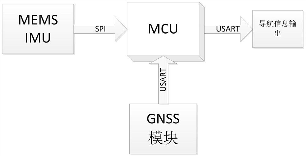
[0029] Such as figure 1 As shown, the MEMS-based GNSS / IMU vehicle real-time integrated navigation method, its hardware part includes MEMSIMU, which includes a three-axis gyroscope and a three-axis accelerometer; MCU main control unit, responsible for sensor data collection and buffering; GNSS, output global A module for satellite positioning information. The MEMSIMU output data is transmitted by the SPI bus with the highest rate, and the GNSS output data is transmitted by the USART bus.
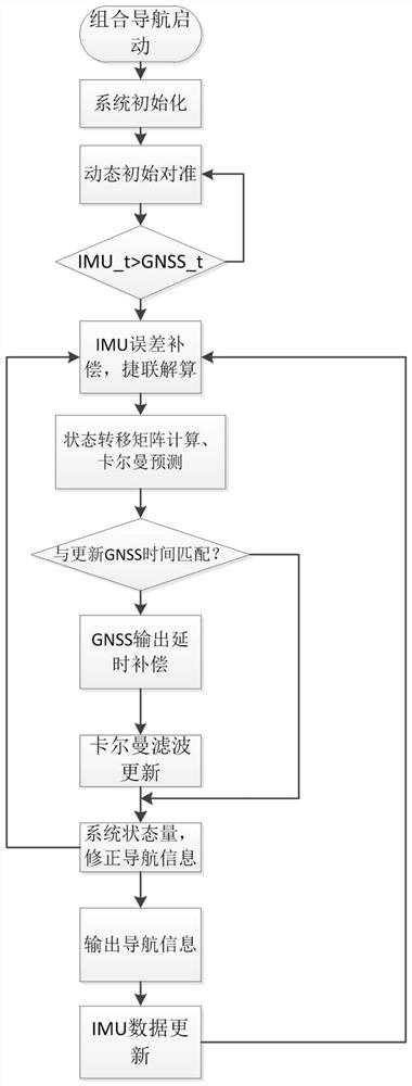
[0030] The method of the present invention comprises the steps of: utilizing the GNSS output information to dynamically align the initial attitude, position and velocity information of the IMU, such as figure 2 In the flow chart shown, the initial alignment calculation process is as follows:
[0031] Update the GNSS data information, use its information to solve the speed and sa...
PUM
 Abstract
Description
Claims
Application Information
 - R&D
- Intellectual Property
- Life Sciences
- Materials
- Tech Scout
- Unparalleled Data Quality
- Higher Quality Content
- 60% Fewer Hallucinations
Browse by: Latest US Patents, China's latest patents, Technical Efficacy Thesaurus, Application Domain, Technology Topic, Popular Technical Reports.
© 2025 PatSnap. All rights reserved.Legal|Privacy policy|Modern Slavery Act Transparency Statement|Sitemap|About US| Contact US: help@patsnap.com


