Method for processing aerial survey data of unmanned aerial vehicle

A processing method and UAV technology, applied in the field of UAV aerial survey data processing, can solve problems such as data deviation, achieve the effect of preventing errors and improving drawing accuracy

Inactive Publication Date: 2019-05-31
华南机械制造有限公司
View PDF8 Cites 8 Cited by
  • Summary
  • Abstract
  • Description
  • Claims
  • Application Information

AI Technical Summary

Problems solved by technology

[0004] The invention provides a method for processing aerial survey data of a UAV to solve the technical problem that the data collected by the UAV will be affected by its own flight angle and data collection, resulting in deviations in the data collected by the UAV, thereby improving The drawing accuracy of the mine topography, and then realize the prevention of errors caused by data errors in construction projects

Method used


Image

  • Method for processing aerial survey data of unmanned aerial vehicle
  • Method for processing aerial survey data of unmanned aerial vehicle
  • Method for processing aerial survey data of unmanned aerial vehicle

Examples


Embodiment Construction

[0036] The following will clearly and completely describe the technical solutions in the embodiments of the present invention with reference to the accompanying drawings in the embodiments of the present invention. Obviously, the described embodiments are only some, not all, embodiments of the present invention. Based on the embodiments of the present invention, all other embodiments obtained by persons of ordinary skill in the art without creative efforts fall within the protection scope of the present invention.

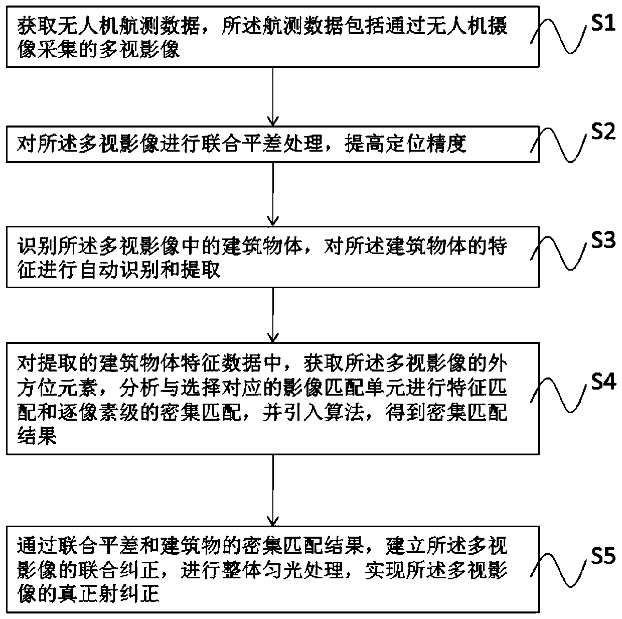
[0037] Please refer to figure 1 , a preferred embodiment of the present invention provides a method for processing aerial survey data of a drone, including:

[0038] S1, acquiring aerial survey data of the UAV, the aerial survey data including multi-view images collected by the camera of the UAV;

[0039] In this embodiment, the multi-view image data includes vertical photography data and oblique photography data.

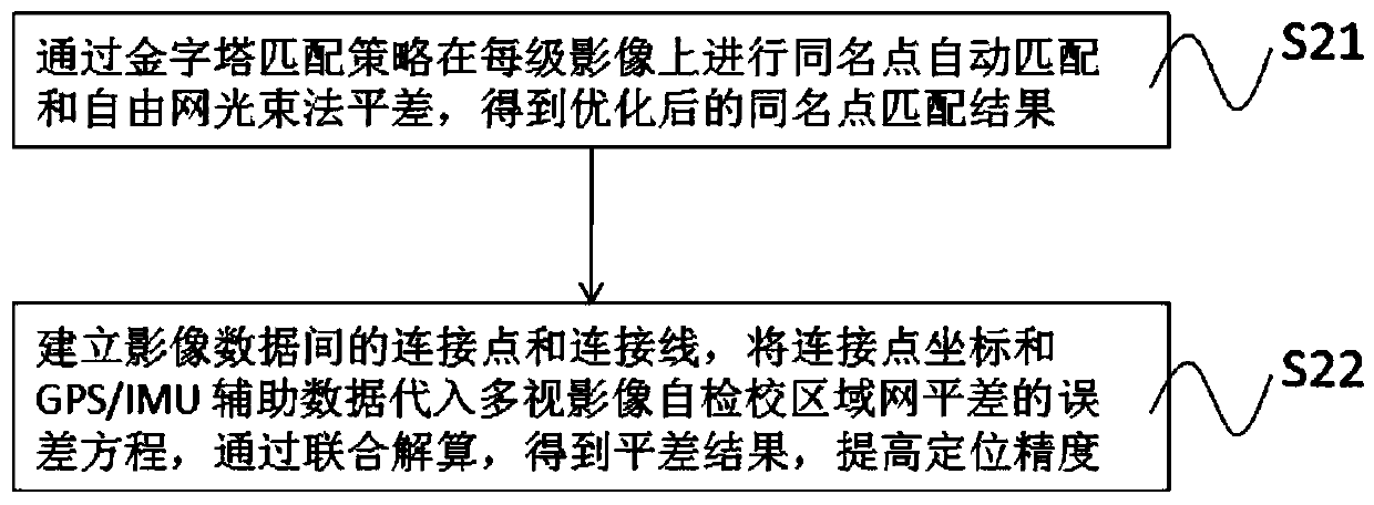
[0040] S2, performing joint adjustment processi...


PUM


Abstract

The invention discloses a method for processing aerial survey data of an unmanned aerial vehicle. The method comprises the steps of: S1, obtaining aerial survey data of an unmanned aerial vehicle, wherein the aerial survey data comprises multi-view images shot and collected by the unmanned aerial vehicle; S2, performing simultanuous adjustment processing for the multi-view images to improve the location precision; S3, identifying building objects in the multi-view images to perform automatic identification and extraction for the building objects; S4, in the extracted building feature data, obtaining elements of exterior orientation of the multi-view images, analyzing and selecting corresponding image matching units to perform feature matching and dense matching pixel level by pixel level,and introducing an algorithm to obtain a dense matching result; and S5, through the dense matching result of the simultanuous adjustment and the buildings, establishing joint correction for the multi-view images to perform integrated dodging processing so as to achieve true projection correction of the multi-view images. The method for processing aerial survey data of an unmanned aerial vehicle can improve the drawing accuracy of mine terrains and can avoid faults caused by data errors on the construction projects.

Description

technical field [0001] The invention relates to the field of aerial survey data processing, in particular to a method for processing aerial survey data of a drone. Background technique [0002] Aerial surveying and mapping of mine terrain by UAV is a commonly used technology in existing mine construction projects, and because UAV is in the process of aerial survey, because the data collected by UAV will be affected by its own flight angle and data collection As a result, there will be deviations in the data collected by the UAV, which will cause deviations in the later drawing of the mine terrain, resulting in construction engineering errors. [0003] Therefore, there is a great need in the market for a method that can process erroneous data from UAV aerial surveys. Contents of the invention [0004] The invention provides a method for processing aerial survey data of a UAV to solve the technical problem that the data collected by the UAV will be affected by its own fligh...

Claims


Application Information

Patent Timeline
Patent Type & Authority Applications(China)
IPC IPC(8): G01C11/02G01C11/04
Inventor 李红轩
Owner 华南机械制造有限公司
Why Eureka
Try Eureka