Five-lens three-dimensional surveying and mapping system

A three-dimensional mapping and five-lens technology, applied in the field of drones, can solve problems such as the camera is difficult to meet, affects the take-off and landing of drones, and the three-axis gimbal is large in size, and achieves the effect of improving accuracy

Pending Publication Date: 2019-07-09
山东蜂巢航空科技有限公司
View PDF7 Cites 0 Cited by
  • Summary
  • Abstract
  • Description
  • Claims
  • Application Information

AI Technical Summary

Problems solved by technology

[0005] Existing UAV surveying and mapping generally use three-axis gimbals and cameras (image acquisition devices), but the three-axis gimbals are bulky and easily affect the take-off and landing of UAVs. Cameras are often difficult to satisfy

Method used


Image

  • Five-lens three-dimensional surveying and mapping system
  • Five-lens three-dimensional surveying and mapping system
  • Five-lens three-dimensional surveying and mapping system

Examples


Embodiment Construction

[0022] The following examples are used to illustrate the present invention, but are not intended to limit the scope of the present invention.

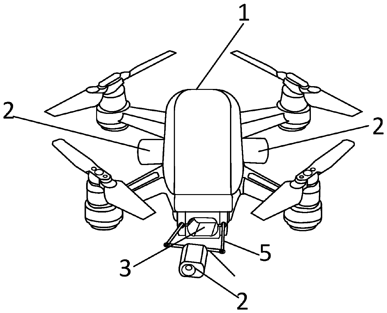
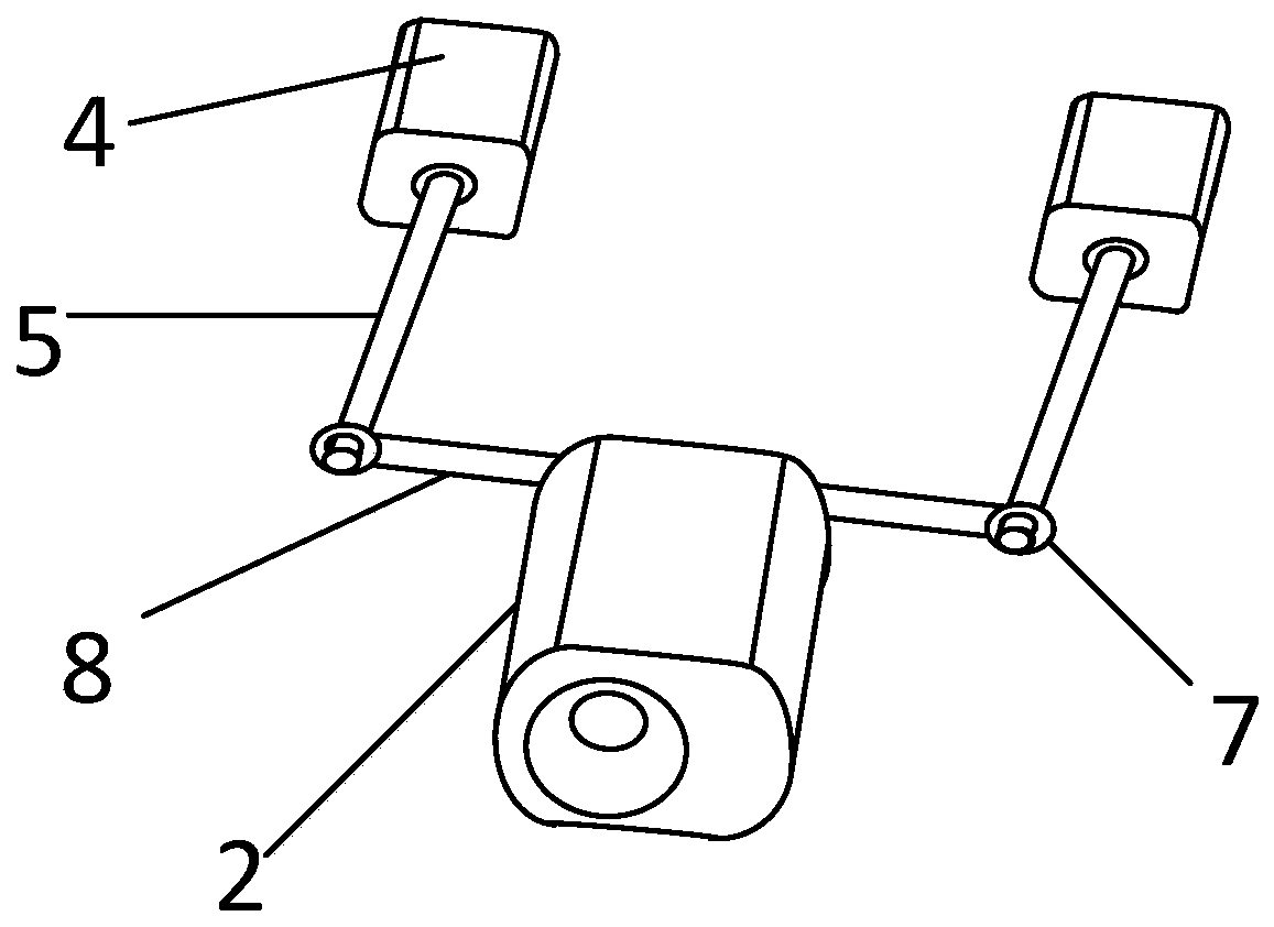
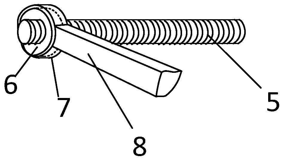
[0023] Such as figure 1 As shown, the present invention provides a five-lens three-dimensional surveying and mapping system, which includes a drone body 1 and five camera devices arranged at the front, rear, left, right and bottom of the drone. The imaging equipment includes a telescopic mechanism and a five-lens camera 2, the telescopic mechanism is arranged in the drone body 1, the drone body 1 is provided with an opening 3 for accommodating the five-lens camera 2, and the telescopic The mechanism is in transmission connection with the five-lens camera 2 and pushes the five-lens camera 2 into and out of the opening 3 . The surveying and mapping system of the present invention is equipped with five cameras at the front, rear, left, right and bottom, and the five cameras can be retracted into the drone body, thereby realizing five-len...


PUM


Abstract

The invention discloses a five-lens three-dimensional surveying and mapping system. The system comprises an unmanned aerial vehicle body (1) and five camera shooting devices arranged on the front, rear, left, right and lower portions of the unmanned aerial vehicle body. The camera shooting devices comprise telescopic mechanisms and five lens cameras (2), and the telescopic mechanisms are arrangedin the unmanned aerial vehicle body (1); the unmanned aerial vehicle body (1) is provided with openings (3) for containing the five lens cameras (2); the telescopic mechanisms are in transmission connection with the five lens cameras (2) and push the five lens cameras (2) in and out of the openings (3). The five cameras are arranged on the front, rear, left, right and upper portions of the surveying and mapping system and can extend and retract into the unmanned aerial vehicle body, so that five-lens surveying and mapping are realized, the normal take-off, landing and flying of the unmanned aerial vehicle are not influenced, and the accuracy of surveying and mapping is improved.

Description

technical field [0001] The invention relates to the technical field of unmanned aerial vehicles, in particular to a five-lens three-dimensional surveying and mapping system. Background technique [0002] Remote sensing surveying and mapping drones provide powerful means for resource investigation and environmental monitoring, and are widely used in land use dynamic monitoring, mineral resource exploration, geological environment and disaster investigation, cadastral survey, map update and other fields. With the continuous deepening of land and resources survey and management and the continuous expansion of applications, the demand for remote sensing mapping image data is becoming more and more significant. [0003] The prior art discloses an unmanned aerial vehicle for landform surveying and mapping, which includes an unmanned aerial vehicle body, a rotating seat is arranged at the bottom of the unmanned aerial vehicle main body, and a camera clamping seat is arranged at the...

Claims


Application Information

Patent Timeline
Patent Type & Authority Applications(China)
IPC IPC(8): B64D47/08B64C39/02
CPCB64D47/08B64C39/024B64U2101/30B64U10/10
Inventor 李威
Owner 山东蜂巢航空科技有限公司
Why Eureka
Try Eureka