
Method for monitoring earthquakes based on digital elevation model data
A digital elevation model and data monitoring technology, applied in remote sensing data and earthquake fields, can solve problems such as unmanned, and achieve the effect of reducing costs and human resources, and reducing the scope of prediction
- Summary
- Abstract
- Description
- Claims
- Application Information
AI Technical Summary
Problems solved by technology
Method used
Image

Examples
Embodiment Construction
[0020] The present invention proposes a method for monitoring earthquakes based on digital elevation model data, which will be further described in detail below in conjunction with the accompanying drawings and specific embodiments.
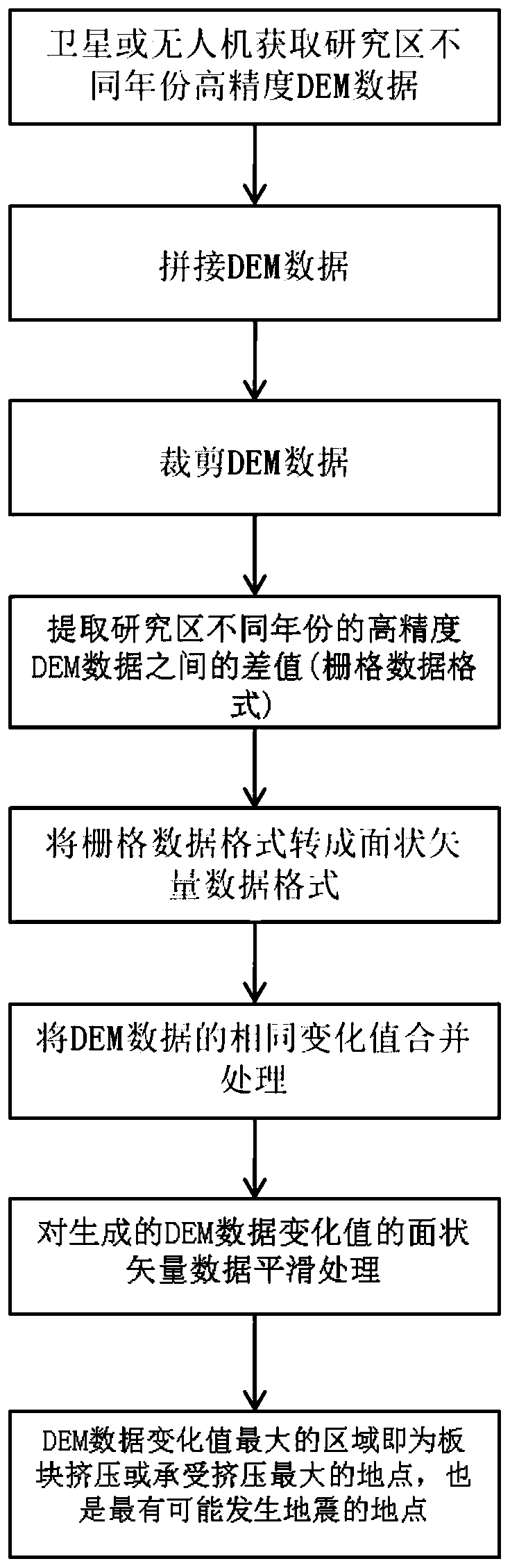
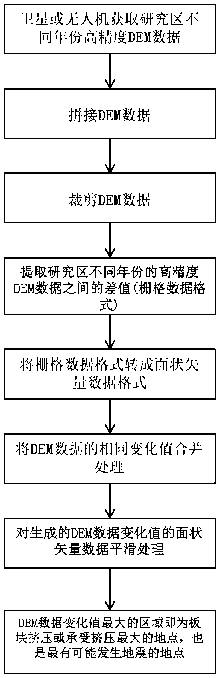
[0021] The present invention proposes a method for monitoring earthquakes based on digital elevation model data. The overall process is as follows figure 1 shown, including the following steps:
[0022] 1) Splicing and cutting the digital elevation model DEM data acquired in two different years in the study area to obtain the cut DEM data of each year; the specific steps are as follows:
[0023] 1.1) Obtain high-precision (accuracy better than 90m) DEM of the research area (that is, the area where earthquakes need to be monitored) in two different years (the interval between the two years is about five to ten years) from the official website of DEM data or UAV Data, since the acquired DEM data is block-shaped, it is necessary to stitch these blo...
PUM
 Abstract
Description
Claims
Application Information