A multi-satellite imaging mission planning method

A mission planning and mission technology, applied in data processing applications, forecasting, instruments, etc., can solve the problem of extremely precious imaging satellite resources, and achieve the effect of reducing algorithm running time, reducing uncertainty, and good stability.

Active Publication Date: 2021-10-22
CENT SOUTH UNIV +1
View PDF4 Cites 0 Cited by
  • Summary
  • Abstract
  • Description
  • Claims
  • Application Information

AI Technical Summary

Problems solved by technology

Due to the increase in user imaging requirements, imaging observations can only be arranged for a subset of the mission set in the mission planning cycle, and it is impossible to meet more user needs as much as possible
In order to solve the problem of short supply of imaging satellites, more satellites have been launched for earth observation, but scarce imaging satellite resources are still extremely precious in the face of a large number of user imaging needs

Method used


Image

  • A multi-satellite imaging mission planning method
  • A multi-satellite imaging mission planning method
  • A multi-satellite imaging mission planning method

Examples


Embodiment Construction

[0098] The following is a detailed description of the embodiments of the present invention. This embodiment is carried out based on the technical solution of the present invention, and provides detailed implementation methods and specific operation processes to further explain the technical solution of the present invention.

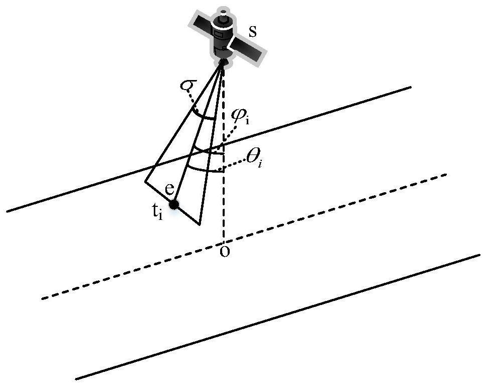
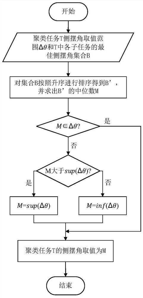
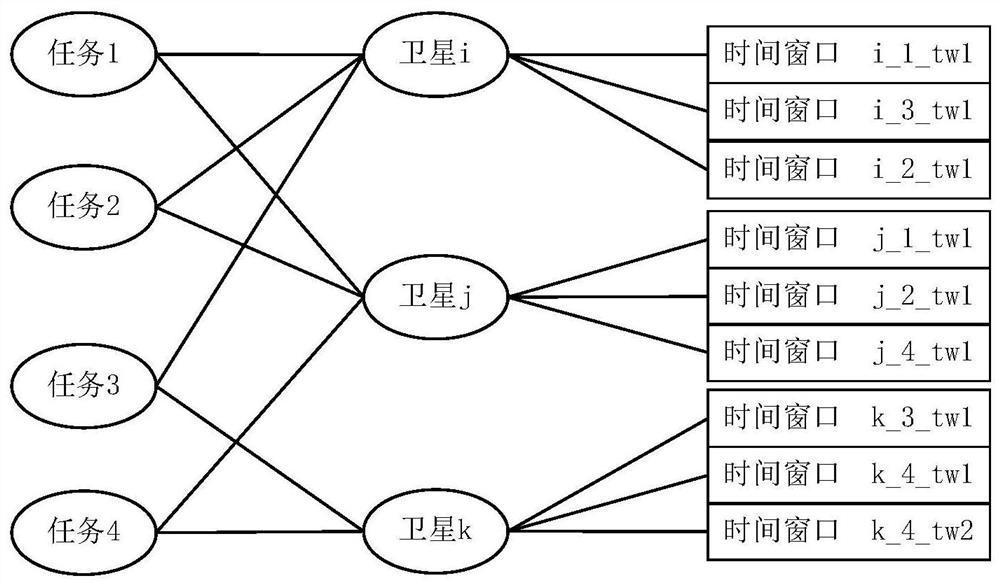
[0099] The present invention proposes a multi-satellite imaging task planning method, including an imaging task clustering method and a task planning method; imaging task clustering, and transforming the imaging task clustering problem into graph theory group division by constructing an imaging task clustering graph model problem, and design an imaging task clustering algorithm based on heuristic rules, which is responsible for aggregating the point target imaging tasks that can be observed by imaging satellites in the same imaging strip into clustering tasks; task planning, by constructing task planning directed The acyclic graph model transforms the...


PUM


Abstract

The invention discloses a multi-satellite imaging mission planning method, comprising: establishing a mission model, using the mission model to represent all point target missions; taking the orbit circle as a benchmark, and taking the tasks in the orbit circle as the cluster diagram model Nodes, and based on the clustering constraints, the undirected edges between the nodes in the clustering graph model are constructed to obtain the imaging task clustering graph model; based on the heuristic rules, the point target tasks that meet the clustering constraints are aggregated into clustering tasks , and calculate the roll angle of the clustering task based on the median theorem; construct and use the constraints and objective functions of the task planning to construct a directed acyclic graph model of the task planning corresponding to the clustering graph model of the imaging task; based on the task Plan the directed acyclic graph model, and use the max-min ant colony algorithm for mission planning, and get the multi-satellite imaging mission planning scheme. Under different data scales, the present invention can obtain satisfactory mission planning results and has good stability.

Description

technical field [0001] The invention relates to the field of imaging satellite task planning, in particular to a multi-satellite imaging task planning method. Background technique [0002] Imaging satellites are platforms equipped with imaging instruments, flying around the earth in a specific orbit, and imaging and taking pictures of ground targets according to user needs; they have the characteristics of long continuous imaging time, wide coverage, and no national boundaries, etc., and are widely used in surveying and mapping , military reconnaissance, environmental protection and land census and other fields have been highly valued by countries all over the world. The increase in user imaging requirements leads to the fact that imaging observations can only be arranged for a subset of the mission set in the mission planning cycle, and it is impossible to meet more user needs as much as possible. In order to solve the problem of short supply of imaging satellites, more sa...

Claims


Application Information

Patent Timeline
Patent Type & Authority Patents(China)
IPC IPC(8): G06Q10/04G06Q10/06G06N3/00
CPCG06N3/006G06Q10/04G06Q10/0631
Inventor 龙军钱哲曼陈仕隆韩笑冬徐楠杨凯飞
Owner CENT SOUTH UNIV
Why Eureka
Try Eureka