

A fast interpolation and coloring method for meteorological automatic station data
An automatic station and interpolation technology, which is applied in the field of meteorological monitoring and 3D digitization, can solve the problem of inability to monitor and collect data evenly distributed, and achieve the effects of improved interpolation speed, accurate estimation and fast calculation.
- Summary
- Abstract
- Description
- Claims
- Application Information
AI Technical Summary
Problems solved by technology
Method used
Image

Examples
Embodiment Construction
[0019] The following specific examples further illustrate the present invention, so that those skilled in the art can better understand the present invention and implement it, but the given examples are not intended to limit the present invention.
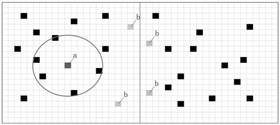
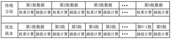
[0020] A rapid interpolation and coloring method for meteorological automatic station data. The main processes affecting the interpolation analysis of spatial hash point data include, spatial data sequence indexing, matrix operations, weight calculation of points to be interpolated, legend reading and Color rendering. This method mainly proposes an efficient processing method for the above process. After testing, under the premise of the same hardware configuration, the same data source and graphical standards, the initial interpolation speed is increased by about 30% compared with the traditional method, and the subsequent interpolation speed is increased by 10%. about times.
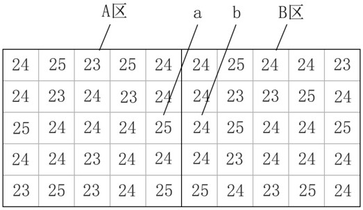
[0021] In the step of reading site data for spatial ...
PUM
 Abstract
Description
Claims
Application Information