

A system and method for monitoring the verticality of a tall frame based on a satellite positioning system
A technology of satellite positioning system and monitoring system, applied in the field of verticality monitoring system of tall frame, can solve the problems of lack of alarm measures, inability to automatically complete, too large granularity, etc.
- Summary
- Abstract
- Description
- Claims
- Application Information
AI Technical Summary
Problems solved by technology
Method used
Image

Examples
Embodiment Construction
[0057] The present invention will be further described in detail below in conjunction with specific embodiments, which are explanations of the present invention rather than limitations.
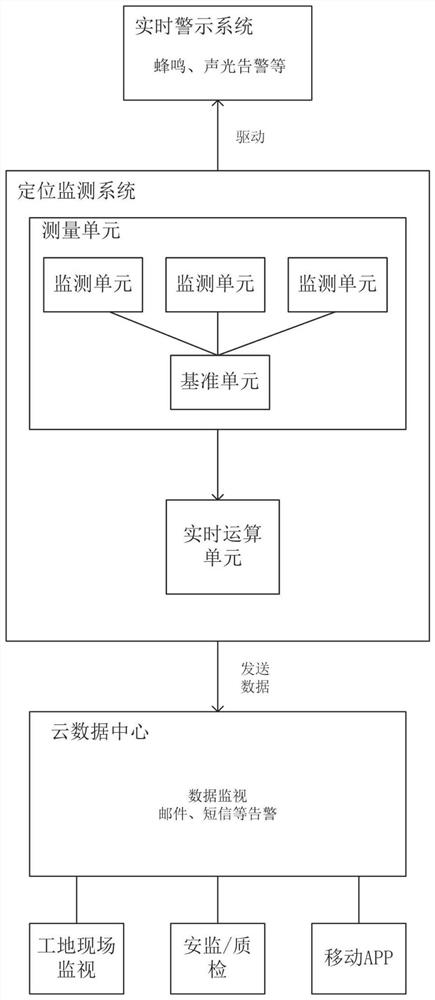
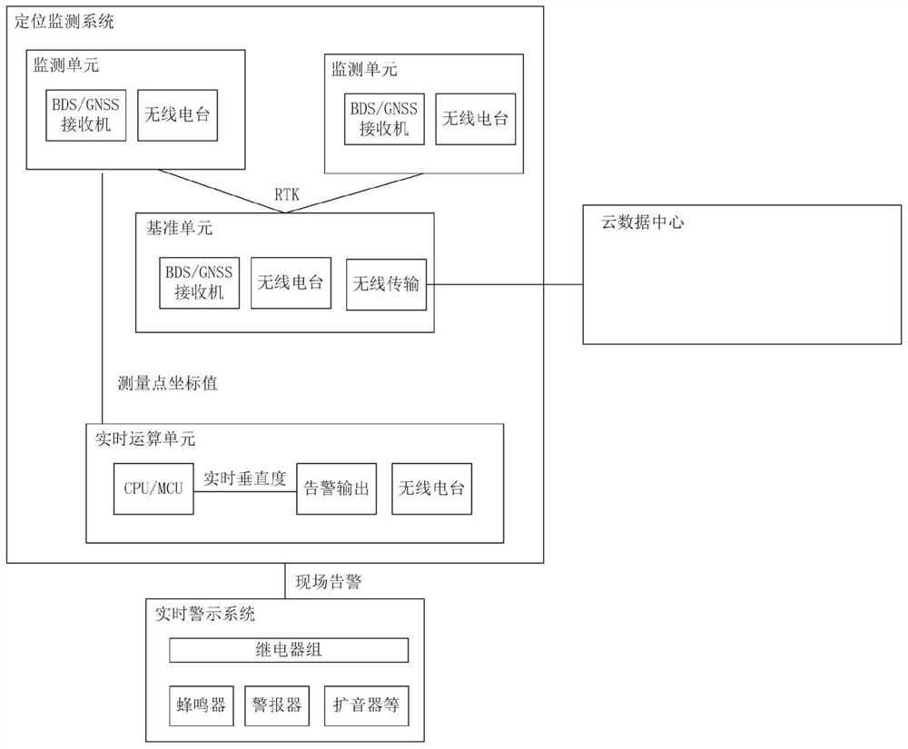
[0058] see figure 2 and image 3 , a verticality monitoring system of a tall frame based on a satellite positioning system, including a positioning monitoring system; the positioning monitoring system includes a measuring unit and a real-time computing unit, and both the measuring unit and the real-time computing unit include a radio station;
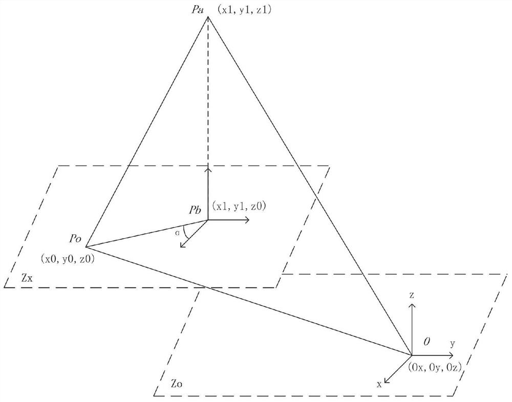
[0059] The measurement unit is used to obtain the geodetic coordinate values of at least three measurement points of the tall frame through its own satellite positioning system, and one of the measurement points is set as the origin of the new coordinate system, and the rest of the measurement points are defined as the origin of the non-coordinate system; The measurement point of the origin of the coordinate system is transformed with the geodetic ...
PUM
 Abstract
Description
Claims
Application Information