Slope unit division method based on multi-scale image segmentation

An image segmentation, multi-scale technology, applied in the direction of resources, instruments, computer parts, etc., can solve the problems of unreasonable long strips, lack of unified standards, and small broken surfaces in the catchment area, and achieve high reliability. , the effect of high division accuracy

An image segmentation, multi-scale technology, applied in the direction of resources, instruments, computer parts, etc., can solve the problems of unreasonable long strips, lack of unified standards, and small broken surfaces in the catchment area, and achieve high reliability. , the effect of high division accuracy

CN110532969AActive Publication Date: 2019-12-03CENT SOUTH UNIV

Image

  • Slope unit division method based on multi-scale image segmentation
  • Slope unit division method based on multi-scale image segmentation
  • Slope unit division method based on multi-scale image segmentation

Examples


Embodiment Construction

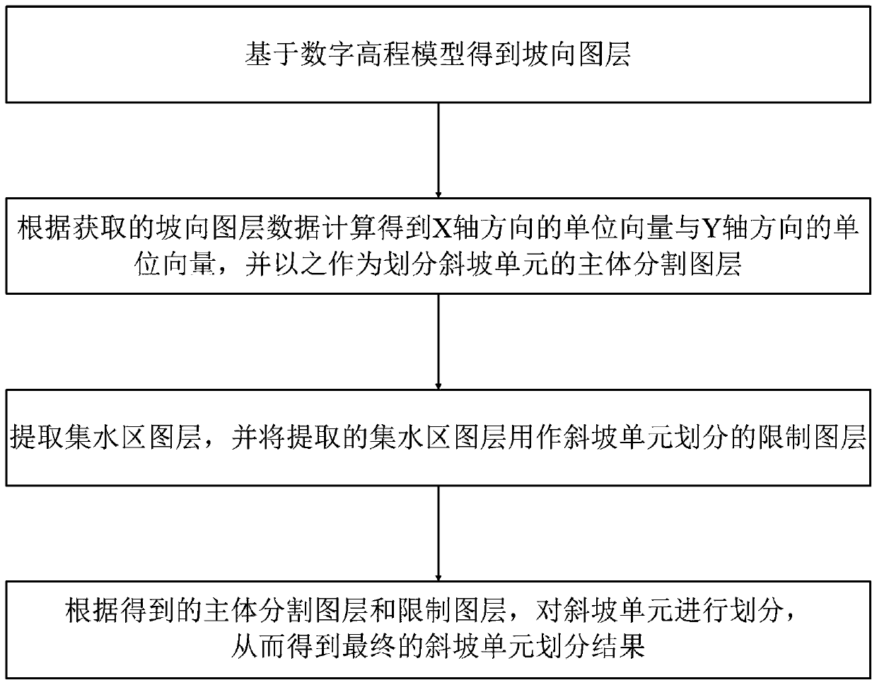
[0051] Such as figure 1 Shown is a schematic flow chart of the method of the present invention: the slope unit division method based on multi-scale image segmentation provided by the present invention includes the following steps:

[0052] S1. Obtain the slope aspect layer based on the digital elevation model; specifically, based on the digital elevation model, the slope aspect layer is obtained through ArcGIS pre-processing, so as to automatically divide the data set of the slope unit;

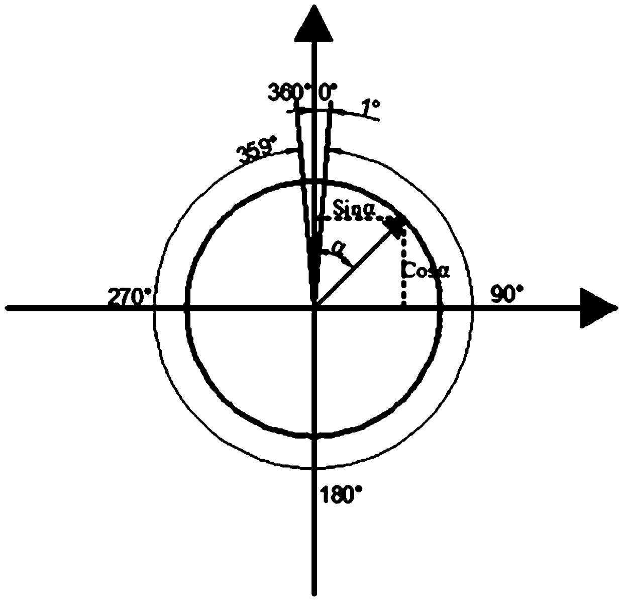
[0053] S2. According to the slope layer data obtained in step S1, the unit vector in the X-axis direction and the unit vector in the Y-axis direction are calculated, and the unit vector in the X-axis direction and the unit vector in the Y-axis direction are used as the main division for dividing the slope unit layer; specifically, converting the slope aspect layer data obtained in step S1 into radian slope aspect data, and then performing trigonometric function calculations to obtain the unit...


PUM


Abstract

The invention discloses a slope unit division method based on multi-scale image segmentation. The method comprises the following steps: obtaining a slope map layer based on a digital elevation model;calculating to obtain a unit vector in the X-axis direction and a unit vector in the Y-axis direction, and taking the unit vectors as main body segmentation layers for dividing slope units; extractinga catchment area map layer and taking the catchment area map layer as a limit map layer for slope unit division; and dividing the slope units to obtain a final slope unit division result. According to the method, topographic elements are comprehensively considered, a data set suitable for multi-scale segmentation, an optimal segmentation scale and a segmentation algorithm are established, and anappropriate slope unit is generated; therefore, the method provided by the invention can provide reliable map unit support for geological disaster risk evaluation, and the slope unit division method provided by the invention is high in reliability and relatively high in slope unit division precision.

Description


Claims


Application Information

Patent Timeline
03 Dec 2019
Publication
CN110532969A